Trip Blog
We crossed into Ecuador today
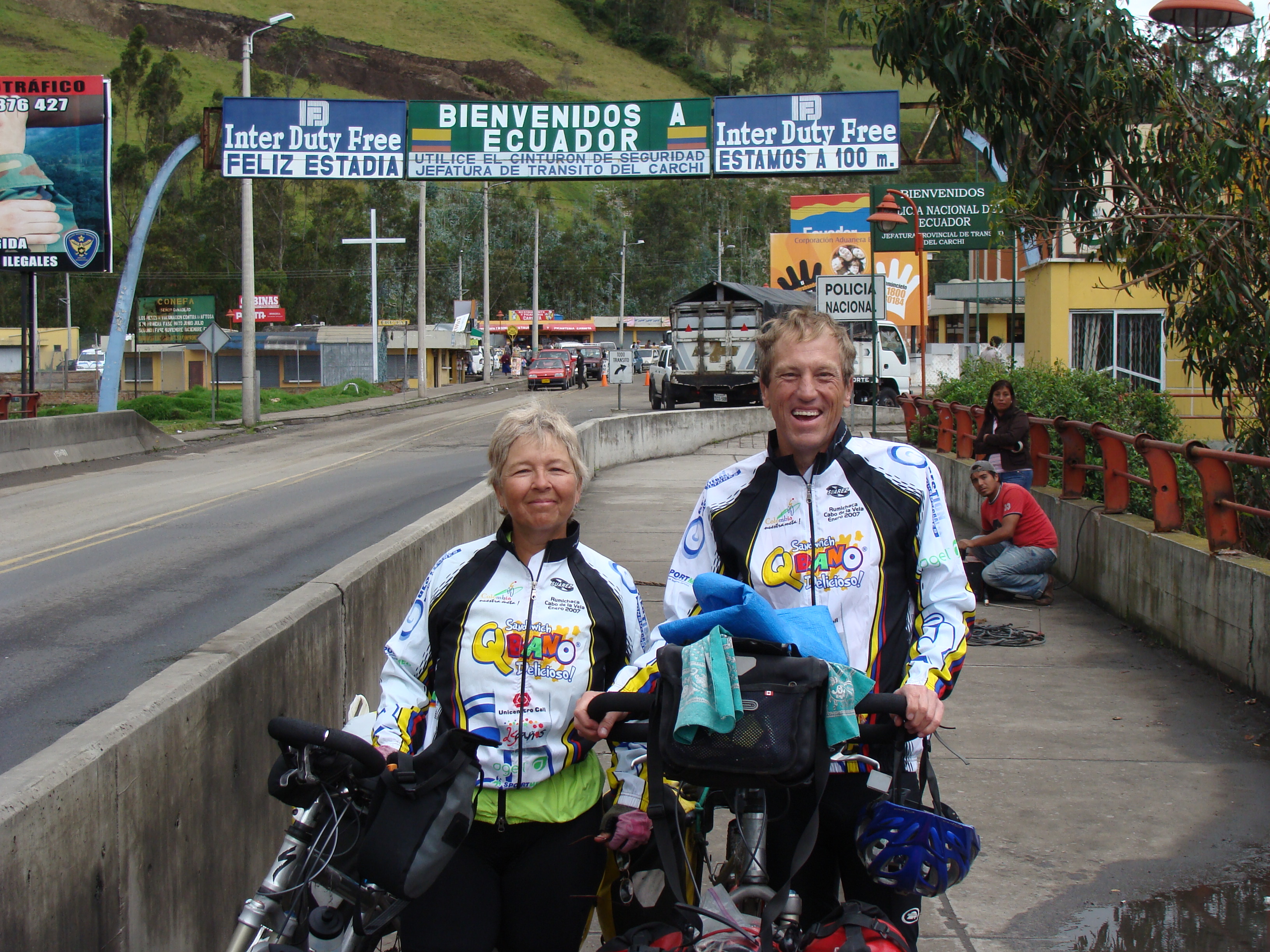
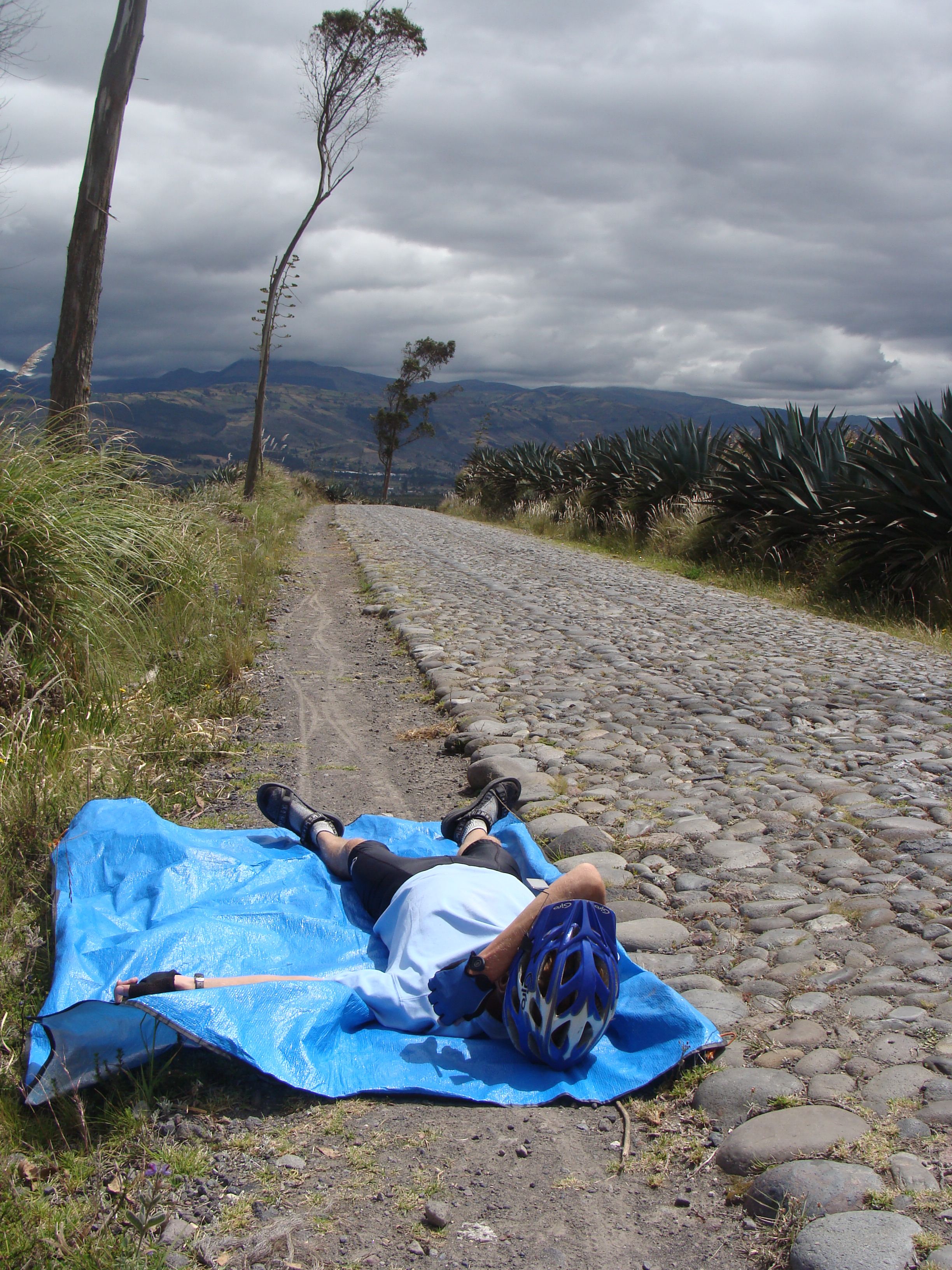
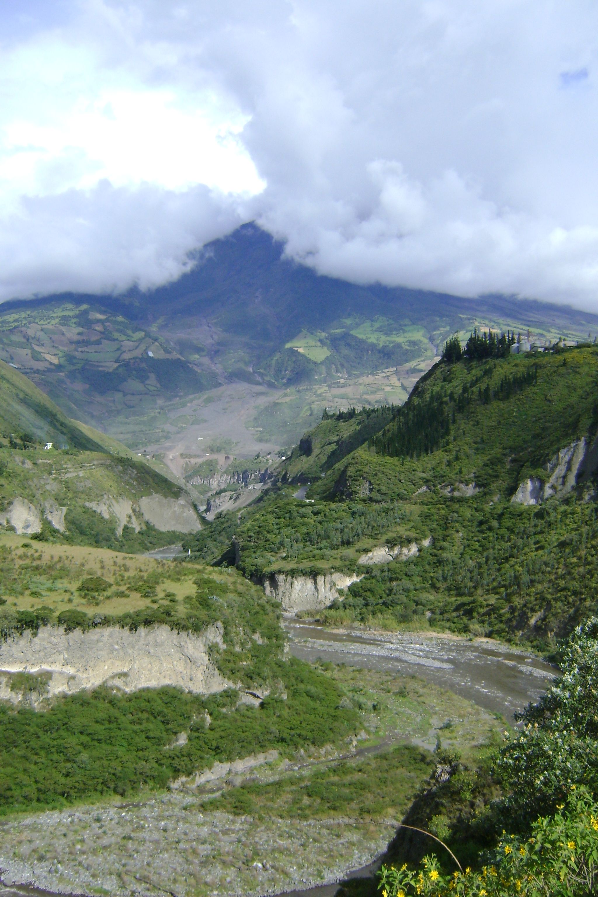
We crossed into Ecuador today! Our 10th country. 11,000 miles (17,700 km) into the ride. It's high, cold, mountainous.
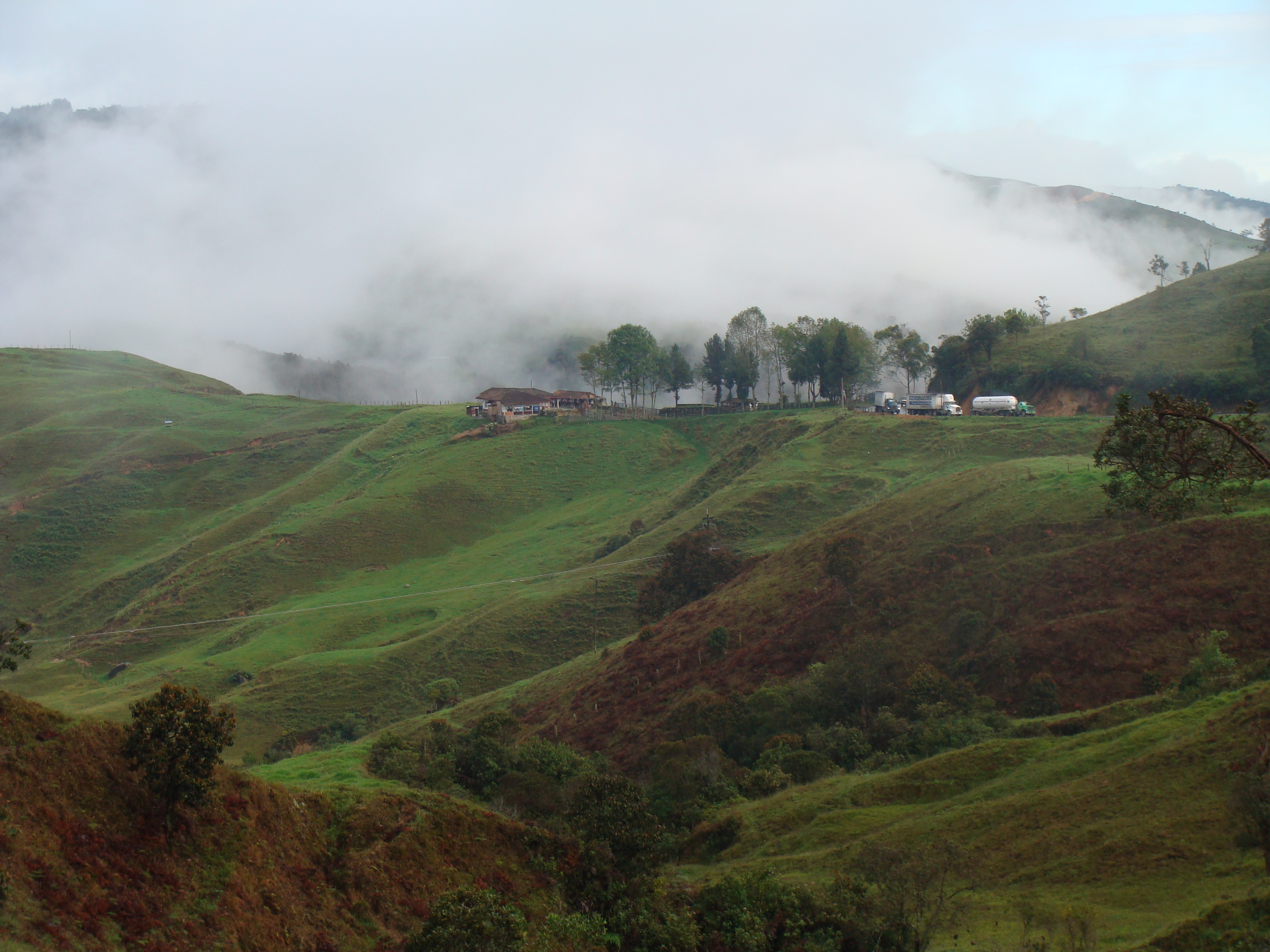
In the last few days we've been riding up to and above 10,000 feet in elevation and it's been so cloudy or foggy that we can't see much at all of the beautiful scenery above us. We can usually see valleys below, but can't see even the sides of the great volcanoes.
Colombia Maps and GPS Information

The most commonly available map of Colombia (outside the country) is the widely available one from ITMB (International Travel Maps). As usual theirs is quite poor, but since it was the only one we could get before arriving in the country, we bought it.
However, we were able to get some excellent map resources at the national institute of geography, the Instituto Geográfico Agustín Codazzi, and that did us very well. They offered a number of maps, but we bought their set of route maps "Mapas de Ruta", that gave 1:750,000 renditions of the major highway stretches of the whole country.
There are also a couple of widely available travel guides for the country, with lots of great information, but they're big glossy books with lots of ads and they're extremely heavy. One of these is the Guia de Rutas Por Colombia and another is published by the big telephone company Telefonica.
The GPS maps we used don't seem to be available, but a helpful visitor commented "If you are looking for very good maps for tha garmin GPS try Gisco at www.mygisco.com."
Nancy's remembrances of Colombia
About a year ago Randy and I started talking about the pros and cons of riding through the most northern country of South America. We all know that Colombia has had a bad reputation for years because of narcotrafficking, the FARC guerrilla organization, paramilitary groups, kidnapping, etc. We even told our family members we would skip this country and fly straight to Ecuador. After reading the wonderful adventures of other cyclists who dared to enter the foreboding country we started to understand things have changed for the better of the last few years. The most current reports tell how Colombia has gone and is still going through a great metamorphosis. Much of the change can be attributed to the President, Álvaro Uribe, who is determined to make Colombia a safe place after more than 40 years of conflict.
The following is my impression of Colombia during our bicycle ride in May 2008.
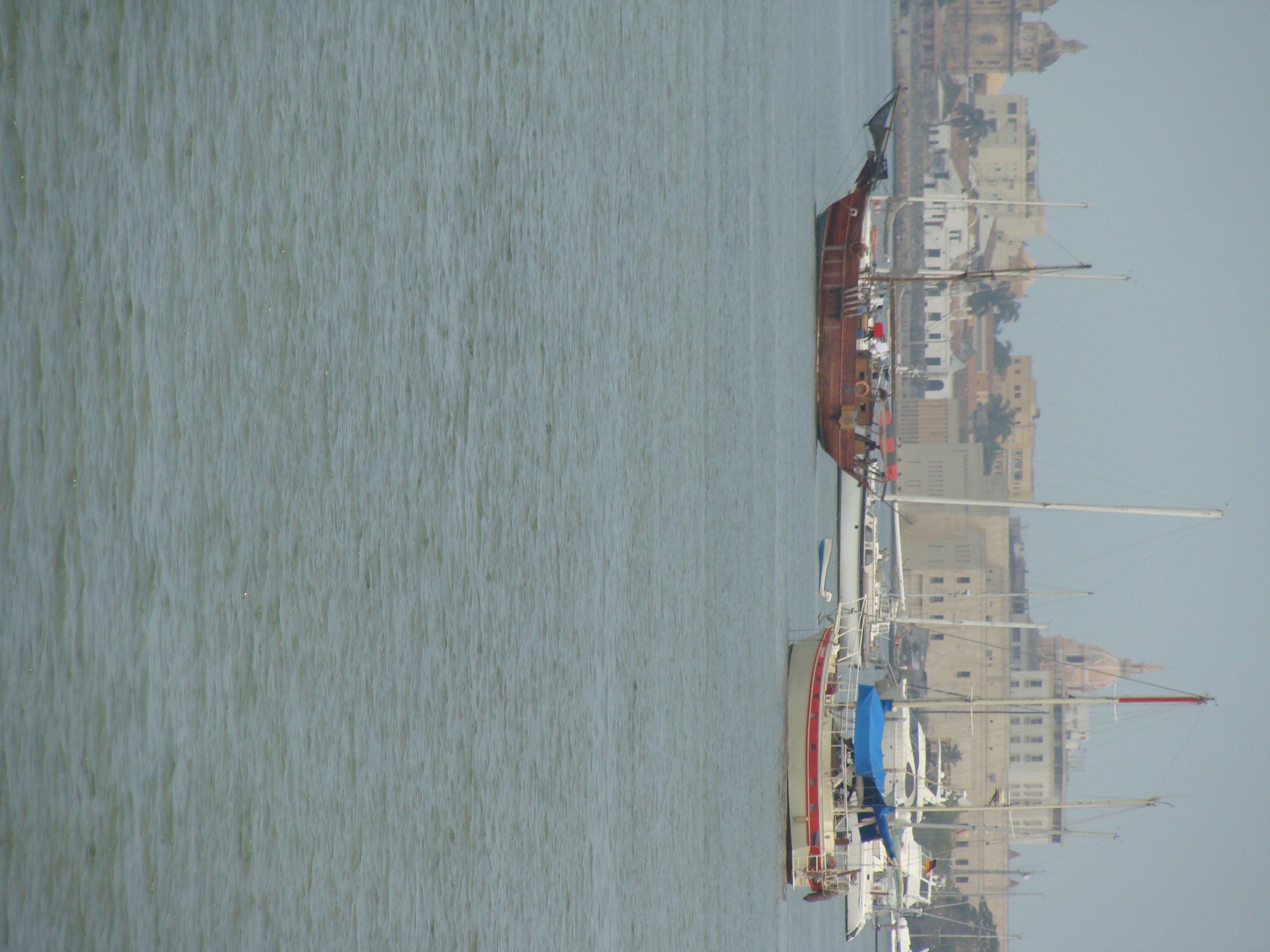
We entered the seaport of Cartagena after sailing from Panama. The cityscape looked like a mixture of Quebec, Canada, Miami, Florida, and New Orleans, Louisiana. Cartagena is surrounded by stone fortresses built to protect the city from years and years of pirate attacks that the city endured in the time that it was a key treasure port for the Spanish. Currently there is an astonishing number of new skyscrapers being built -- I counted over 20 huge cranes hanging over the city´s waterfront, a sure sign of prosperity and growth.
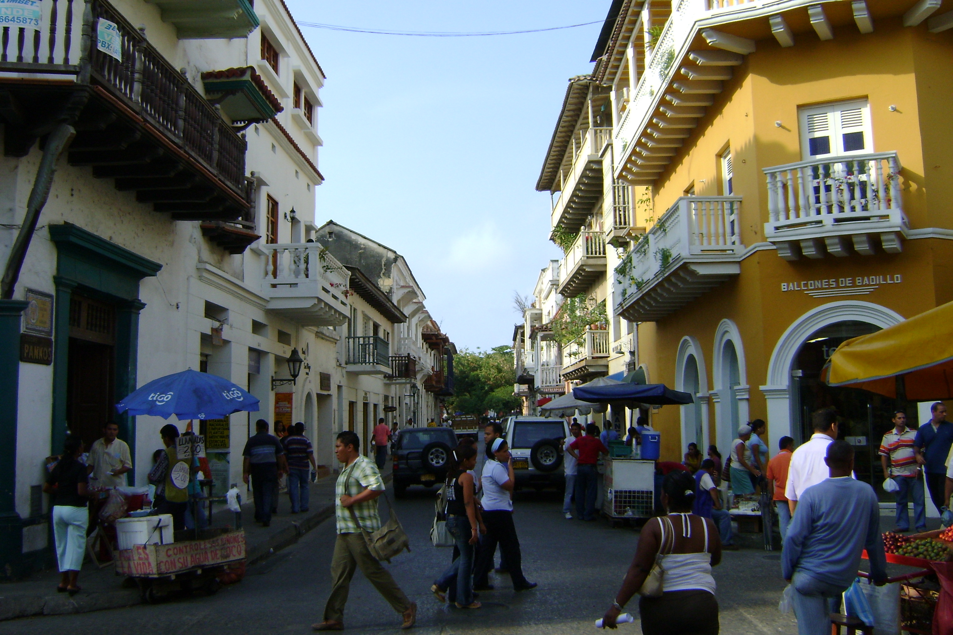
The old part of Cartagena is a wonderful colonial city with every building painted stark white and with black wrought-iron metalwork covering the windows and red tile roofs spread out as far as the eye can see. The city has a feel of New Orleans: lively, musical, colorful vendors, and a tad bit on the seedy side which adds to its character. We did not do this city justice as far as visiting all the sites but we did have a good look around. The highlight of the afternoon was the the Naval Museum, in the southwest corner of the city walls in the the Plaza de la Marina. What I liked most was the 1/16th scale sailing vessels from all over the world. But my all time favorite was Gloria, a real stuffed dog who once was a mascot to a commander in the Navy. The dog had more articles written about its life story then the commander.
We were itching to get on the road again, so we headed out to explore South America after visiting Cartagena for only one and a half days. We headed west along the coast of the Colombian Caribbean. What I remember most about this part of the trip was the mango trees, the flat land and the incredible heat. Oh the heat! One day Randy´s bike thermometer read 112 degree Fahrenheit which equals 44 degrees Celsius. We would get up at 4:00 in the morning so we could be riding by first light and try to beat the heat which became very hot by mid morning. Some days we would be wasted by heat exhaustion and having a nap along the side of the road by 10:30 in the morning. The early morning rides were delightful, comfortable and the humid lowlands made for long fiery sunrises.
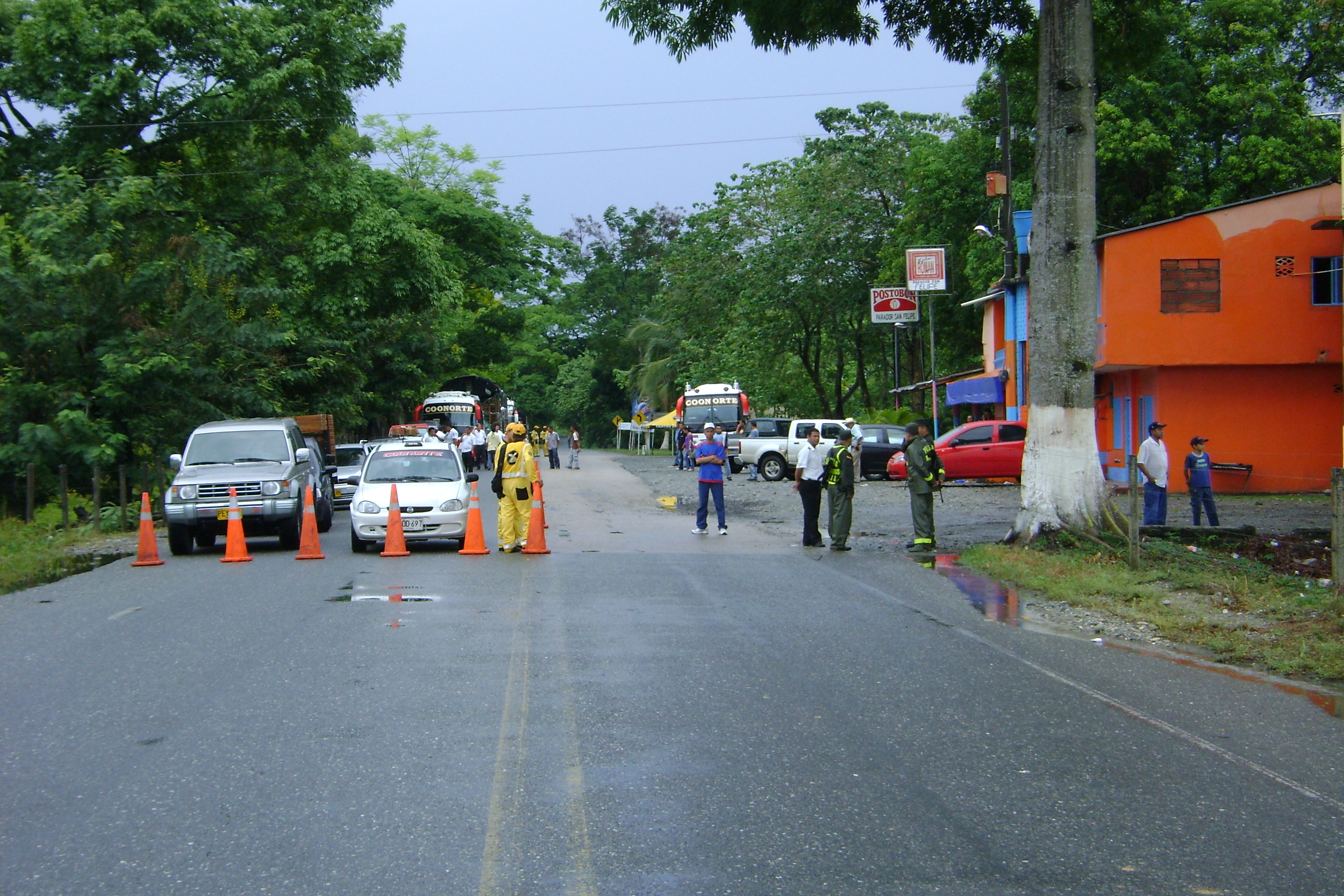
We stayed on the Pan-American highway all the way through Colombia because we were advised that it would be safe for two cyclists like us. It turned out to be very safe because it is secured by hundreds of military checkpoints. The purpose of the stops are to check vehicles for drugs, weapons, kidnap victims and an assortment of other illegal activities. In any one day we would ride by one to ten controlled checkpoints. I guess we looked harmless so most of the time we were waved through. I often thought that if we were smugglers our disguise was a great one because not once were we stopped for a check of our bags. Once in while military personnel would wave to us to stop because they wanted to know about our trip, like where we we from or where are we going or why are you doing this. We stopped at one check point to ask for directions and ended up talking to the group for about 15 minutes. After giving the top commander one of our business cards, he gave us a present in return. I thought he was reaching for something in his jacket pocket but he was just putting away our card. He leaned over and gave Randy and me a huge bear hug and best wishes on our travels.
Most of the military were young men doing their compulsory year of service. We would just wave at them as we rode by and look to see if anyone wanted us to stop for a check. Some of the military men waved back, others just looked at us and while many just ignored us and kept talking on their cell phones. I wondered if the military personal gets free cell service because of the young men seemed to spend a lot of time on the phone. It's probably a way to take away the boredom. Only once did we have to halt our progress for the day because of potential conflict. There was a demonstration by campesinos whose coca fields were being destroyed by the US-led plan to destroy illicit crops. However, they have no income to replace their former living, and are quite upset, so created a roadblock on the highway.
It was late in the day and the young men at the military checkpoint told us to hang it up for the day. We found a hotel for the night and continued in the safety of the daylight. I was a little tense riding through the small town that was under military control. What we found out was that two days earlier there had been a skirmish between the campesinos and the military during a protest where one person died and several were hurt. I must admit I was tense as we were waved passed the road block by the riot squad and into the small town of Taraza. I remember seeing the charred remains of tear gas, spent metal parts and burnt tires scattered through out the towns main street. It was the closest I had ever come to a war zone and I was scared. Randy jokingly said we should stop for breakfast. I said "no way" and we rode on toward a more tranquil part of Colombia. I took my first deep breath about 15 miles past the town and did not stop sweating for another 10 miles.
The people of Colombia are great lovers of sports of all kind. Soccer, billiards, skating, bull fighting but especially cycling. In the first hour of our riding out of Cartagana we saw more sports cyclists than we had seen in all of Central America and Mexico combined. We even rode with a couple who rode every morning with a group of friends. When we stopped, the group gathered for a photo with the gringo cycle tourists. They had so many questions we did not know which one to answer first. From then on every time we neared a city we would see dozens and dozens of cyclists riding with full professional gear. They would ride with us and want to hear our stories. They would ride two or three abreast blocking traffic with no worries. The traffic just went around them with no problems.
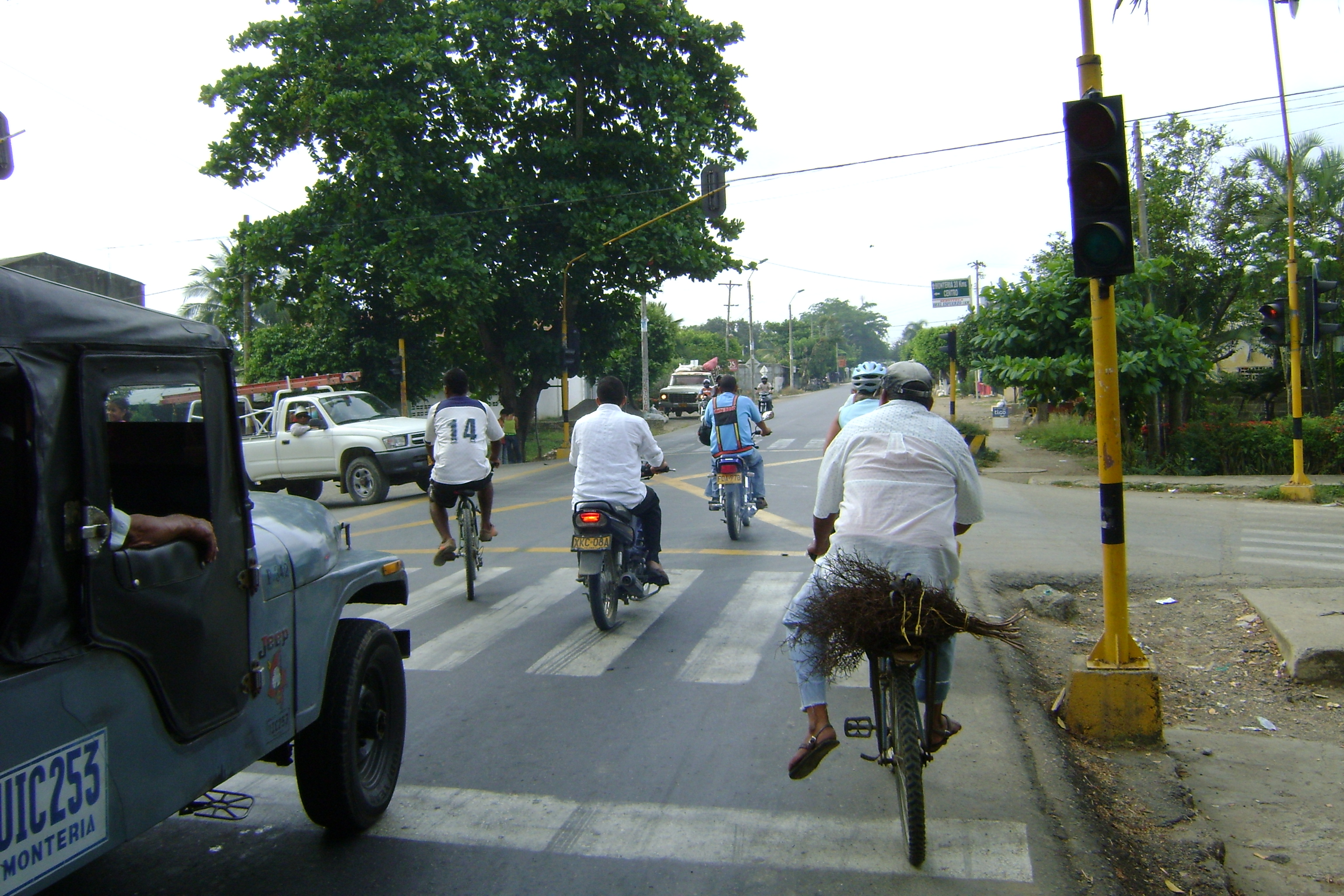
The roads of Colombia belong to everyone. The dogs, the horses, the cows, the cyclists, the motorcyclists, the cars, the buses, the trucks, the semis, and us. They drivers drove slow and the Pan-American highway had a nice shoulder most of the time. It was a pleasure to ride this country because of the Colombians' huge respect and support for cycling. We received many thumbs up and waves from all sorts of drivers, cyclists and people throughout Colombia. I often felt like a queen, and I know the queen of England would be green with envy.
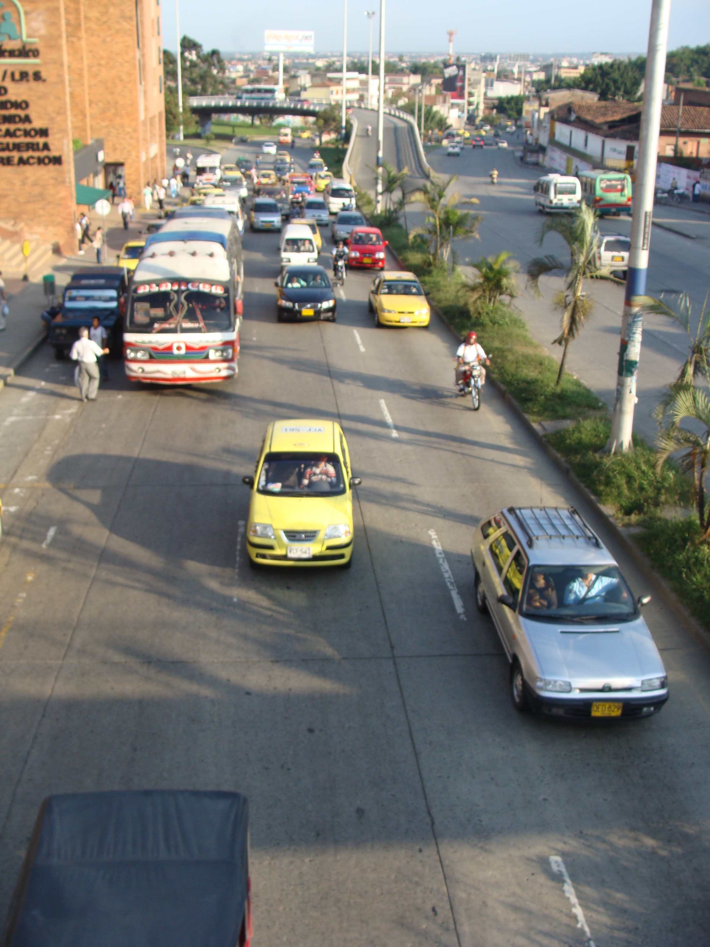
My general impression is that Colombia is a well-developed country with the majority being educated and more affluent then most Latin American countries we've visited. I do not mean there is no poverty because there are many people who are living way below the poverty level. But a majority seems to be able to afford either bicycles or motorbikes as forms of transportation. There is good bus transportation in the cities as well as the country all which seem to have good emissions. Colombia has a good medical system and appears to have less crippled and maimed people throughout the country. The cities of Medellin and Cali are world centers for plastic surgery of any kind because of the advanced technology and lower prices. The LASIK technique was actually developed by a Colombian, Jose Barraquer, around 1950.
I even got a quote for some alteration with plastic surgery. To tighten up my skin and to reverse the current sun damage to my face, I could have a Botox treatment for about US$400. I could have a total alteration for around US$10,000, including a face lift, chin tuck, breast implants, arms firmed up, a belly tuck, and some liposuction around the buttocks and thighs. It would take a couple of months of healing before I could get on my bike and continue my trip. Since we do not want to interrupt our current forward motion, I decided I will come back for a full treatment in two years. By that time I may not need any of the treatment because I will be in awesome shape.
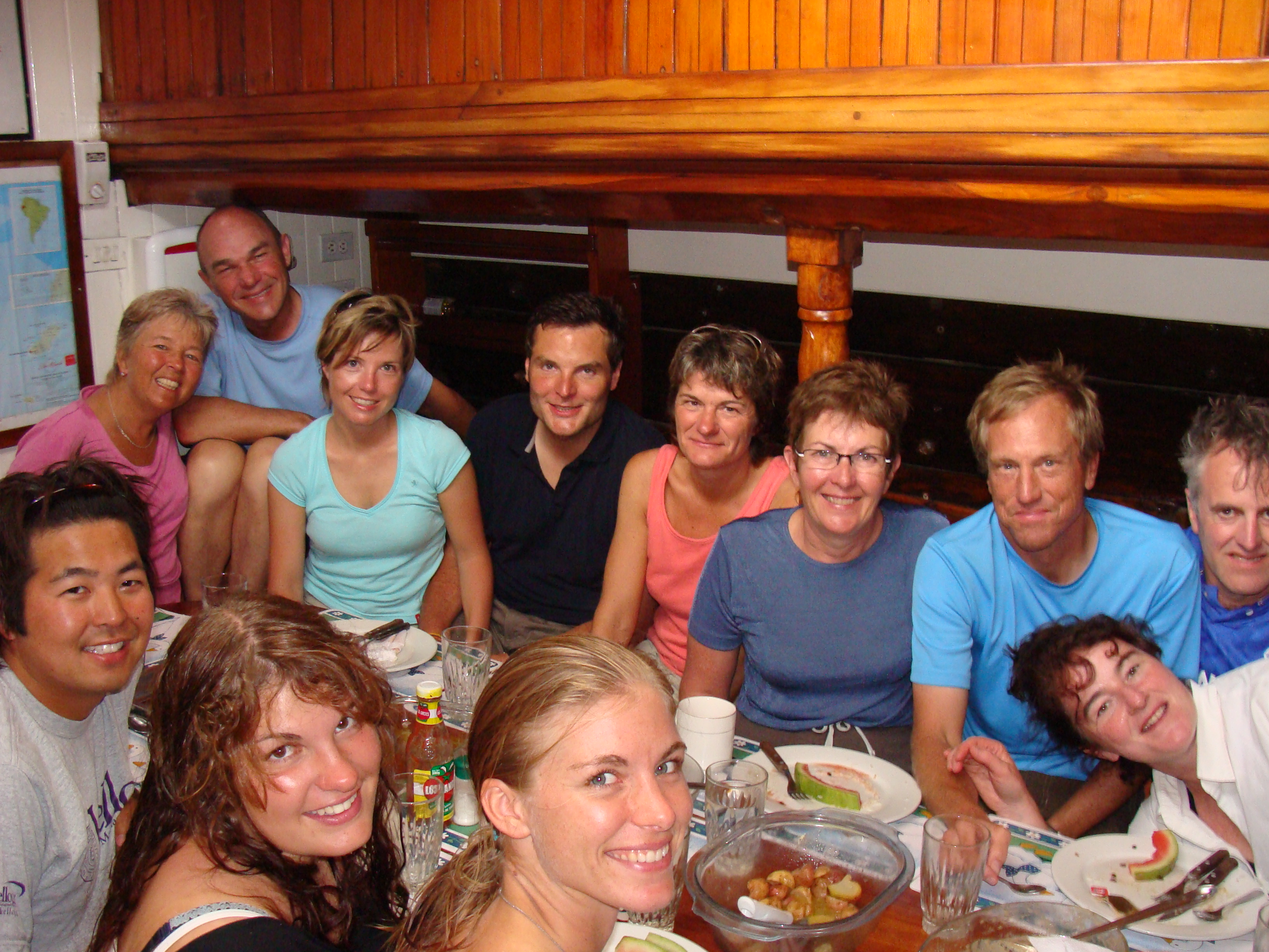
We had the incredible fortune of staying with four different host families who are members warmshowers.org. Each host offered us different insights to life in Colombia. All which we are very grateful for the enriching experience.
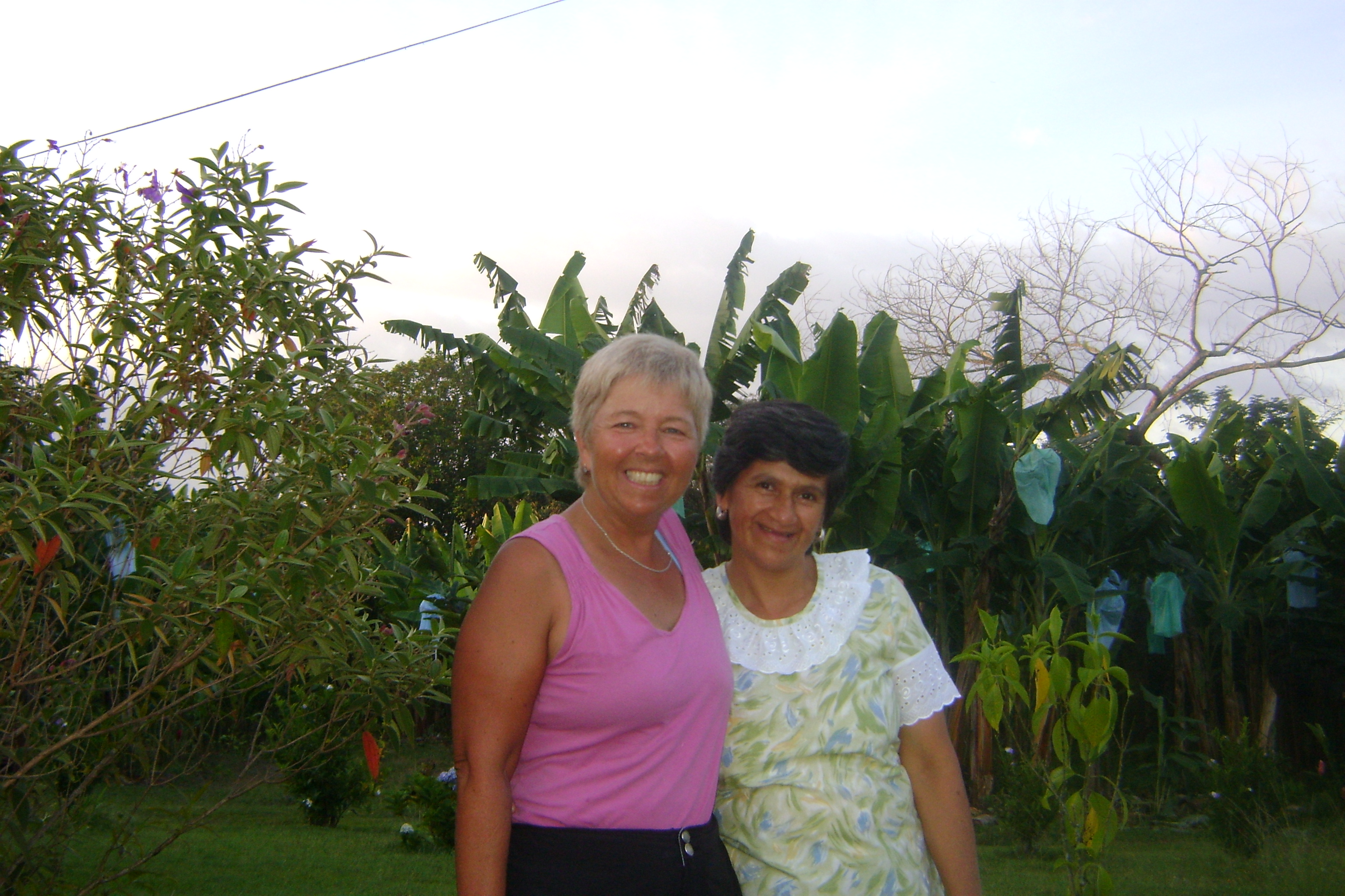
We stayed with Jon and Ivo in Manizales, a young newly web couple from two different countries. Ivo is a well educated Colombian from Bogota and Jon is from Minnesota working as a teacher in a bilingual school in Manizales. They taught us a lot about the local culture both from the gringo point of view and a Colombian point of view.
We also visited Gonzalo in Armenia where we stayed on his familiy's finca, a Colombian fruit farm growing platanos. Platanos look like huge bananas but require cooking.. We were well cared for by the caretaker family, especially Nelcy, who cooked traditional Colombian food over a wood burning stove. Every meal we had bananas prepared many different ways. It was very peaceful staying out on the finca and we were treated like royalty.
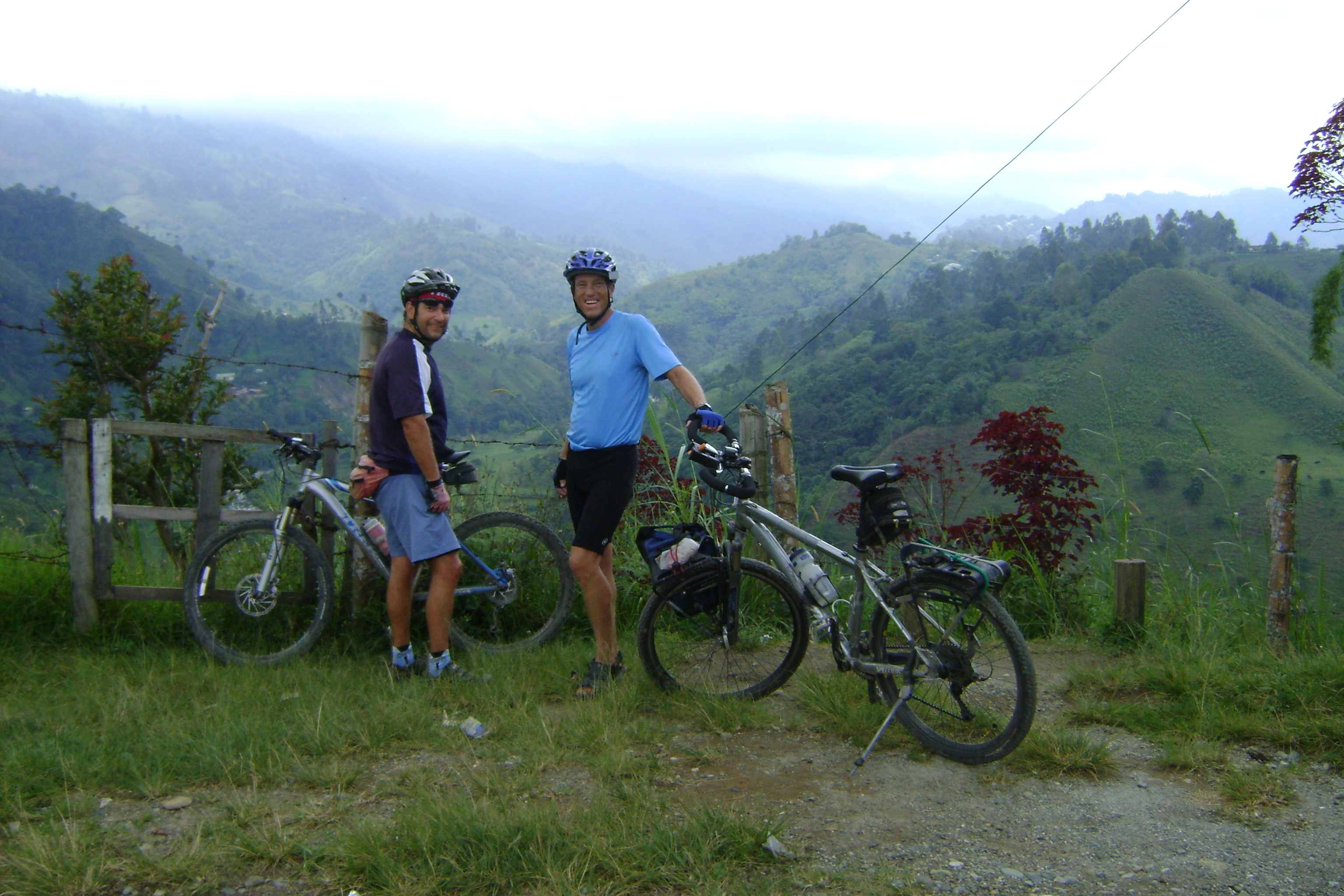
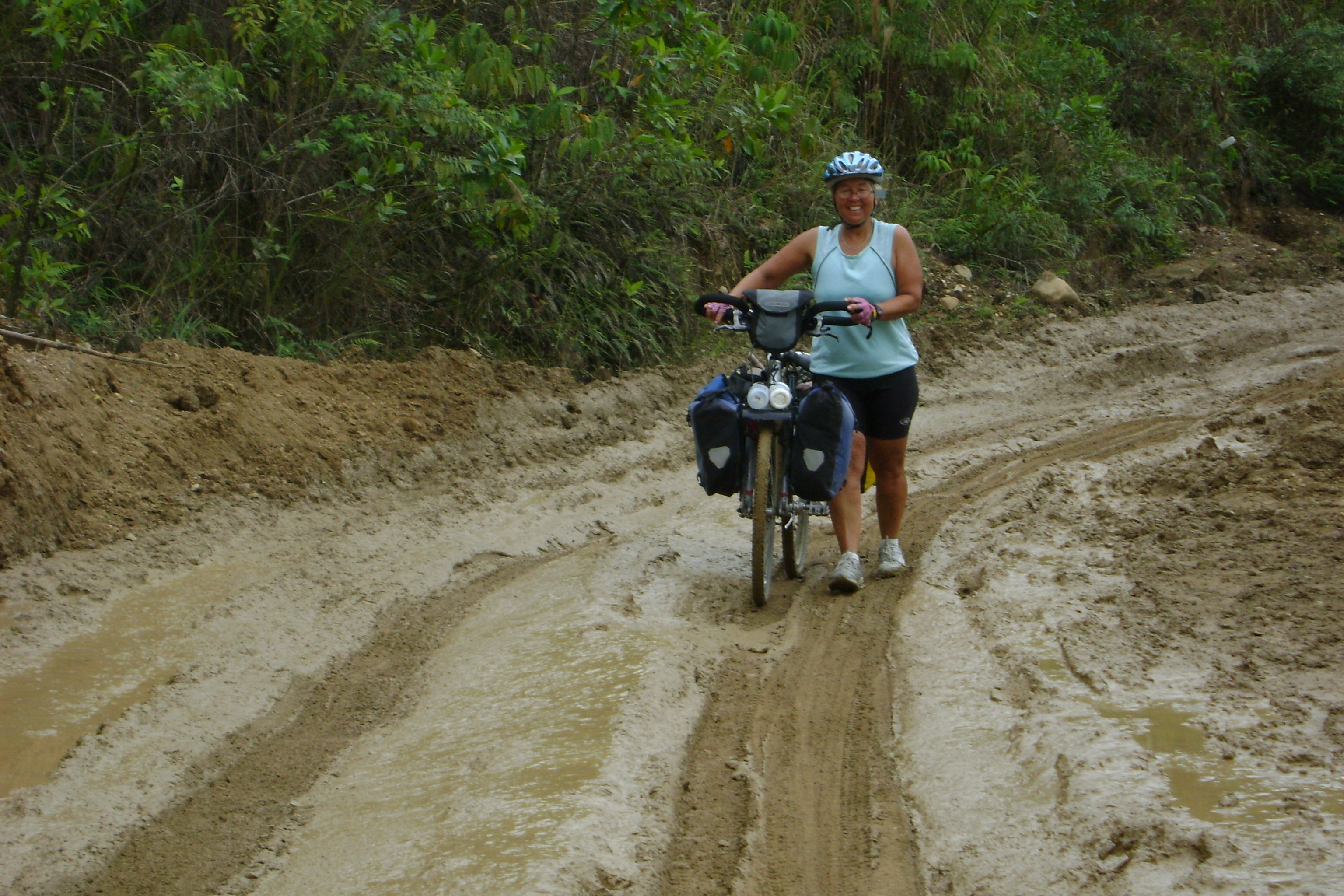
Gonzalo took us mountain biking and I'll never forget it, because of the stunning back roads we explored that took us through green rich fertile areas, past banana plantations, up and over mountain ridges and to one of the most scenic villages in Colombia. In Salento we stopped for an excellent lunch of trout which was wonderful, beautiful and cheap (Bueno, Bonito Y Barato). We topped this off with a fruit cocktail that I thought was one of the best foods in Colombia, The salpicon had a dozen different fruits in natural juices. Oh, it makes my mouth water thinking about it. After lunch we went for the second half of the ride which I will always remember as the muddy slot. Because it was the rainy season the single track we descended was only doable by walking our bikes down. It was just a tunnel of mud that made no sense to be on and especially with bikes. At one time I had to step down the steep path backwards with my bike held uphill as I slipped backwards down the mucky way. After 30 minutes we reached the pavement and by that time I had enough of mountain biking in Armenia but our host was not finished yet. We washed our bikes in the stream after after I expressed I had enough of forward motion we headed home, which I thought would be along the pavement and the short way home but no, we went along the back muddy roads full of extremely beautiful landscape with fruit trees, cornfields, canyons, forests and streams. We finished the ride in the pouring rain. Ever bit of us was soaked but the rain had washed off the 25 miles of dirt we had collected in the rugged back roads of Colombia. It was the "Tour de Excellency de Armenia". That night we shared a meal with the Gonzalo, his mom and his aunt at the finca, of course prepared by Nelcy. We talked for hours of what life has been like in this part of Colombia a long time ago and how it has changed over the years. We talked about coffee, bananas, fruit growing, cultural difference for women and so much more. Again this provided us another view of life in Colombia.

At this point we rode on through the challenging Colombian Andes. We were starting to get in shape and are riding well. And it's a good thing to be riding strong under the "shadows of the giants". Every day we climbed to immense heights and descended enormous slopes. The weather was gentle on us and waited until we reached a place to stay at night. When we were not staying with a host we stayed in hotels which for the most part were quite decent and on the average are higher quality then other places in Latin America we have stayed in. Clean, well lit, have bathrooms with toilet seats, nicer beds though hard, nice sheets and blankets, clean and cheap for an average of $8 or $10 a night. The cheapest was $7.00 and the most was $25.00 We stayed a few places near discoteques which were very loud and stayed open until 4:00am. In this case we got out our earplugs. The people love dancing and music which is everywhere. We now make sure our hotels are not near a discoteque.

We next visited Cali and stayed in a Casa de Cyclistas which offers hospitality to cyclists. Miller Hernan and family open up their humble home to traveling cyclists like us. They offered a nice place for us to set up our tent which was great because it was cooler sleeping outside. We had use of the kitchen, a bathroom with a cold shower and a nice family experiences. We stayed there during the Mother´s Day weekend and felt welcome as if we were part of the family. The family has limited resources but has a richness that is shared openly and eagerly. For a Mother's Day present, everybody else in the house jumped in and took over the day's chores. Miller and I went to the farmer's market at 6:30 in the morning and bought all the makings for the a speciality soup called ajiaco. It took several hours of preparation and several more hours cooking over a wood burning fire, and was delicious.
We stayed a couple of days and explored the city with Miller and a new friend Jose and his son Juan who all are biking enthusiasts. Jose and Juan spent a half a day showing us all the highlights of Cali. Jose is currently organizing the second annual bike tour of Colombia called Colombia Nuestra Meta which translates as Colombia is our goal. He even gave us very, very nice cycling jersey. We now have a sponsor, more or less. If I can say so myself we look so cool. You will be seeing photos of us wearing our fancy jersey in famous places like the Equator and Macchu Picchu.
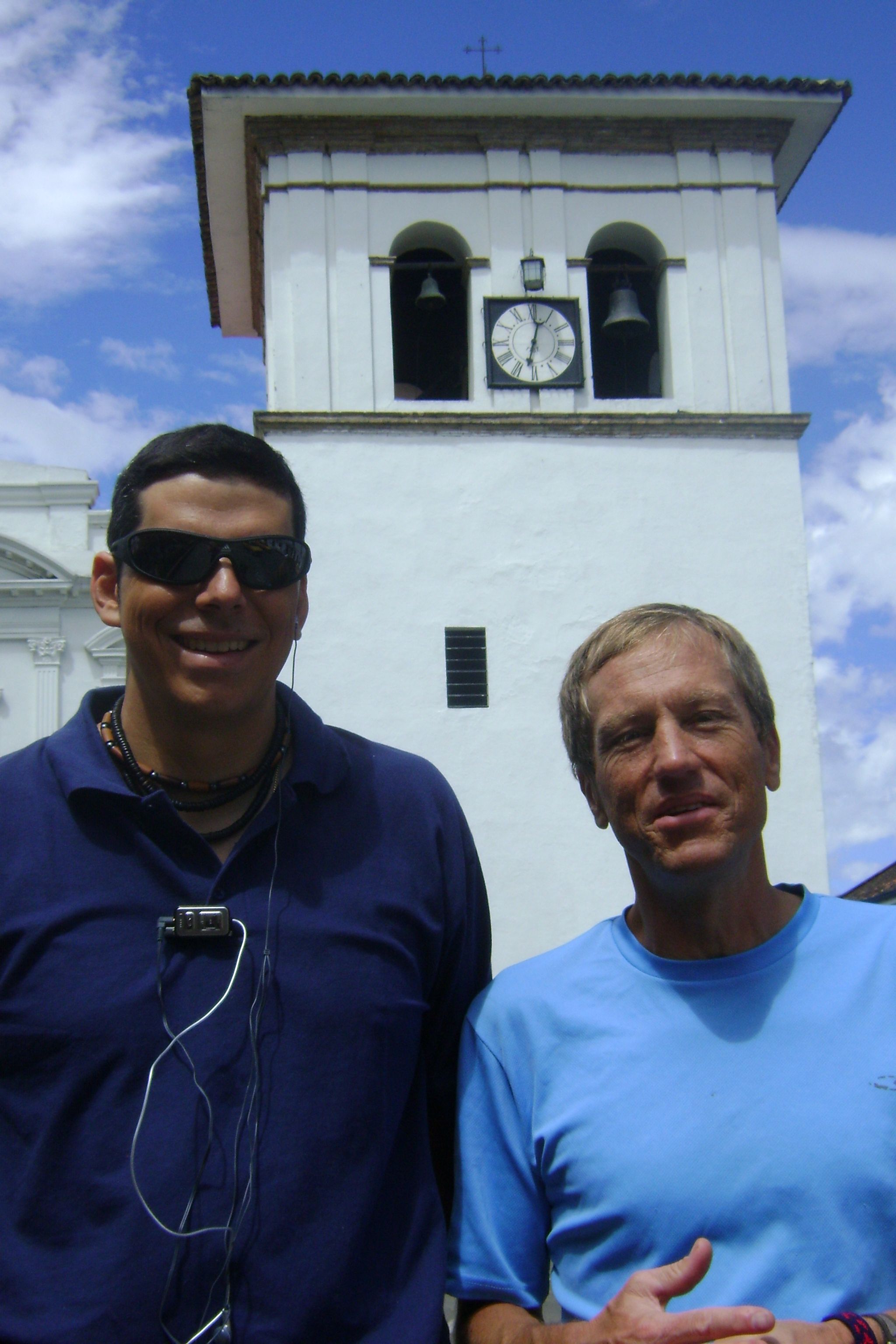
Our next major stop was at Popayan where we stayed with Santiago and his family. The family would be considered upper middle class in any culture. They live in a two story apartment in the middle of Popayan. Both Santiago and Marta are hard working folks, have one daughter whose beautiful name is María Camila, also a small chihuahua dog and a live-in servant. Santiago gave us a complete tour of Popayan including the dozen of churches and we were tested on all the names of the churches.
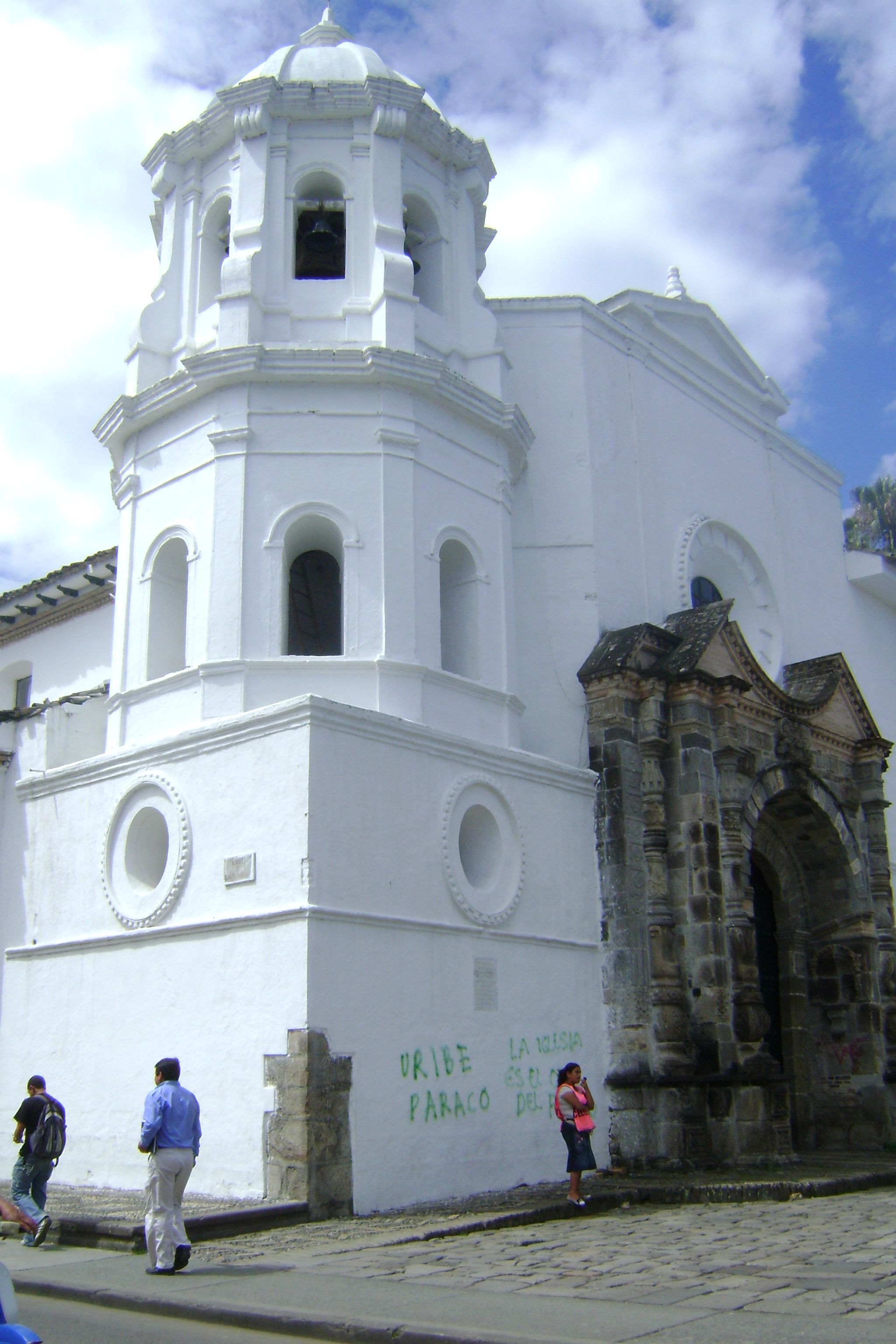
Let´s see if I remember all of them: San Francisco, Santo Domingo, La Ermita, San Agustin, San Jose, La Encarnacion, Cathedral Basilica Nuestra Senora de la Asuncion, Belen, El Carmen. There are as many churches as there are banks in this medium size town of 250,000. The buildings in the historic center, like Cartagena, are all painted white. Of all the places we visited in the 6 weeks in Colombia, Popayan is my favorite. Perhaps it was how well we were treated by our very generous hosts. We were treated to a fine dinning experiences at a posh restaurant serving fine typical local food. Santigo and family we thank you very much for sharing a few days in your lives and educating us about the fine people and town of Popayan.

The last week was full of more climbing and descents and rain. As we approached Pasto the weather did not hold back any more and the dreaded rain tested our spirit and followed us into Ecuador. But all and all the weather was great for the majority of time, the food and fruits terrific and the people were the highlight of our visit in Colombia.
My general impression is that Colombia is a well developed country with the majority being educated, more affluent then most Latin American countries. I loved all the different fruits like lulu, mora, guayba, and the ice creams and juices made from the exotic fruit.
The food was varied enough from location to location to be an adventure by itself.
What I will remember the most about Colombia is the absolute friendliness we experienced as cycle tourist. The country loves cycling and supports it in so many different ways. First of all the drivers seemed to give us plenty of space and shared the road with everyone. The huge number of cyclists of all kind is very impressive from the sports enthusiast to the worker, the commuters, the townspeople doing their errands.
Colombia is has many riches and is a very developed country that one day will get the respect from around the world that it deserve as a first class place to visit and live.
Incredible Scenery in the Colombian Andes
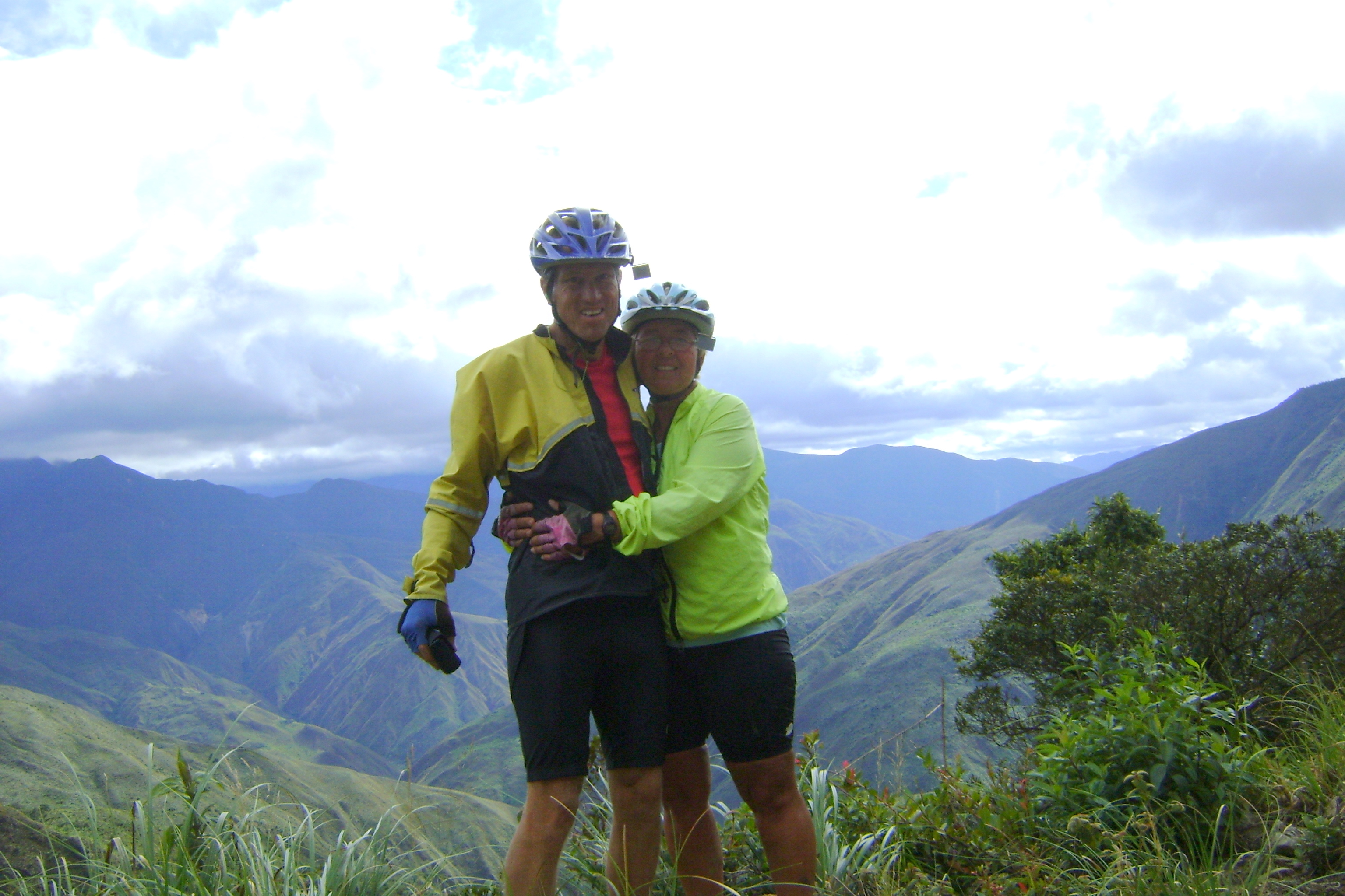
We crossed the Equator!
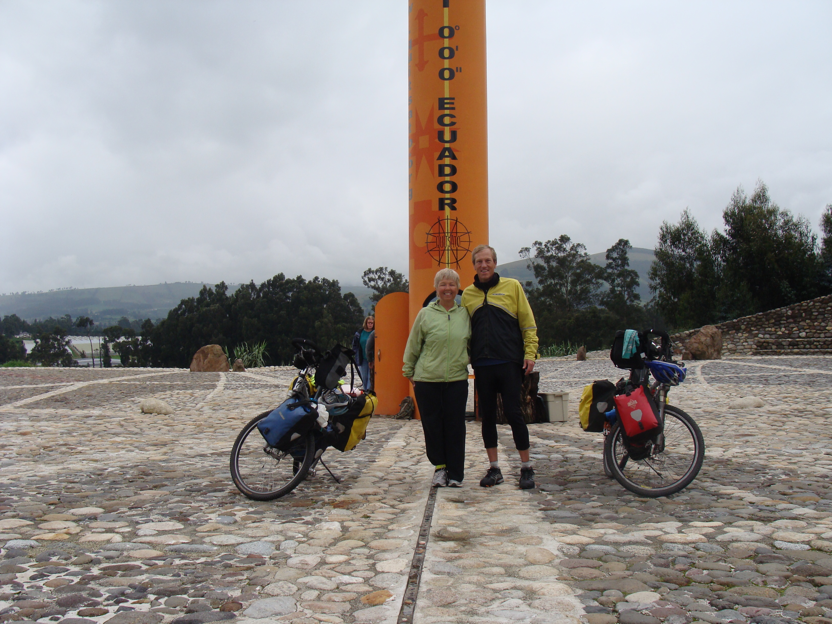
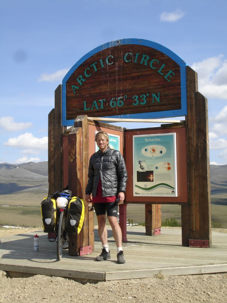
We crossed the equator on May 29, almost 2 years after we crossed the Arctic Circle on June 14, 2006! The amazing thing is, take a look at our clothing... I think we were colder at the equator (near 9000 feet of elevation) than we were at the Arctic Circle!
There was a fine monument alongside the rode with an incredibly intricate sundial showing the day of the year as well as the time of day. It was all for nought on such a cold, cloudy, rainy day though.
Stop Thief, Stop!
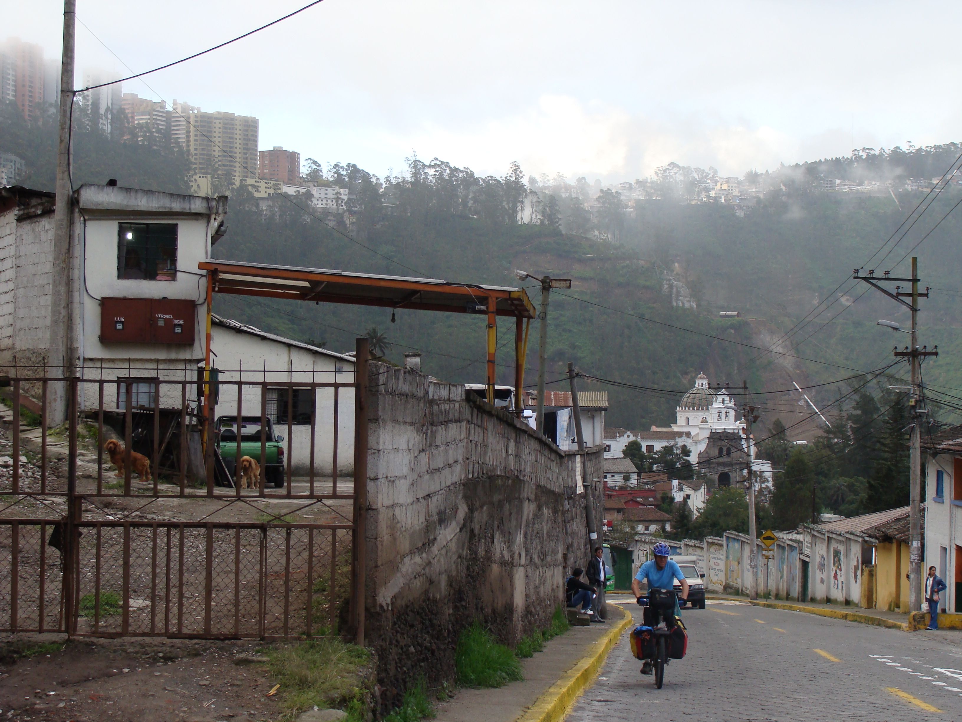
We had a funny experience yesterday on the way home from a fine afternoon wandering around the old city of Quito. We were on the excellent and cheap, but crowded, trolleybus. Whenever you're in a crowded bus anywhere in the world, especially standing, you need to take care of your possessions, and we were keeping a close eye out. Nancy spotted a young fellow in a brown baseball cap eyeing her as she put her camera away in her bag, and kept an eye on him. In fact, she was giving him the evil eye and he was also making eye contact in return. They understood each other completely.
As we stood there he snaked his way through the crowd, moving closer and closer to us and Nancy thought he was evaluating me as well. About the time Nancy was reiterating her warning to me to watch my pockets, we heard a lady call out "Thief - there's a thief here." Then another woman yelled "The one in the brown cap!" And the first one said "He's after the tourist lady!" (Nancy).
Then came the incredible part. Somebody yelled again, "The one with the brown cap". And they all started beating him with umbrellas and fists and forcing him to the front of the bus. The bus driver asked what was going on and stopped the bus and delivered the apparent theif right into the hands of a waiting policeman.
It was quite amazing. Nothing happened at all. We didn't get robbed or even come close, and I don't think he would have been successful with us. But to see all those people taking care of us (and brutalizing the accused thief) was pretty impressive.
New Photos (Colombia and Ecuador) and the Maps are Updated
We got our photos of Colombia all updated, and also the maps and elevation profiles of our route through Colombia are now there.
You can see the pictures:
- Second half of Colombia (or as a slideshow.)
- Ecuador (or as a slideshow.)
The maps and elevation profiles (including an overview of the route) are here.
Donde Estamos: Quito, Ecuador! Junio de 2008

¡Saludos a todos nuestros amigos que hablan español! Ya estamos en Quito, Ecuador después de un recorrido montañoso desde Medellín, Colombia.
Al contrario de todo lo que ustedes han oído sobre Colombia, hemos conocido nada mas que buena gente. Y no tuvimos problemas con la delincuencia ni narcotraficantes ni la guerrilla. Nos quedamos también en las casa de cuatro familias muy agradables que abren sus casas a ciclistas. Nunca olvidaremos la amistad y el cariño de esta gente. (Gracias a Jon y Ivo en Manizales, Gonzalo y toda la familia en Armenia, Miller y su familia en Cali, y a Santiago y su familia en Popayán. Ustedes nos dieron una experiencia increíble en Colombia.)
De Medellín pasamos a Manizales (que queda muy alto) y Armenia, Cali, y Popayán. De Popayán tomamos un bus para visitar al sitio arqueológico de San Agustín. Allí vivían desde 2000 A.C. hasta 700 D.C. una cultura increíble, y su esculturas nos hizo recordar la escultura de los Olmec del este de México.
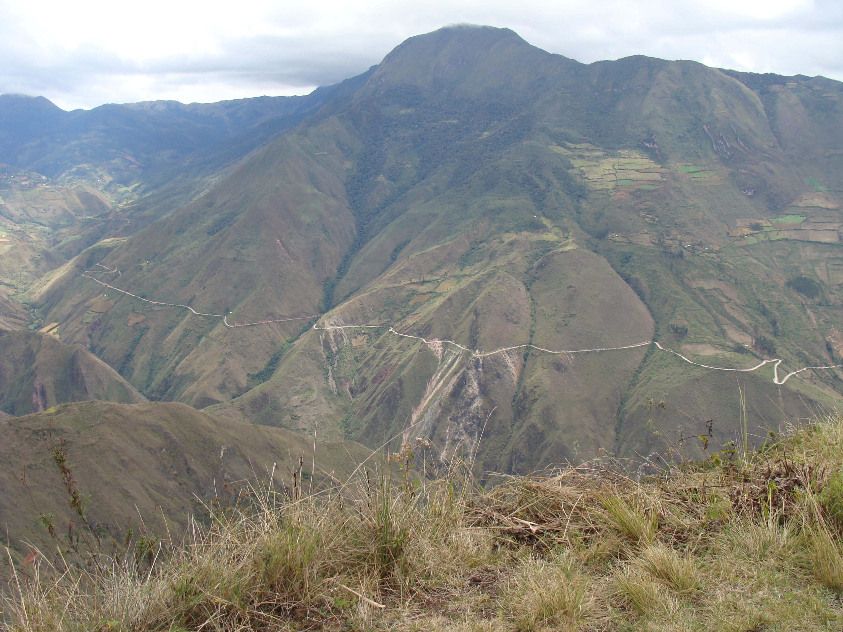
Antes de Popayán habíamos experimentado montañas y grandes cuestas, pero de Popayán h la frontera con Ecuador fueron increíbles subidas y vistas, valles, y barrancos enormes. En un solo día tuvimos que subir hasta 3000 metros o más, bajar a 900 metros, y empezar a subir de nuevo. Pero el paisaje fue de lo mas bonito que hemos visto en nuestro viaje. (En todo nuestro recorrido desde Canadá decíamos que todo era práctica para las Andes, y ya que estamos aquí reconocemos que decíamos la verdad! Pero aunque es duro, también es bonito, interesante, y emocionante. Y estamos muy orgullosos que lo podemos hacer.)
Del sur de Colombia hasta Quito experimentamos una ola de invierno -- el tiempo siempre estaba nublado y no pudimos ver los grandes volcanes que dominan a Pasto e Ipiales (en Colombia) e Ibarra, Otavalo, y Quito (en Ecuador). La lluvia y llovisna aumentó al punto de estar incómodo a veces. Pero esperamos que cuando empecemos de nuevo tendremos el tiempo agradable del verano, con cielos azules para que podamos ver el volcán Cotopaxi y todos los demás que nos esperan al sur.
En el norte de Ecuador cruzamos el ecuador, a un latitud de 0! Hace casi dos años cruzamos el Círculo Ártico, y ya llegamos al ecuador! Hay fotos de nosotros en los dos lugares aqui
Mañana vamos a iniciar un tour de las Islas Galápagos (por avión y barco pequeño) para conocer esas islas fantásticas y su fauna increíble. Regresaremos en una semana con las cámaras completamente llenas y tal vez les tendremos que mandar otro correo.
Y entonces empezaremos de nuevo nuestro viaje al sur. Nos faltan todavía 700 kilómetros de pueblos, paisaje, y cultura en Ecuador antes que lleguemos a Perú. Todavía nos faltan mas o menos 9000 kilómetros hasta que lleguemos a la Patagonia en Argentina y pensamos que con un poco de disciplina podremos llegar allá en Marzo del año que viene, antes de la llegada del invierno allí.
Una cosa más: Queremos recordarles de nuestra caridad favorita, Agua Para La Vida. Agua Para La Vida provee agua potable a aldeas muy retiradas en el campo de Nicaragua, y hace un buen trabajo. Si puedes darles algun tipo de apoyo, les damos gracias a ustedes.
Gracias por seguirnos por email! Mándenos una nota cuanto nos piensen.
Nuestras fotos ya están actualizadas:
- Segunda parte de Colombia (o como slideshow.)
- Ecuador (o como slideshow.)
También los mapas y perfiles de altitud están
aquí.
Siempre hay muchas historias en nuestro sitio http://hobobiker.com/espanol, y puedes leer una mala traducción de todas las historias en este enlace.
Gracias!
-Randy y Nancy
Nuestro libro sobre Las Mujeres de Puente de Amistad en Guatemala

Hemos terminado la traducción a español de nuestro libro que trata de las increibles mujeres de Puente de Amistad, quienes conocimos trabajando en Guatemala en Junio y Julio del año pasado. Esas mujeres fueron tan impresionante y admirable. Por eso escribimos el libro, pero nunca tuvimos bastante tiempo para traducir a español y revisarlo. ¡Y las mujeres del libro nunca lo han visto! Pero en Quito pasamos casi una semana estudiando en el Cristóbal Colon Spanish School, y Randy tomó como su objetivo la traducción y revisión del este libro.
Usted puede leer el libro en forma PDF aquí. También es posible comprar una copia imprimida (a nuestro costo, sin ganancia) aquí en blurb.com. (Desfortunadamente no ofrecen pedidos a muchos paises, pero si a México y Argentina.)
The ride south from Quito
We rode out of Quito heading south on Sunday morning to miss the busy traffic. But we did not succeed in missing the polluted buses that blew thick black exhaust straight into our taxed lungs. We had just been at sea level for 10 days and the re-aclimation back to 10,000 feet was taking me a few days. Chest pains, shortness of breath, and rapid heart rate was not helped by the pollution emitted by almost all vehicles that passed us as we climbed to higher elevations. The city landscape was replaced with green pastures, cows, llamas, sheeps and small pueblos with amazing markets. I started to breathe a little better but about 20 miles outside of Quito, I called it quits for the day and we stayed overnight in Machachi. I spent the afternoon roaming around the markets where I bought a pair of high socks made of wool and looked at the traditional felt hats which ranged according to quality from $10-$50 and wool ponchos for about $15. Randy who can't tolerate shopping for a whole 5 minutes headed to the internet.
The next day we rode the Pan-American highway for about 20 miles and then found a back road that headed south through much quieter, farmlands. This road is what I like about bike touring. No traffic, no painted line, fresh air and rural folks who waved at us as we pedal past their adobe homes. It felt good to be on the bike again and feeling much better.
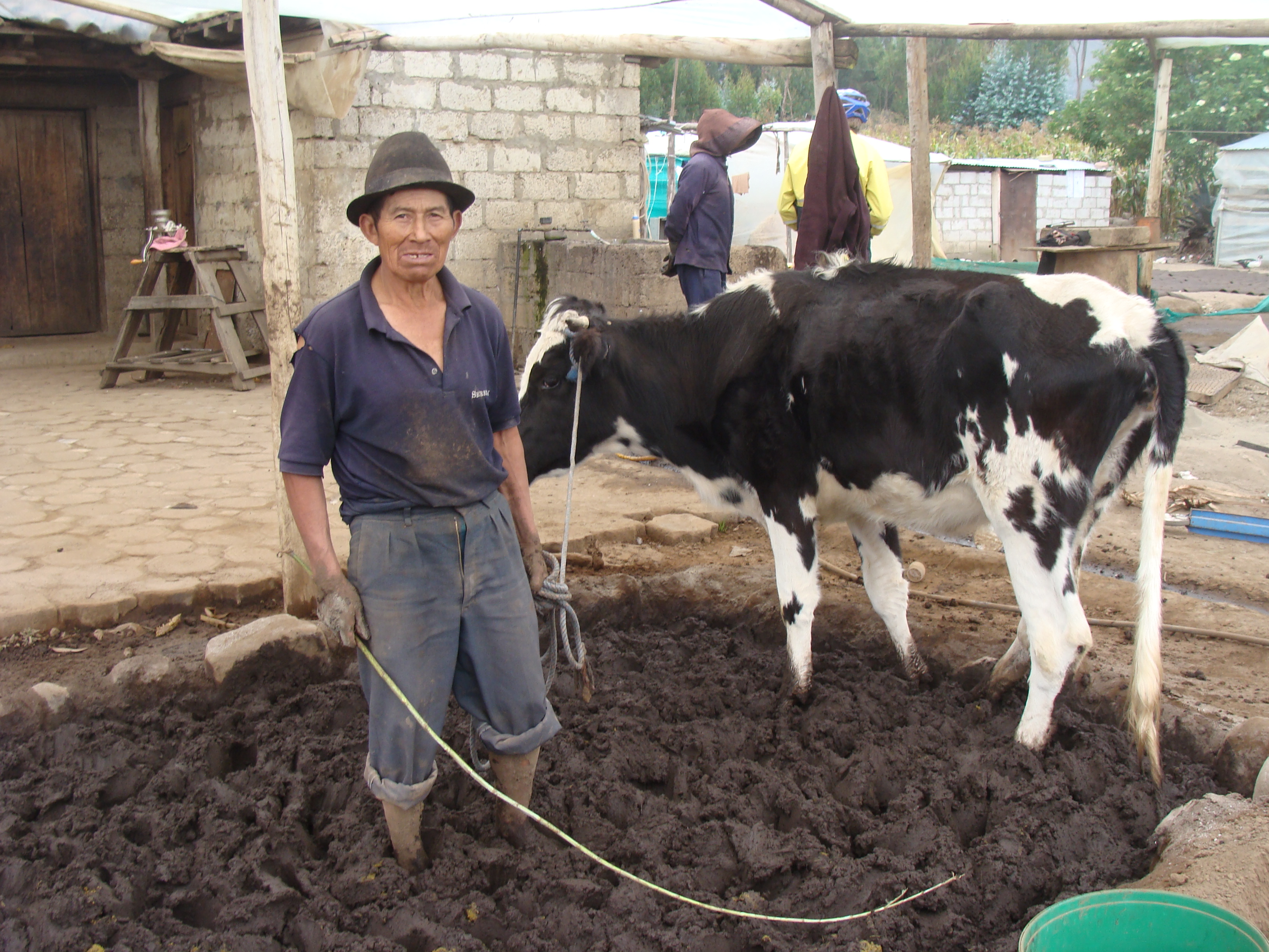
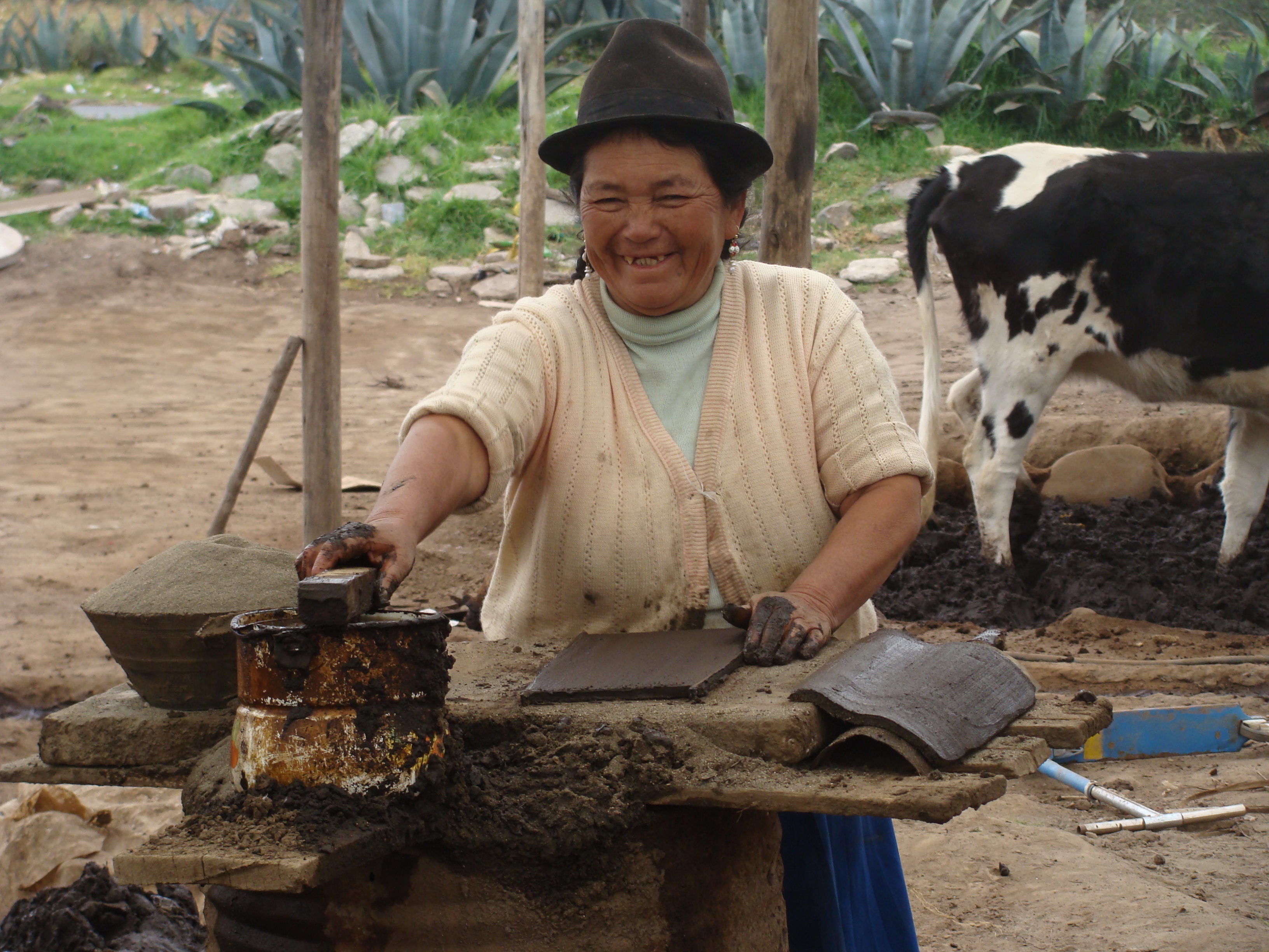
The first family we met was an indigenous family running a by-hand rooftile manufacturing operation. We had a great time with them, seeing how they work the clay with a cow and then form the tiles by hand. They get about 2 cents for every tile, and can make about 500 in a day. Thus the whole family working together might be able to gross $10/day. They don't have their own oven to fire the tiles, so have to turn them over to someone else.
We found our way to indigenous village called Pujilí. As we entered the outskirts of the town, a friendly old guy on a bike, who may have been hitting the bottle, caught up with us and escorted us into town. He was a delightful friendly fellow. He brought us to the only place to stay in town which is called the Casa Campesina, and is really a place for poor people who come to the market and have no place to sleep to spend one night but they take in anyone who needs a place to stay for absolutely nothing. The place is a whole complex with 8 or so different building. It is painted beautifully white and is supported by folks from Italy. It turns out there are Casas Campesinas in many towns, provided by the local Catholic church. We stayed in a dormitory room which sleeps 4 but had the room to ourselves. We slept on hand woven mats on bunkbeds with no mattresses but did have wooden slats. Three very old and poor women slept in the next room. The room smelled like people who have lived on a farm for a real long time and have not showered in ages. They where very cute in thier traditional Ecuadorian ponchos and hats. In the early morning they joined us for coffee before we all had to leave by 7:00 am. As a parting gesture we gave them 50 cents which they kissed and thanked God for the gift.
We took the back road to Salcedo which was a terrible ride because for 30 kilometers it was paved with rocks the size of softballs. All nicely lined up every 5 inches or so. Randy ate something bad yesterday so he was pretty sick. We managed to get to town after a spine splitting ride down to Salcedo. We found a nice hotel next to the center plaza. Randy is currently resting and recovering from this not so optimal day. I am amazed how strong he is, even when he feels sick as a dog, he rides strong without complaining.
Our Trip to the Galápagos Islands
Note: You can see all the pictures of the Galápagos trip here.
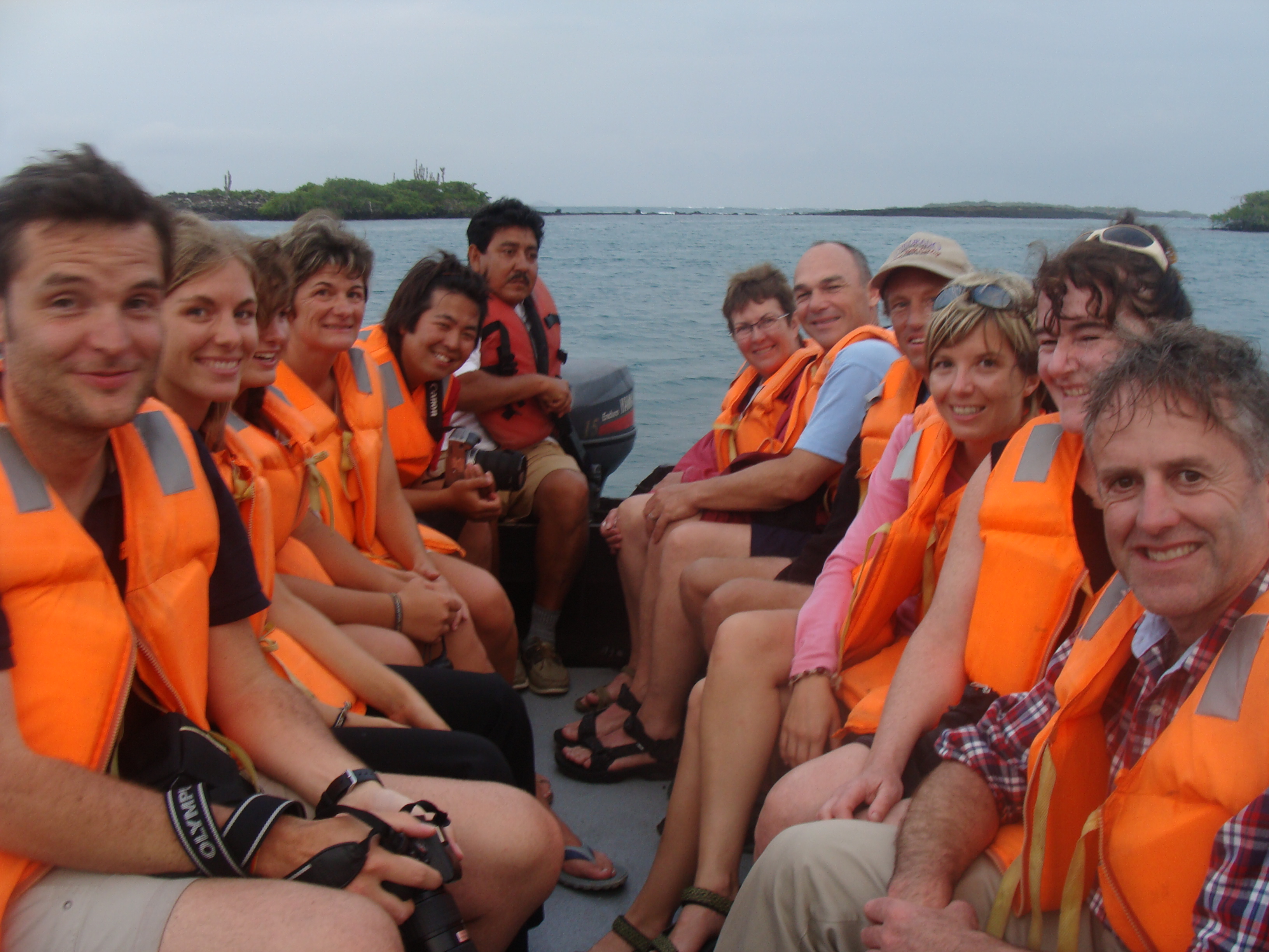
Having cycled all this way, we decided since we were kind of in the neighborhood, we should visit the Galapagos Islands, which are part of Ecuador and 600 miles west of the Ecuadorian coast. We made the reservation for an 8 day tour of the Galapagos through the Happy Gringo travel agency in Quito, which had been recommended by another cyclist. Not knowing exactly when we would get there we communicated through email for a few days prior to our arrival in Ecuador. I was very impressed with their quick and thorough responses to our thousand questions.
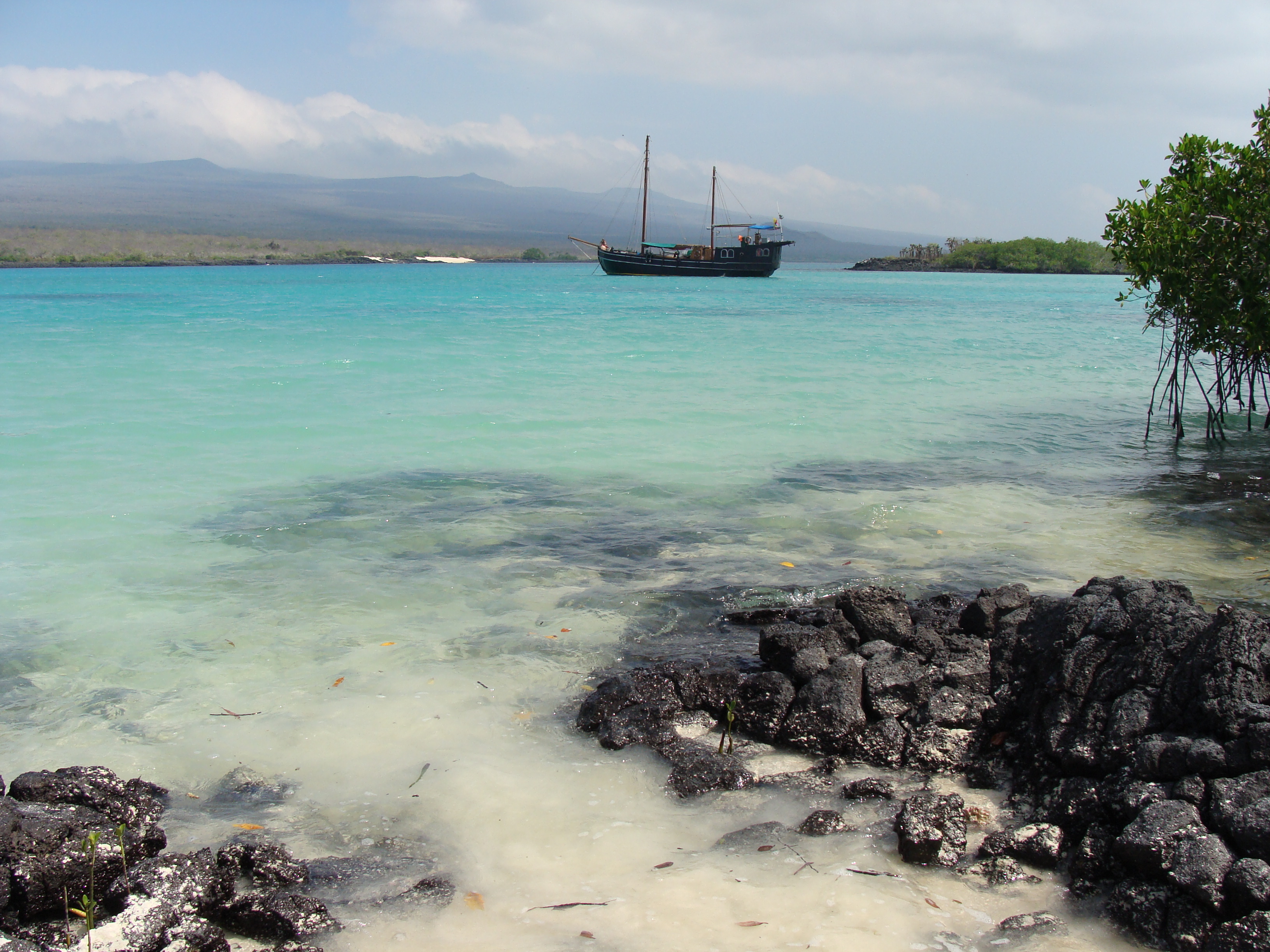
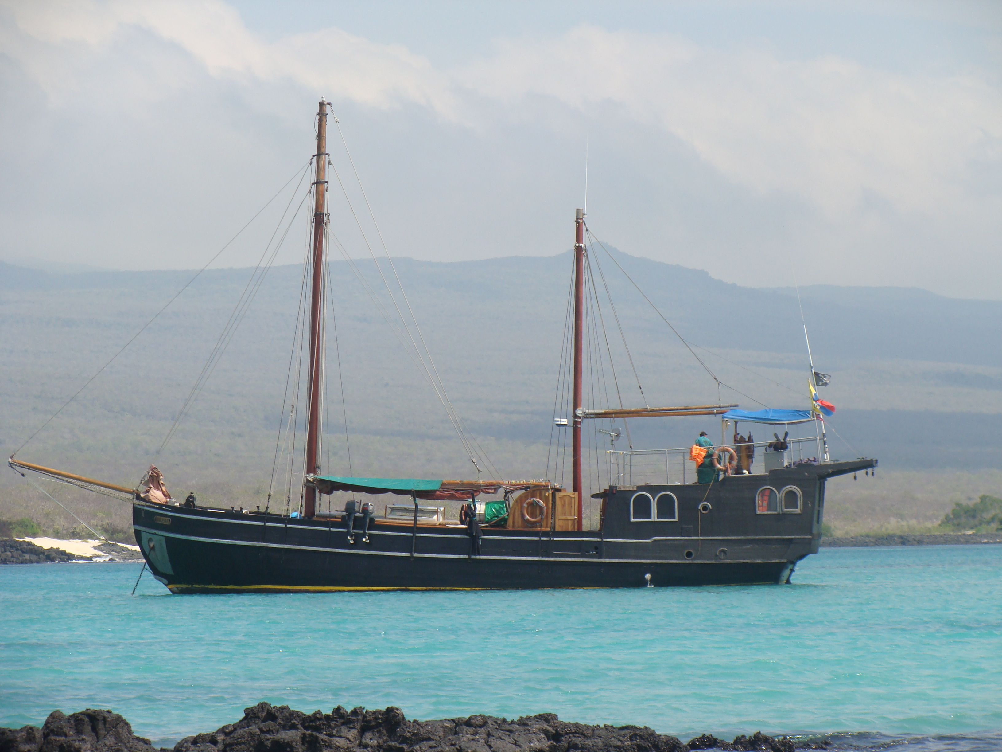
When we finally got everything arranged, we had reservations on a 100-year-old twin-masted ship called the Sulidae (built in Denmark at the turn of the 20th century). They call it the pirate ship because of its age, style, and because it's painted black as night. Seeing the ship for the first time, I knew we would have a unique experience.
We flew out of Quito and arrived at the San Cristóbal airport where we met most of other passengers we would share this experience with. Right off, I knew we would all have a great time together. They seemed like similar folks with similar interest and all choosing to do a similar medium cost adventure. There was a couple from Canada, a couple from Australia, a mother and two adult children from Denmark, a newly in-love couple from Germany, and Ken, a masters student who reminded me of a National Geographic photographer.
When we boarded the ship after the group briefing we were shown to our cabins. We did seem to get the smallest of the cabins and the smelliest. But luckily we did not bring much luggage, and our three small panniers just fit under the bottom bunk. I got the top bunk with a hatchway that opened so I could sleep cooler at night. We figured out what the smell was from the small bathroom that was part of our cabin and it was basically the combination of mildew, sea, and the nature of the beast. All week it would a challenge to manage, especially during times we experienced rougher seas. We did not plan on spending much time there other than sleeping so we just coped with it. We had the small room and more toward the front of the boat where we felt more of the rise and fall of the ship during the times when we where sailing (always at night). The people in the back of the boat had larger spaces, but the sound of the pumps and the motor were going all night long.
The purpose of the trip was to see the wonders of the Galapagos Islands and we did that! During the 8-day trip we saw an extensive part of the Galapagos Island and had no time to sit and relax. We were on the go the whole tour from 8:00 in the morning to 8:00 at night. We brought along books we had imagined we would need to pass the time but hardly read a chapter the whole trip.
The crew sailed the boat at night and we arrived at a new place before the morning meal. After the morning meal would would take the panga, the (very) small motor boat to either an island to hike or a new place to snorkel or swim with the sea lions or motor around seeing the wonders.
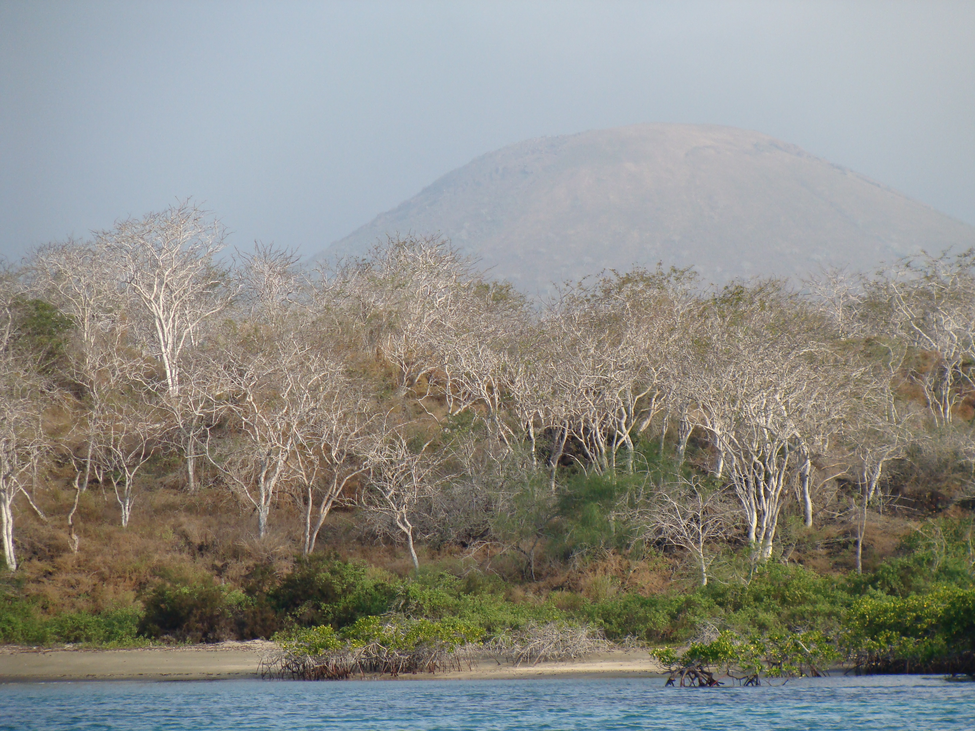
The first day we walked a nature trail on San Cristóbal Island and learned about the delicate environment that is home to much life that only can be found in this area. Actual the amazing thing about the Galapagos is that the animals, birds and many plants have adapted to each particular island.
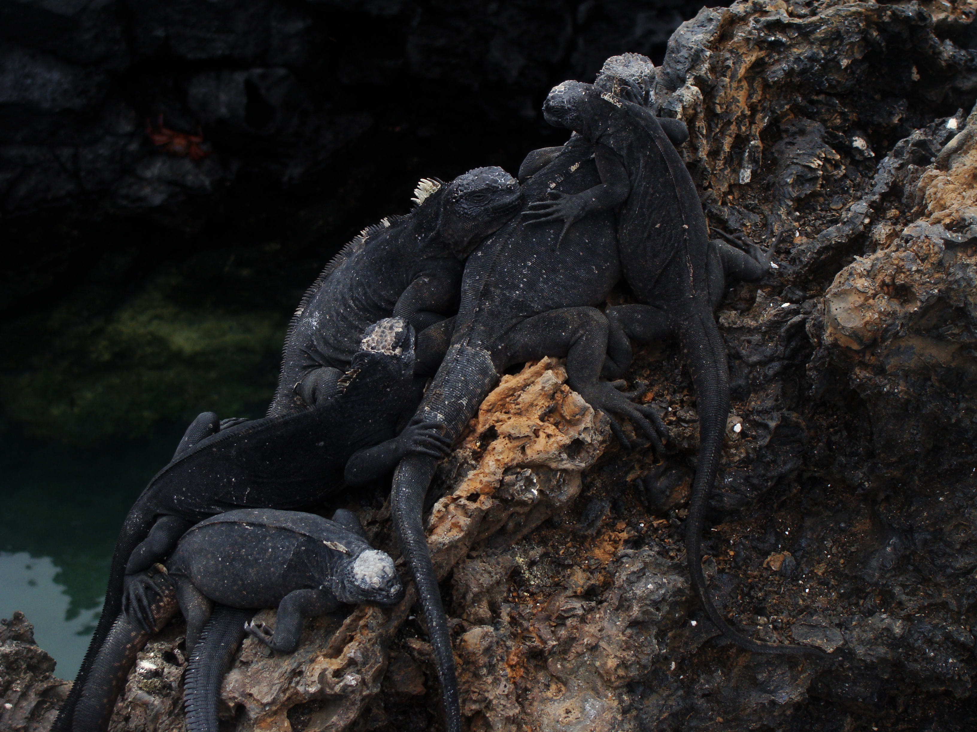
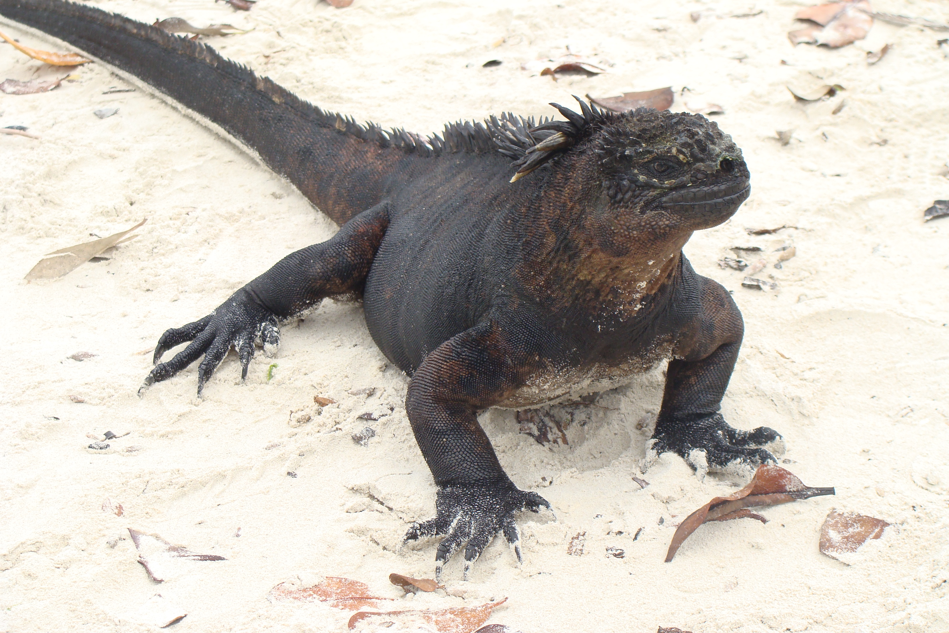
During the next 8 days we would take many nature walks, guided by Raúl, the well informed park ranger/guide who was born in the area. In English, he educated us about the magic of the islands. I never tired of seeing black marine iguanas (they swim and dive, deep!) sunning on the black lava rocks, the restful sea lions lazing on the beach and or admiring the 500-pound giant tortoises munching on grass. Living up to 175 years, one old tortoise we meet was supposedly born during the time Charles Darwin did his research at the Galapagos Islands.
In 1835 Charles Darwin studied and noted the similarities and differences of the flora and fauna and finally concluded that the species, in order to survive, would gradually alter based on environmental conditions. After 20 years of research he published the "The Origin of the Species by Natural Selection" in 1859.
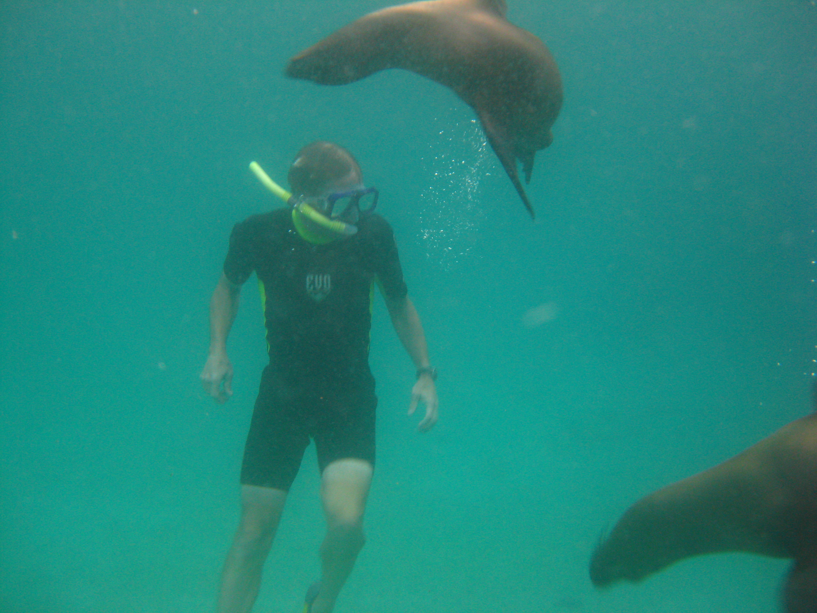
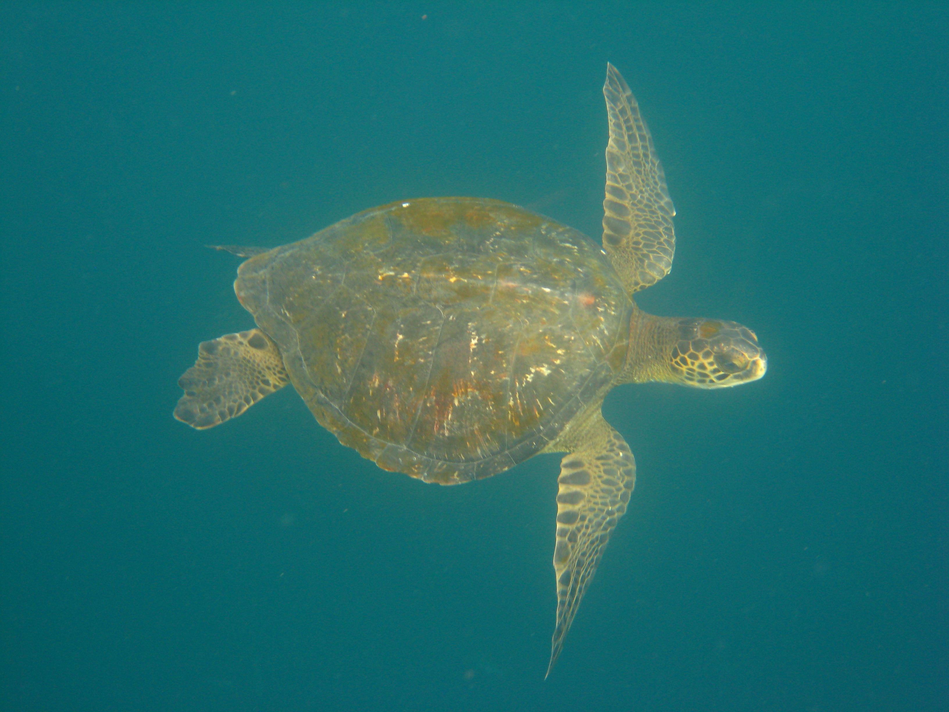
What I enjoyed most was the snorkeling and swimming. Randy and I rented wetsuits and snorkeling gear so during the hours in the water we were comfortable and enjoyed the feast of underwater life. The most entertaining was swimming with the friendly and curious sea lions. They would swim right up to our masks and just about kiss the glass before swimming around in a circle and returning. One group of sea lions actual absconded with the anchor of our small motorboat and hung it up in some rocks. Randy had the most fun diving down into the deep water and being surrounded with many these wonderful creatures. Together they would twist and dive and resurface for a breath of air and descend once again for another frolic in the sea.
Once Randy paying to much attention to his new friends and was swimming upside down near the bottom and clobbered his head on a massive rock. Laughing he came up for a breath holding his head and continued on with his play.
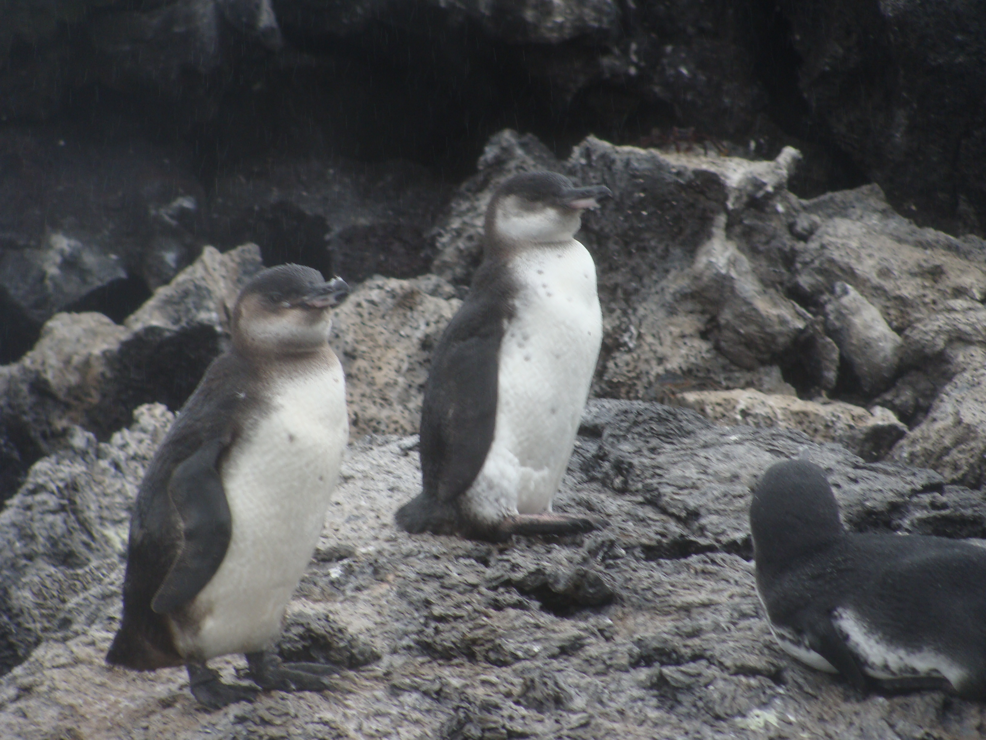
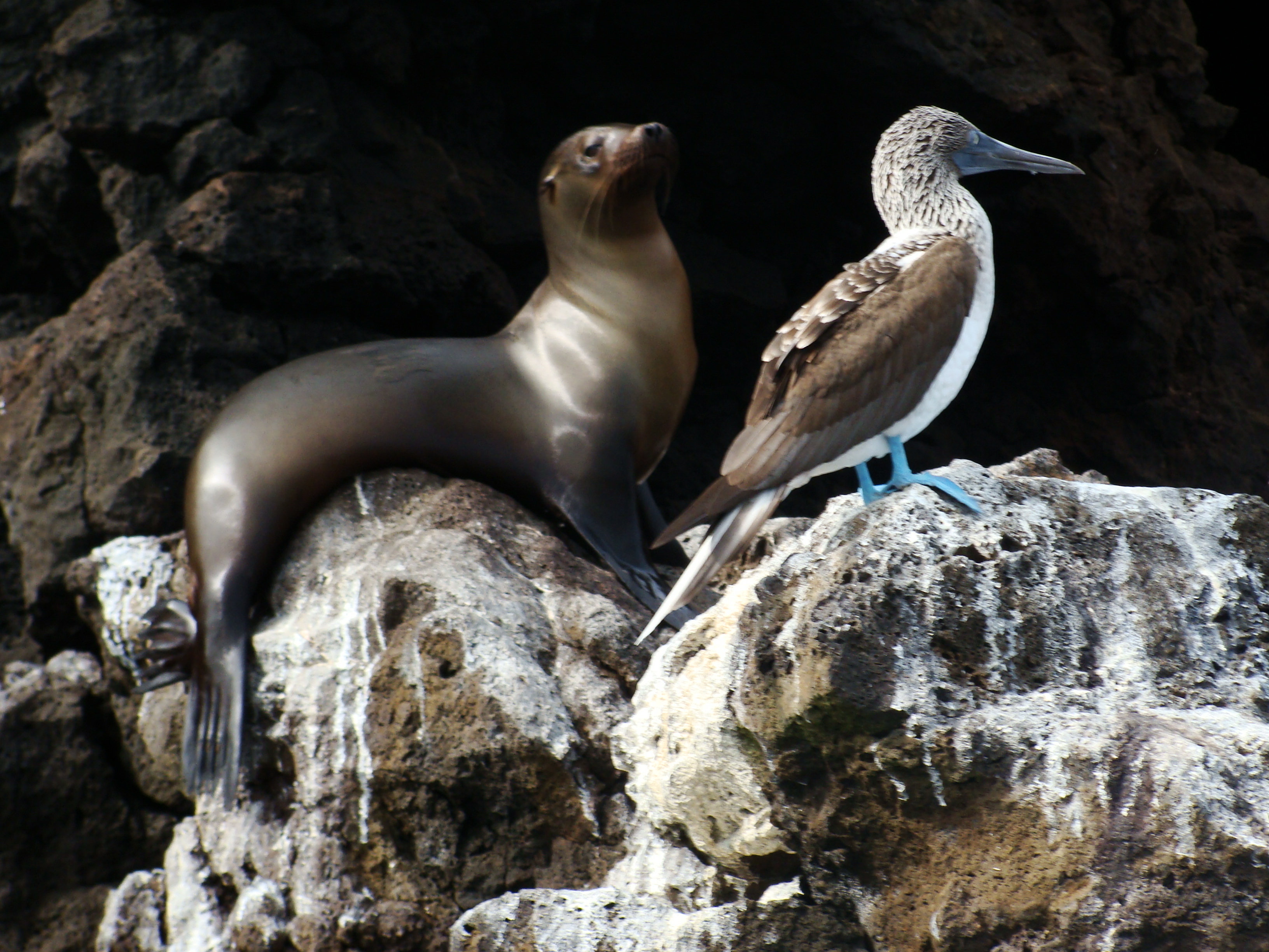
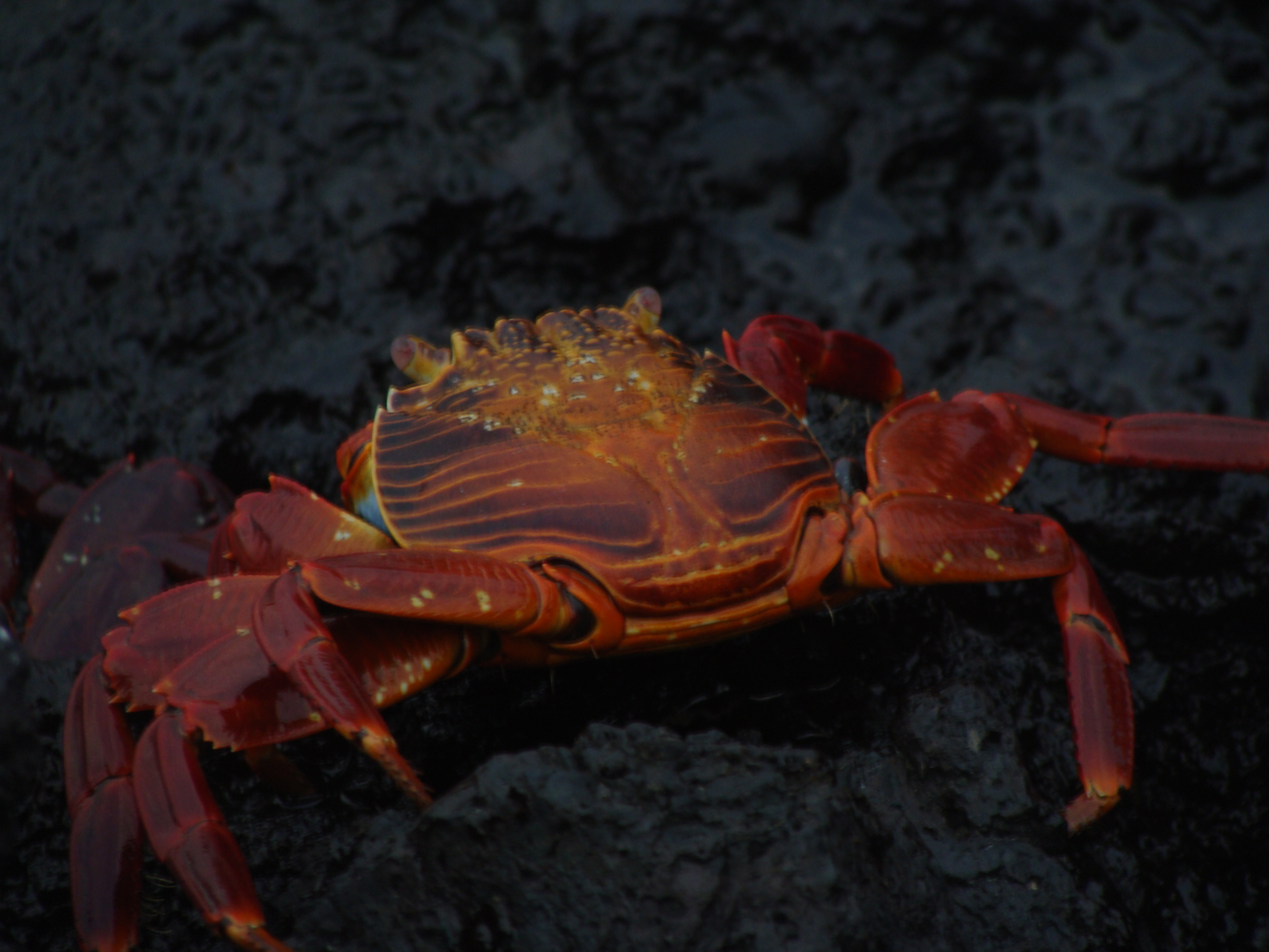
In total, we visited 4 islands: San Cristóbal Santa Cruz, Floreana, Isabella. We saw the famous blue-footed boobies, the lava finches, magnificent frigatebird, swam with Galapagos penguins, marine Iguanas, land Iguanas, Darwin finches. Galapagos hawks, and doves. pelicans, and Sally Lightfoot crabs. We visited several reserves and research centers,
We rode some very old and tired horses up to the second largest crater in the world on the Fernandina island. But the day was foggy and rainy so we did not see the crater. Three of the 16 horses fell during our trip including mine. My horses footing was shaky at best. It tripped forward onto its front two legs and forward I followed. I gripped on to the neck which softened my landing and I just rolled down and up on to my feet. I was a little bruised for a week or so but nothing major. One family who are experts on horses refused to ride the horses because they felt they where underfed and not fit to have riders and perhaps this is why 3 riders went down.
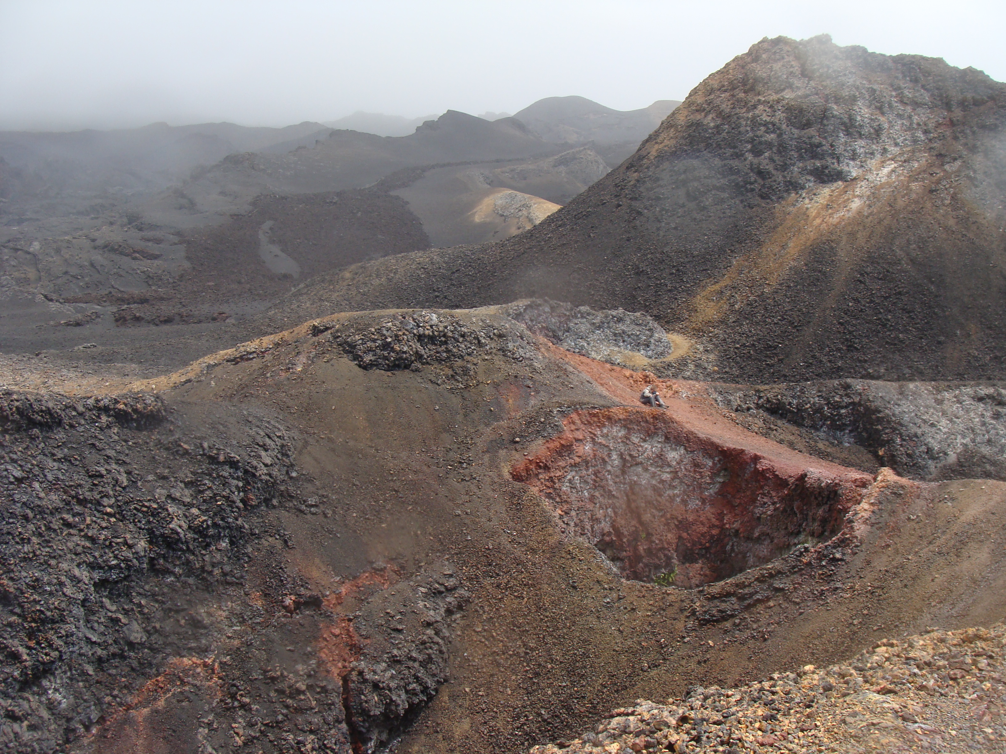
We did get a beautiful view of Volcan Chico with newish lava flows. The old flows have turned red from the release of iron and the massive pitch-black flows from the 1968 eruption lie over the older oxidized under-base creating a surrealistic moonscape.
Another adventure we went on was by fishing boats. Because of the safety factor, the expedition went out on two boats which each had two 250HP engines. During the one hour trip to the lava tubes where we were going to snorkel the boats pounded through the open water.
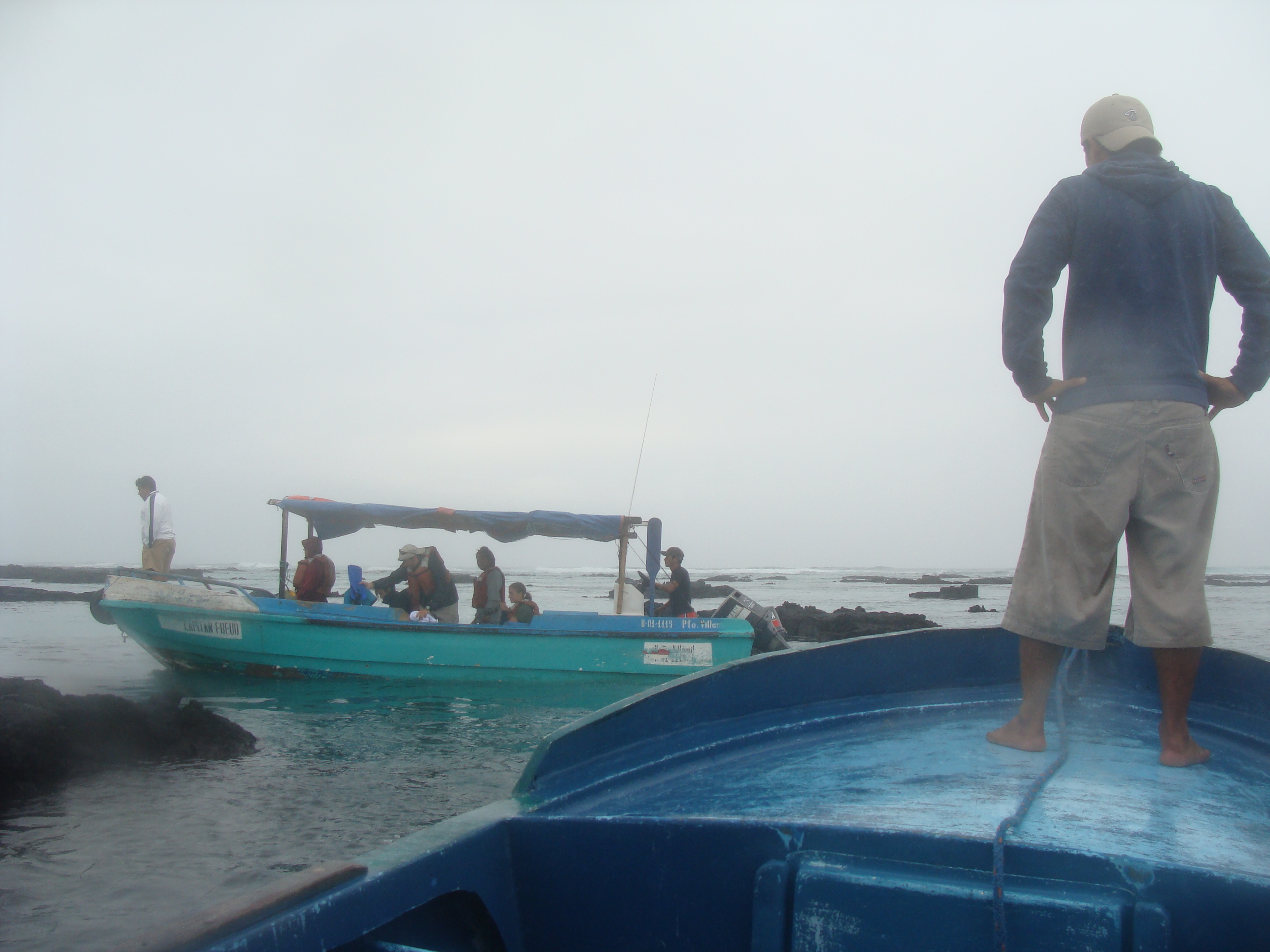
The boat slammed so many times, I imagine I am 1 inch shorter (if that is possible) after the spine crushing expedition. Once we got close to the cove the real adventure started. In order to get to the cove we had to find a way to shore through the 3 -5 foot surf waves. After scouting for a route through the surf for 30 minutes and many tries the fishermen finally succeeded by revving up the two powerful outboard motors and raced the surf into the quieter waters of the cove.
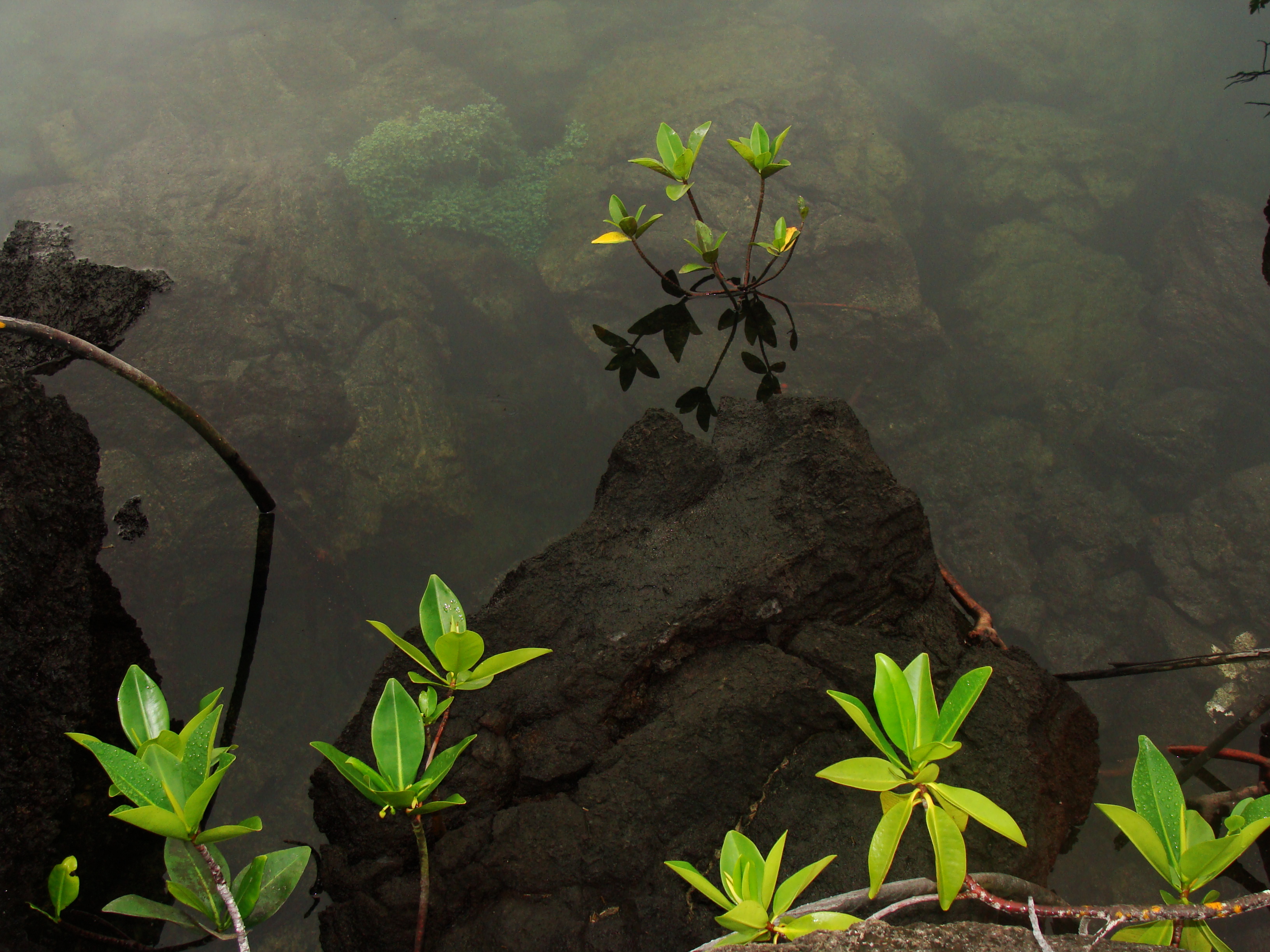
Our driver put a handle of one motor between his legs, up into his crotch and the other motor he directed with his left hand. Once into the coves we swam with sharks, giant tortoises, Galapagos penguins, school of tuna and tons of other colorful fish. The collapsed lava tubes provide an enchanting cove of lava arches, brackish water just right to support giant swimming turtles and intermingled mangrove trees. I have never seen a more magical place.
The boat ride out of the caves was even more treacherous than the ride in. Our boat almost got creamed by the other boat on one failed attempt. The boat we rode in made it out after a half a dozen tries, but the other boat made it safely out of the crashing waves only after 30 minutes of trying and failing. The trick is to wait until there is a perfectly quiet set of waves. I did admire the fishermen's patience, skill and experience.
One of the best parts of our trip was the wonderful food cooked by Carolina. Every meal she made was great, including homemade deserts. She cooked these fine meals in a space no bigger then 4' x 6'. How she created all those masterpieces in such a small space aboard a rocking ship, I will never know but I will remember her tortas, chocolate mouse, Carmel cheesecake and the shrimp bisque. Three fine meals a day were served up to twelve of us hunger explorers.
The ship sailed at night for 6 to 10 hours most nights in order to reach another island. It was rougher then we had anticipated but all but one night we got some sleep, well most of the time. The last night was the roughest.
I had to close my hatch above my bed because of the waves crashed on to the deck and into my air hole. That night I do not want to experience again. I felt real bad for the new passenger we picked up for the last night of our trip and it was the beginning of her trip. She was sicker then a dog. I wonder how she survived.
The whole trip was wonderful: the crew, the places we visited, and the folks we shared this incredible week with. It is amazing that a small bunch of strangers for all over the world can become such good friends in a short period of time. It must be the magic of the place.
If you are thinking of going to the Galapagos Islands, arranging a trip on a ship is a way to see more of the area. Go on a ship with 12 passengers which makes the experience very interment, faster to embark and easier on the delicate resources. Large ships with many passengers is taxing on a delicate environment and may be prohibited in the future. Pay more then you think you can for a quality boat. Go on the biggest boat you can find to make the sailing smoother, but not more people. Take sea sickness pills before you need them.
Go during the ocean's quiet time (not that we know when that is...). The high season costs more and is during July and August but it may also be the high season for the wind and the waves. No mater, just do it and you will come away with many wonderful memories of a place of incredible beauty.
Down into the Amazon basin and back up to Cuenca
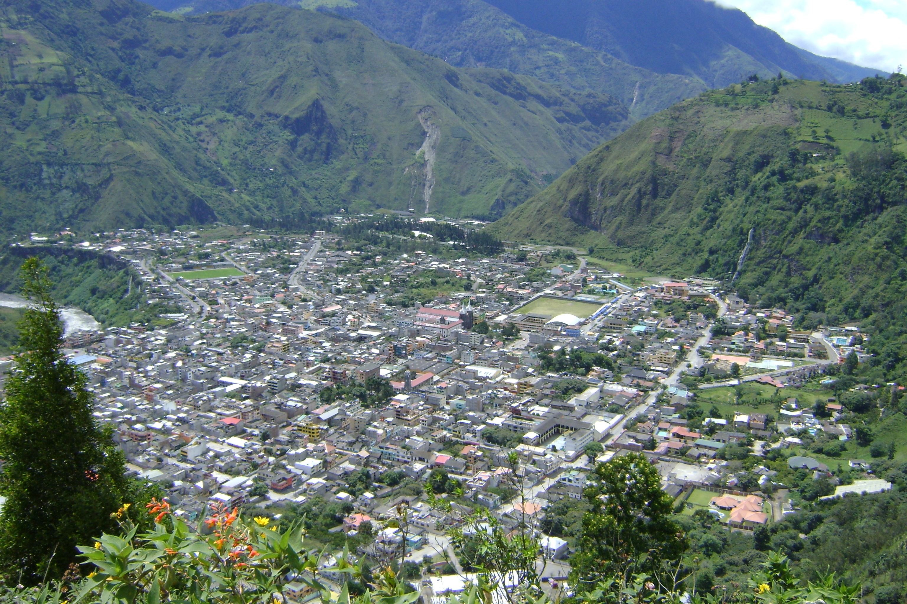
We have surfaced again and now are in Cuenca, Ecuador. After riding the Pan-American highway south from Quito for a hundred kilometers or so we decided to go to Baños to soak in the hot springs. Well, we liked that route much better than the Pan-Am, we continued down to the eastern Amazon region of Ecuador on the edge of the jungle and followed the roads south. Most of the time the roads were brand new and magnificent and other times dirt and pretty bad but the jungle lowlands were enchanting with wild bird sounds all around, exotic flowers, low traffic. The rain would would come and go most of the day and most times we found somewhere to sleep in a town. Actually the fanciest hotel we have slept in on our whole trip was in the delightful little town of Sucúa. It was our 3rd wedding anniversary and we felt we had found the honeymoon suite for $16 and just in time because we were like drowned rats arriving there in a big rainstorm.
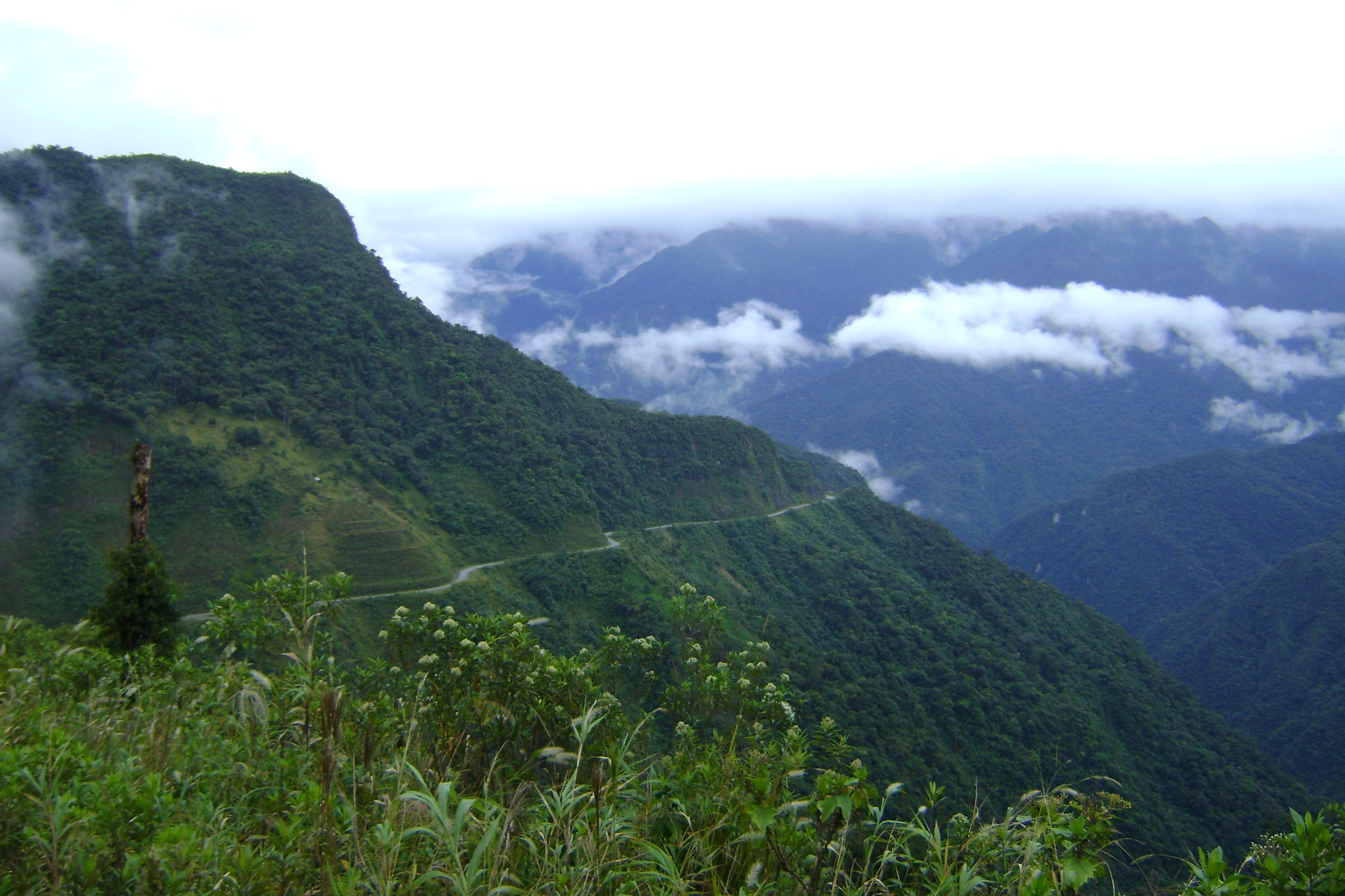
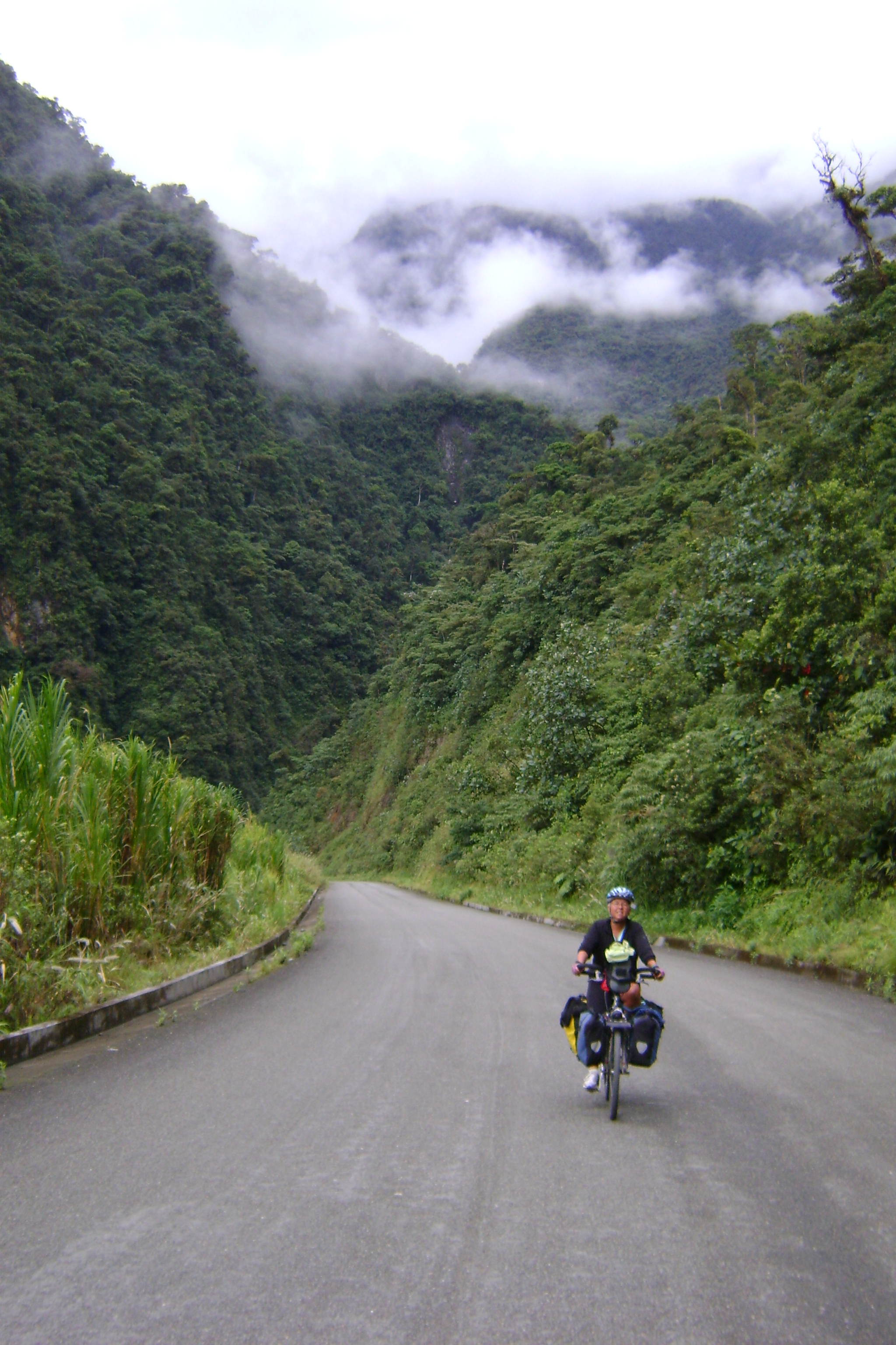
A good part of the first part of the trip was around huge volcanos. We stopped in Baños for some hilly walks, soaking in hot springs and a visit to the local zoo. We then dropped down to the jungle on the way to Pugo. The road from Baños to Puyo was a mountain biker's dream come true. Though there were 7 tunnels along this road, the cyclists were diverted around on dirt roads and through wonderful forest.
At one spot the road is washed out so we had to carry our bikes through a running creek that had fallen trees and brush. All part of the adventure. After about 6 hours of riding we dropped down to the Amazon lowlands where we would ride for the next 3 days. The forest is being deforested at an alarming rate. We saw so much wood being cut for lumber and stacked along the road side, I believe it was the only business in this region. It was sad to hear the chain saws and see the results of the swift destruction of the lowlands of eastern Ecuador. The jungle was being raped and no reconstruction was seen anywhere. This has been going on for some time throughout the Amazon region, of course, but it's not pretty to see it firsthand.

As we rode we would hear strange and wonderful bird calls, see exotic fluna and rode in awe of this remote place. The new aspalt finally ended on the first day and aspalt did not appear again for another day. We bumped along the dirt and stonelined road through areas that have not seen the likes of us. The people where quite and reserved and most just watched us in silence as we made our way past. The people live in simple homes, some with thatched roof huts and other with concrete blocks. Some how they carve a living in this area by living off the land.
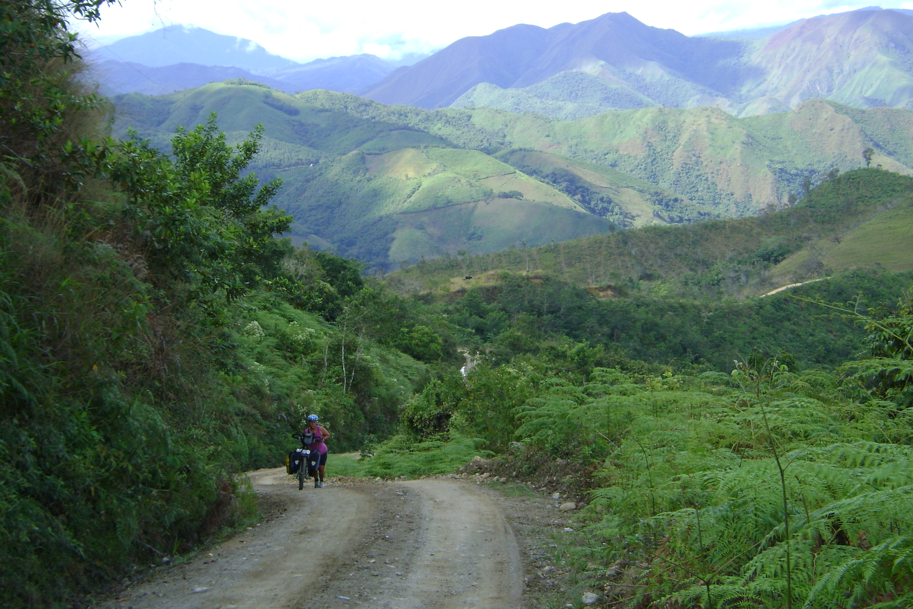
In contrast to the flat roads of the lowland of the Amazon which got down as low as 500 meters of elevation (about 1800 feet), the trip up to Cuenca (elevation 2500 meters or about 8000 feet) was difficult and stunning. We rode through a part of the Sangay National Park which is protected and has amazing beauty of towering mountains and cascades after cascades that seem to fall thousands of meters straight out of the sky.
One morning of camping at the humble home of Manuel and Maria and their six kids, we awoke to the most stunning vista of the blue-ish green massive mountain of the Sangay Park, valleys with running rivers and distance clouds resting in the far valleys.

During our early morning ride, we descended into those clouds and then continued below them in just 5 minutes. We lost 500 meters which we knew we would have to earn those meters back because we we need to climb up to Ecuador's finest city.
It seemed we would climb for two hours only to descend back down to the elevation we started at. This happened over and over for two days. After going down to the Paute river one more time, I finally said enough and we hitched a ride for 15 kilometers and up 700 meter higher to San Pedro, where we had a great lunch and a long talk with the owner about our trip.
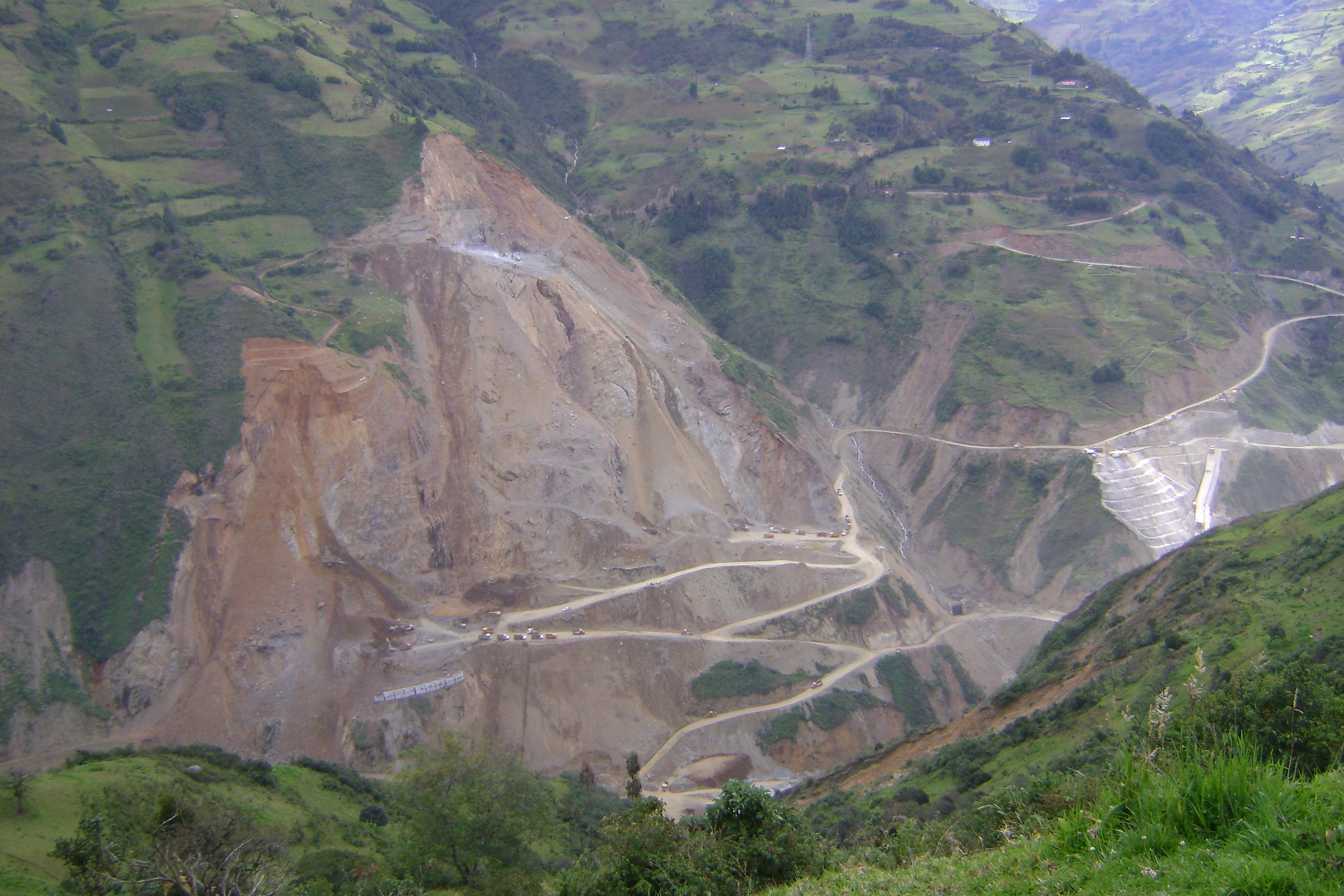
Fully fed, we continued on, passing by the huge new hydro-electric project that is being built on the Paute river. The current dam lasted 33 years and is now obsolete because of the amount of deforestation and erosion in this area has silted up the reservoir and the project can't produce efficiently any more.
As we climbed slowly up the the highlands, we seemed to ride slower and slower as it got colder and colder and the dogs got meaner and meaner. We would only ride 25 miles a day on this section because of the rain and cold.
2630255970After riding 18,000 kilometers, we finally encountered a real big bad dog. Climbing slowly up a hill, a two large dogs came after me and one got me. It bit me in the upper thigh. How the dog could get his mouth open that wide, I do not know but I do know it hurt. After getting a safe distance from that beast, we examined the area discovering the bite broke the skin just a tiny bit. We went back to the house and had a talk with the owner to find out if the dog had his shots and it turned out that he did and it was current. He had two dogs and he knew which one was the bad one. Continuing on with our ride this stretch of the road had many, many dogs that would run out and chase us. It was scary trying to control the bike with mad dogs chasing us and traffic going by. I added a stick to the back of my bike and now make sure my water bottle is full so I can spray attacking dogs. Randy would ride with me and chase the dog with his bike if the dog would not back down. One dog got kicked in the face and I hope he thinks twice about chasing a bike again.
We finally arrived in Cuenca a week after we left the Pan-America Highway a week ago which was my fault because I looked at a map and wondered where that red road would take us. It took us to the lowlands and back to the highlands through very rural country and through areas populated by the amazon indigenous homelands and through an amazing Ecuadorian National Park and back up to the agricultural highlands. We meet a lot of nice people who shared a part of the lives with us and extended complete strangers hospitality and friendship. Thank-you new amigos!
Ecuador route notes for touring cyclists, including map and GPS info
Some notes about routes in Ecuador that are probably only interesting for people planning to tour here:
- Our Route, Trip Log, Notes, and GPS Tracks: Our complete maps and notes are now up..
- Maps: We carried the ITMB Ecuador Map. Although I hate the ITMB maps, this one worked. In addition, we bought the excellent book of strip maps published by the Instituto Geografico Militar, which is available in good bookstores in Ecuador, like Libri Mundi in Gringolandia in Quito and at other sites. There is also a general tourist map available in tourist offices. Its biggest benefit is the extensive charge of distances between cities.
- GPS Maps: We were unable to find any GPS maps at that time to download into our Garmin GPS, but since GPSTravelMaps.com has come into existence. If you know of others, please send us a note or leave a comment here.
- We came in from the north, at Tulcan, which is where most cyclists coming from the north would get to. By the time we got to Ibarra, the traffic started to get irritating on the Pan-Am.
- Approaching Quito, we kept on the Pan-Am. There's a turn where most of the traffic goes the more direct route (not on the official Pan-am) via Tabacundo. At that point the real Pan-Am via Cayambe becomes a delight (and just past Cayambe is a fantastic equator marker). Per the advice of a tourist official, we followed it to Cusubamba, where there is a turn to the left toward El Quinche. That road was OK but got busier and busier. It finally dumps into the main road into Quito from the East. The idea was to get into town fast. It didn't work out perfectly. The road got quite busy.
Nancy found an important alternate route: Passing into Cumbayá, ask for the back road up to Guápulo, which is a vertical road climbing right up the cliff that lands right in the main part of the new city in Quito. (Our friend who just stayed on the busy highway into the city from the east ended up hitting a couple of nasty tunnels, one of which had a policeman who turned him back when he was partway through.) It was quite a climb, but the traffic was respectful and slow. All that said, there has to be a better way into Quito. Maybe the bus. Quito is a huge and long north-south oriented city, so coming in from the north means endless metro riding. Who knows.
- Our guidebook suggests that a northern route would be via the Mitad del Mundo, and that there is an old road from Mitad del Mundo to Otavalo. Sounds good to me.
- A friend also highly recommended the back road from Otavalo to Cayambe. We didn't take it because it was a gloomy rainy day and we didn't want to deal with a dirt road.
- Leaving Quito to the south was also irritating. It was 20km from the New City out to where the highway starts. It worked out OK.
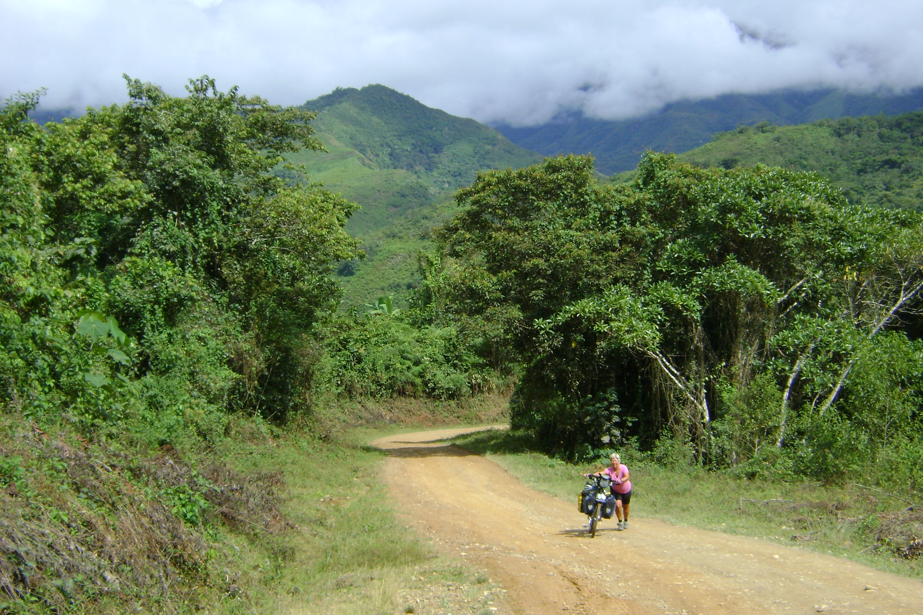
- Nancy got irritated with the Pan-Am, so we detoured east to Baños (very nice), and then continued on the marked bike path down to Puyo. It was delightful. We then continued an Oriente loop to Macas. Just 30km of this was unpaved, to the Pastaza River. It was pretty ugly at first, but it got better. All but this 30km was delightful pavement. From Macas we continued to Mendez, which again was mostly paved, but there was 20km of poor-ish dirt road. Then we ascended up to Paute, which was an awesome ride. About 25km of this was unpaved. An amazing amount of elevation gain. And incredibly beautiful sights. This Oriente detour is highly recommended and could be combined with a jungle expedition pretty easily. It was a bit remote than what we've usually done, so we ended up camping a couple of times, and once we needed more food than the pitiful amount we normally carry.
- Cuenca to Loja was pleasant, but the best part was about 20km past Saraguro (a nice town) at San Lucas. There at the bridge we took a left turn to go down the river on the Old Pan-Am, which was a delightful dirt road. No traffic, (but dogs of course), and just a great way to go. And shorter and easier than the new Pan-Am.
- Most bike tourists follow the Pan-Am from Loja to Macara and to the coast of Peru, then down through Trujillo and then up into the Cordillera Blanca. But more are now continuing on in the sierra through Vilcabamba and Zumba. That's what we decided to do, and it was great (and quite rough). About 20km past Vilcabamba it becomes dirt (to all the way past San Ignacio in Peru) and starts to climb over valley after valley. The first day out of Vilcabamba we enjoyed it too much and lost track of the time and got stuck camping in a good rain at 2600 meters. Not a good night, but it was a beautiful place. From Zumba to the border were two steep hills that took us most of the day. It was an easy little 7km downhill to Namballe, the first real town in Peru, and we actually made it before dark.
Update from Peru:
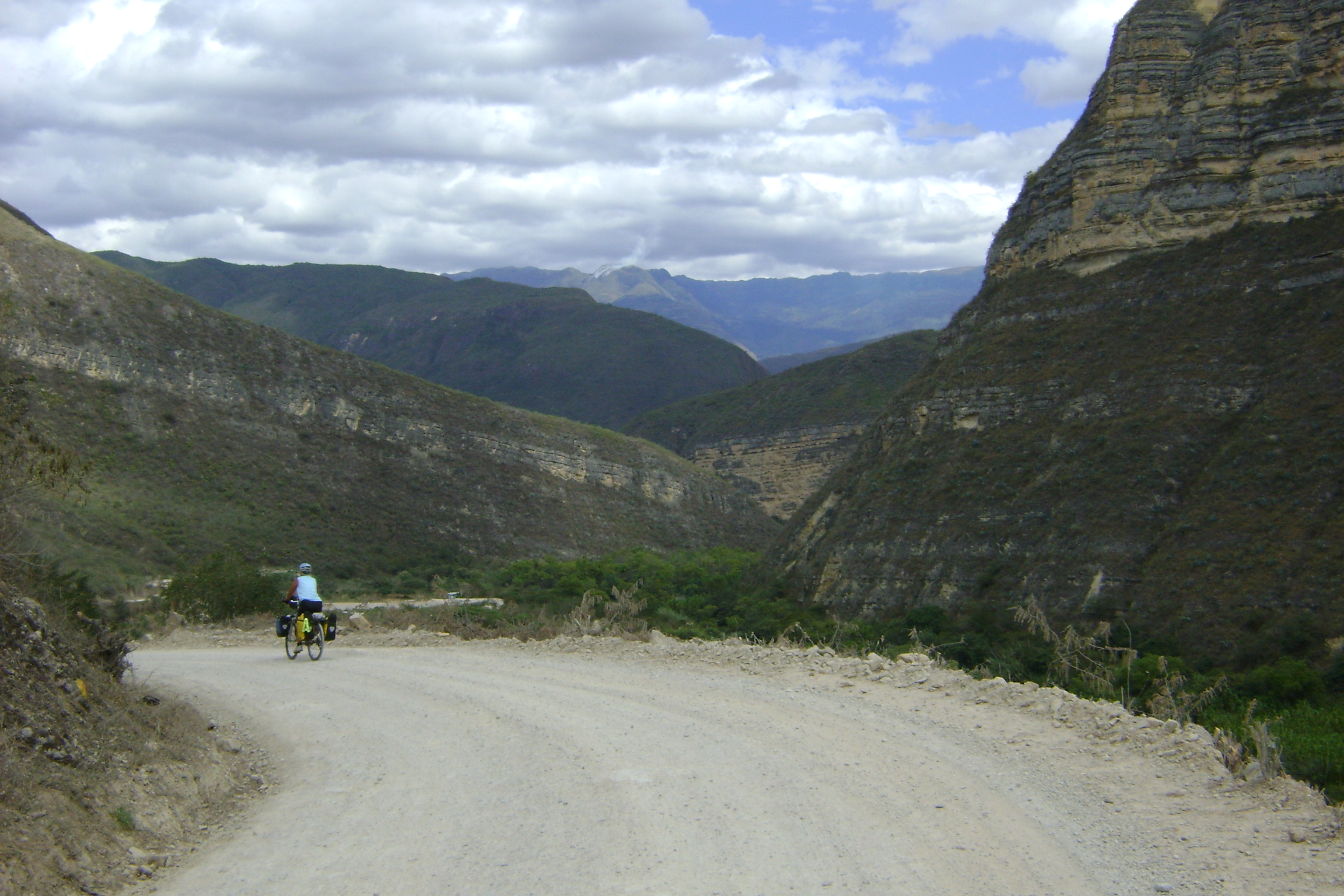
The route from Vilcabamba south to Zumba, into Peru, to San Ignacio, Bella Vista, Chachapoyas, Kuelap, Celendin, and to Cajamarca has turned out to be one of the most delightful stretches of the whole trip. Highly recommended. Mostly dirt road, some muddy, some hard (not too hard in Peru - the grades have been easier than in Ecuador). But all wonderful. A great way to enter Peru.
Cuenca to the Peru Border
The ride from Cuenca to the Peru border was one of the best and most beautiful (and hardest) rides so far on this trip. We rode on quiet roads, some paved but most dirt. The landscape was gorgeous and the views amazing. We rode through small indigenous villages where the women wore colorful traditional dresses, jewelry, and felt hats. The traffic was almost non-existent as soon as we left Cuenca. It picked up a little as we rode in and out of Loja. In Loja by chance we met Chaski, a Peruvian man who is walking the Inca trail, learning about the traditional ways people grow potatoes. He is an educator and he is connecting the indigenous people of South America together. We had met him in the far north of Ecuador and got to have dinner with him again.
The next day we rode to Saraguro, a pleasant village with proud and friendly people. The people seem to have a nice life, a sense of community and continue with the traditional Ecuadoran Indigenous life style. Many of the indigenous villages we had passed through seemed reserved and hardship seems to weigh on their shoulders. This village was strikingly different. It was a much happier place. The people more open and had smiles to share. We wanted to stay for the Sunday market but Vilcabamba was calling us.
Vilcabamba is a village of a few thousand people which has a reputation of being a wonderfully healthy place to live. The people supposedly live a long time there due to the magical properties of the water and the climate. I knew if we went there and spent a few days we would also benefit from the magical place. I wonder if by just visiting the place we can also extend our lives, living happily and healthy to 110. Stay tuned for another 60 years and you can find out.
We stayed at the Hotel Izhcayluma, 2 kilometers south of town. The place was so relaxing with hammocks outside our room and views of the Podocarpus National Park and priced right for our budget. Randy and I played ping-pong for hours, and shot some pool and played chess. I entered a ping-pong tournament where the winner was supposed to jump in the pool naked. Luckily I was knocked out of the competition the second game I played, but I did lose to the eventual winner. On the second day there we hiked for 5 hours, leaving from the hostal, passing through the outskirts villages of Vilcabamba, and up then along a path that followed a knife-sharp ridge. You could look down to the left, viewing one valley 1000 feet below and the view to the right was the town of Vilcabamba more then a 1000 feet below. The ridge wound it way down to a dry river bed which we followed for another hour. The next day we hiked in the Rumi Wilco Reserve. This nature reserve was created by an Argentinian couple, Alicia and Orlando Falco, in an effort to reverse the environmental degradation caused by slash-and-burn agriculture. Randy hiked up to the higher parts of the reserve getting himself in and out of trouble while I found a hammock to have a nap. I ended the day with a well-deserved one-hour massage.

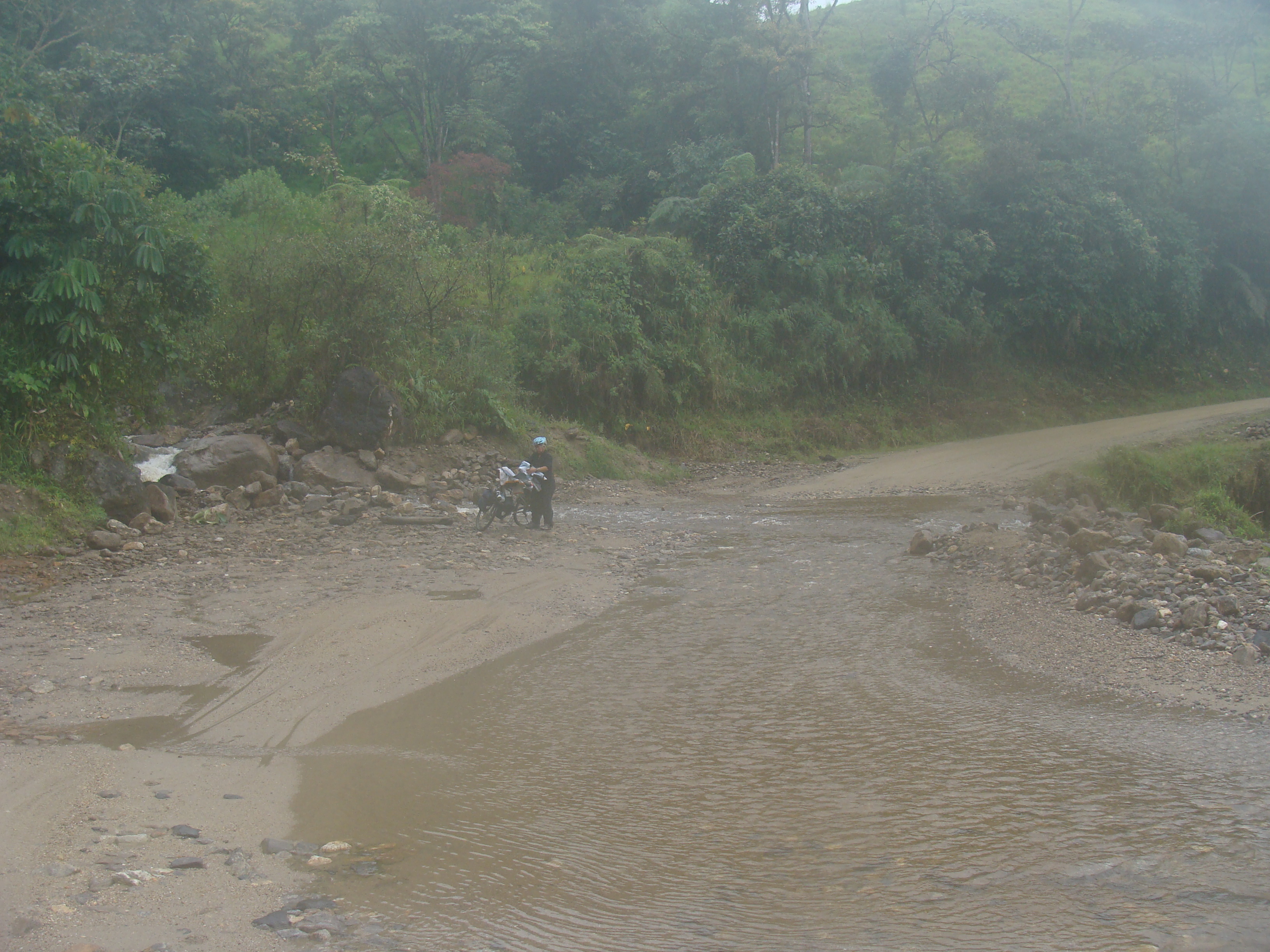

After three nights of pampering, we hopped back on the bikes and slowly rode to the Peru border. Again the steep climbs caused us to get off our bikes and push up the steep parts. The nice pavement ended after just 20 kilometers (for the next week) and the real work started. We climbed up over the continental divide somewhere in the Podocarpus National Park. The road was muddy because of the amount of rain that falls in this cloud forest. We had several stream crossings. Randy rode through them, but I changed into my sandals and walked across. Sometimes we could see foggy vistas, but sometimes the clouds limited us to views of the mossy vegetation we rode by. Tiny flowers sprung out of the cliff-hanging moss and orchids thrived in this perfect environment. We topped the climb at 2772 meters thinking we were about to descend 1000 meters into Valladolid. It was cold and windy. I dressed in all the warm clothes I had and rode hard to stay warm. We did descend just a bit, and it got a hair warmer, but it started to rain harder too.
The ride was enchanting and we lost track of time in this misty wonderland as dark descended around us. Not a house or a finca was anywhere to be found. We considered setting up the tent along the graded banks of the road but we knew that camping 5 feet from the road was not optimal so we continued our search. When we crested the next climb we found a flat marshy spot under some electric wires, a safe distance from the road. As quickly as we could we set up the tent and dove in. The rain which was to this point gentle had changed its characteristic and hit us hard. We dragged all of our panniers into the vestibule of our tent and settled in for the night. Unfortunately we dragged our wet selves into a dry tent and contaminated our dry sanctuary. With wetness everywhere we did manage to sleep most of the night.
We did twice hear trucks stopping at the crest of hill and getting out. We held our breaths and listened as we heard the doors open and men´s voices appearing outside the cabs, talking and laughing. They hung around their trucks for a short while before driving away. Our little flat plateau must of been the only place to have a pit stop to relieve their bladder from the pounding of the rough, dirt, muddy road. A few cars more drove by and beeped at us. After having dinner of cold granola, we feel asleep and dreamed we would not wake up drowned rats. When we woke up in the morning the rain continued as we packed up. It seemed warmer in the morning as we put on our damp clothes. We rode on to the small town of Palanda.
We had planned on spending the night there. As I went looking for hotel, I found a bus to Zumba instead. I did not want to climb the 5000-foot (1500 meter) climb to Zumba on the wet, dirt, slippery muddy, steep, cold, treacherous road. We took the one o´clock bus to Zumba. We stuck the bikes and our gear under the bus in the large luggage storage area. The views were tremendous and I was glad to be in a nice dry, warm bus.
We checked into a hotel in Zumba that had a covered roof top and a washing basin. We washed the mud of all off our gear and hung it overnight to dry. The next day we set out for the Peru border. Again the climb was tough, and I walked a fair number of places that just took too much energy to ride. At the top of the biggest climb we crossed through the second military checkpoint in the area. Randy talked with the officer in charge, Hector, about our trip. He had so many questions and was truly interested in our experience. The two younger soldiers just looked on with amazement. We found out that all men in Ecuador are obligated to serve for one year. Or they can pay $40 to be exempt from service. These soldiers were stationed here for 24 hours and then had 24 hours off. They wrote down our passport information and wished us well as we climbed the last hill of Ecuador. I walked half of it.
The last few miles was downhill to the river and to the new bridge at the La Balsa, the border crossing. The last section was downhill and so steep, I could not ride it. Randy rode my bike as I walked. A fitting end to the steep hills of Ecuador.
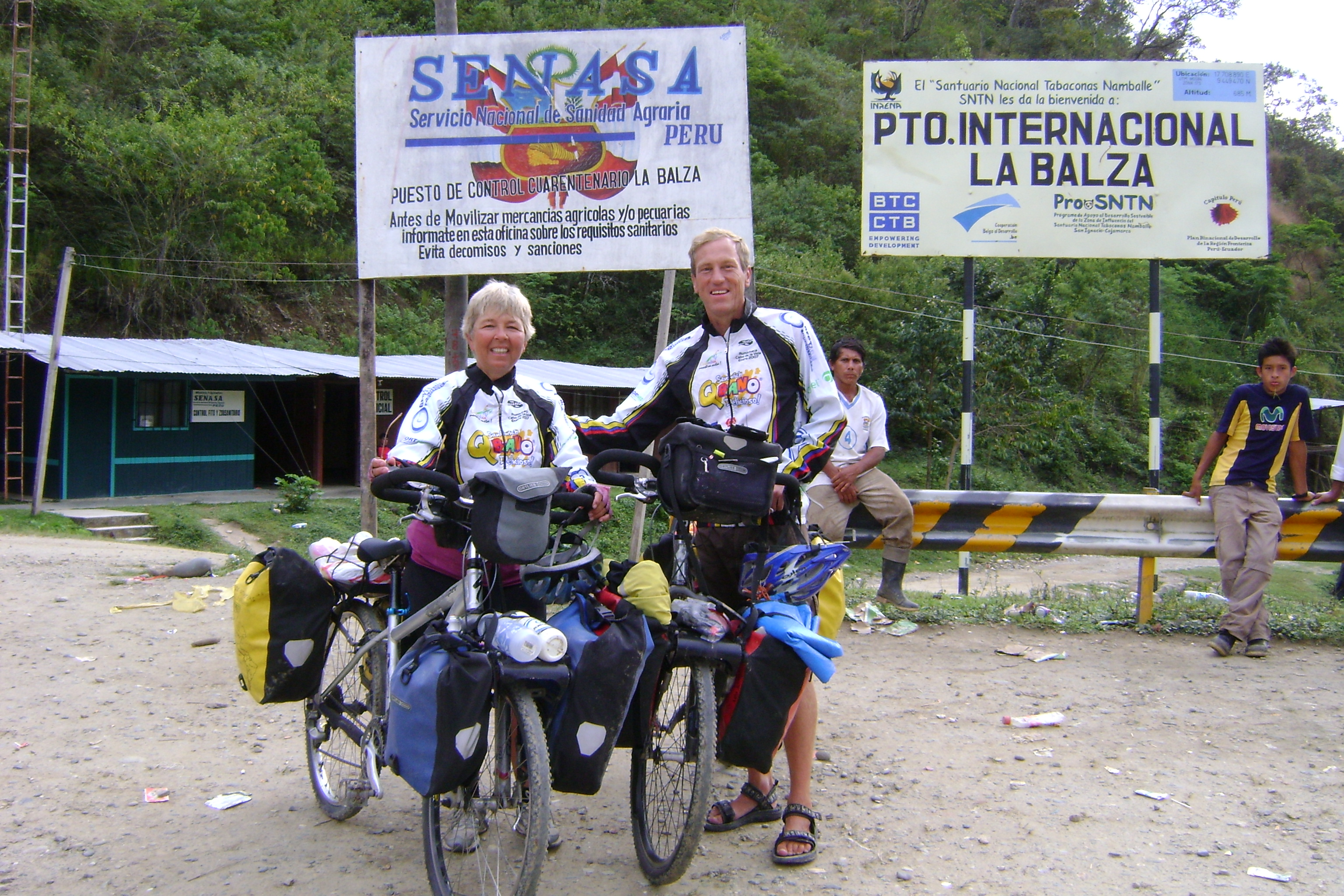
Riding into Peru at La Balsa
We are now in Peru. Another country! This is the 11th country we have entered with our bikes. With something like 11,800 miles (19,000 kilometers) we crossed the Ecuador border into Peru at La Balsa. This was the quietest and most rural border crossing we have done to date. As the immigration officer stamped our paperwork, a chicken roamed the room pecking at crumbs, a herd of cows passed out front and the money changers sat on the bridge enjoying beer on this late Saturday. No one came up to us asking if we wanted to change our money from dollars (which they use in Ecuador) to Soles (Peru's currency). That was a first.
From the border we started off following a river and actually had a flat road for 7 kilometers. Yes flat. We heard that Peru is flatter then Ecuador but we could not believe it. Of course, we found out otherwise in the morning, as the road rose above the village of Namballe. The people were so friendly on our ride from Namballe to San Ignacio! We feel like rock stars once again. Everyone waves and beeps and everyone says hello and "welcome to Peru". We even got filmed by a couple passing by on motorcycles. He explained it is for marketing material promoting tourism in the town of San Ignacio. Along the route a young boy ran after us with two papayas in his hands to give us as a present. His name was Carlos and he had no shoes but he had a wonderful smile to go with his kindness. We have found the people much more outgoing and less intimidated than the reserved folks of the highlands of Ecuador. We like it when people think we are special. We make more contacts and find out more about the people we see along the way.
The roads so far are dirt and very rough, no smooth grading like in Ecuador. However, our first road was more gentle in slope - we were able to ride all of it, with no pushing. All the culverts seemed to have been washed away or never existed. As a result we find ourselves riding through huge mud holes. One spot seemed about 50 feet long and the whole width of the road and no way around, so we were forced to ride through it. The coffee-colored mud was consistency of thick yogurt. In some places it may have been 6 inches thick. I know I could not see where I was steering. I just rode blindly, holding tight to my handle bar. I just hoped I would not slip and fall into the slop. The final section offered two deep ponds of mud. Randy told me the left hole was the better one and I should ride through it. At last, I did not have the courage or the skill to maneuver through it. I dismounted my steed and waded through the mud and around the ponds, adding to the collections of mud I had been accumulating all day. When I got to the other side, I looked back and saw I had an audience watching us with our fully loaded bikes making our way through the river of mud. I wonder if they had made bets if we would make it through or wipe out.

We stopped for lunch on top of a hill and watched the local Sunday afternoon football games. People came from all over dressed in their Sunday best for the afternoon festivities. As I we sat down on top of the hill to prepare lunch the papaya slipped out of my grip and rolled down the embankment, and came to rest against a parked motorcycle. Everyone waited to see my reaction. I started laughing seeing the fruit down near the foot ball field. Everyone else joined me laughing. I climbed down the embankment and retrieved it. It still tasted wonderful and just a little bit smashed. We had it with peanut butter on our bread - a great combination. I fed the peel to the chickens, the dogs and the donkey who seemed to enjoy it the best.
That day we rode only 44 kilometers (about 28 miles) and climbed 4300 feet (1300 meters). I was tired because of the technical riding, the bad surface and many muddy areas. I slipped off my bike just once and ended up upside down with my bike. Yes, my bike ended upside down resting on its handlebars and seat with me lying next to it on my back, laughing away. Randy wanted to take a picture of me but he thought it would be better to make sure I was OK. I did appreciate his kindness and consideration but I was really fine and was again amused at the silliness of the situation.
We where concerned at the end of the day we would not make it to our destination and started to look for camping spots. It turned out we had a great downhill stretch and made it before dark to San Ignacio. After looking at 3 hotels, we found a room in a house for $8. The owners seemed to have a party until 3am so we did not rest well and moved to the Hotel Dorado the next day where we paid $10 for a night, which seems normal so far. Meals (all basically the same) cost between $1 and $1.50. Breakfast looks like lunch and like dinner: Rice with chicken with yuca.
Tomorrow we will follow the river south for a day or two. We had been told the road is flat and paved. We since found out it is not paved, but more dirt like before. This is ok and I can live with this. But I do hope it is not as steep as some of the roads we've ridden recently. I really want to ride some more flat before we have to climb the giants of the Peruvian Andes. I hope it is flat, I hope it is, I hope….


Ecuador Wrapup
Links:
- All our Ecuador stories in order
- All our Ecuador pictures
- Galapagos pictures
- Route notes and details, including maps and elevation profiles
Ecuador turned out to be a very pleasant, tranquil country. With the exception of Quito, which has problems like any other large city, we felt completely comfortable and safe everywhere in the country. In fact, we felt that Ecuador was as safe as our previous most-comfortable country, Nicaragua. (Nicaragua would have to exclude its capital, Managua, as well, but we didn't go there.)
Ecuador is incredibly well-organized for tourism and gringos. There are tours and language schools and even a fair number of people who speak some English. They use the US dollar for currency. There is a whole section of Quito (Gringolandia) devoted to nice restaurants and stores of every type catering to gringos. We were able to get some nice sports equipment (warm clothes and such) that you would not have found in most places we have been. It's a very easy place to be.
However, as was the case in Costa Rica, we enjoyed Ecuador less than many countries we've visited, because the people seemed more reserved, and it was probably just because they are a bit fatigued with all the tourists. People didn't call out to us as we rode by, or honk greetings to us as much, or come up to us on the street to talk, or really even look up at us as we rode by. In other countries we're happy to be the center of attention, feeling like "rock stars" everywhere, and we were a bit peeved at the Ecuadoreans for denying us that attention :-)
Of course the Galapagos Islands are an amazing wildlife and natural experience, and one of the most amazing things Ecuador has to offer. But it was like another world, and of course doesn't seem like it was even Ecuador.
Some numbers:
- Miles we rode: 763
- Time in Ecuador: about 6 weeks (including a trip to the Galapagos)
- 2 rides on trucks for big hills: 15 miles (25 km).
- 1 bus ride: 30 miles (50km)
- Total mileage for the trip at the Peru border: 11768
- Mileage remaining to Ushuaia: 6000-8000. We're hoping for the lower estimate.
- Time we expect to spend in Peru: 3 months
Prices:
- Standard "set meal" for breakfast, lunch, or dinner: $1.25 to $2.00, with two courses, a soup and a place of rice with chicken or beef.
- Hotel, per person: $5-10
- Bus in the city: $0.25
- Taxi: $1-3
- Gas: $1.50/gallon (the cheapest we've seen anywhere. Ecuador is a big oil producer and seems to be subsidizing internal consumption.)
- Internet: $0.70-$1.00/hour
One little thing we really liked about the way they do coffee: It's often served as just hot milk, with some instant coffee to add to it. It's tasty!
And from the perspective of Peru, it's surprising how many commercial goods were available everywhere. It seemed that basic services were available in many places too, at least along the highways. In Ecuador we never used an outhouse/latrine at a restaurant as we have in Central America and Peru.
Also from the perspective of northern Peru, Ecuador was very cold and wet, and the riding was quite difficult. We pushed our bikes more in Ecuador than we have in any other country, even on the PanAmerican highway. We think the highway standards must be different in Ecuador, because those roads are really steep.
Up the Utcubamba River Valley to the land of the Chachas

From San Ignacio we descended rapidly into a completely different kind of country - rice paddies everywhere. Neither of us had ever seen the cultivation of rice before, so we were amazed to see the effort required to work with the plants at the various parts of their life cycle. It was beautiful, too, but like we had left the high mountains and landed in a south-east Asian area!
After about 50 kilometers of dirt (formerly paved, but long since decayed) we hit beautiful new pavement for the first time in days. And it was downhill, too. But we soon turned off for a shortcut that we read about in Peter Berechree's incredible blog of his Andes-by-bike adventure. We took a dirt-road turnoff to the town of Bellavista and found our way to the banks of the Rio Marañon, a major river headed to the Amazon. Hoping that we'd gotten to the right place, we waved and yelled to a fellow cleaning his boat on the other side, he eventually came for us. We loaded the bikes up a 2x4 ramp and crossed over in a jiffy, then road a few miles to catch the highway again. We got a pleasant little diversion from the highway and probably eliminated 50 kilometers from our route.
Soon we were starting up the beautiful valley of the Utcubamba River, which we would follow for something like 130 kilometers (75 miles). For the first section it climbed rapidly and we looked at the rapids of the river below wondering whether they were runnable in a kayak, remembering our favorite sections of rivers in Colorado, but feeling simply fear looking at these rapids.
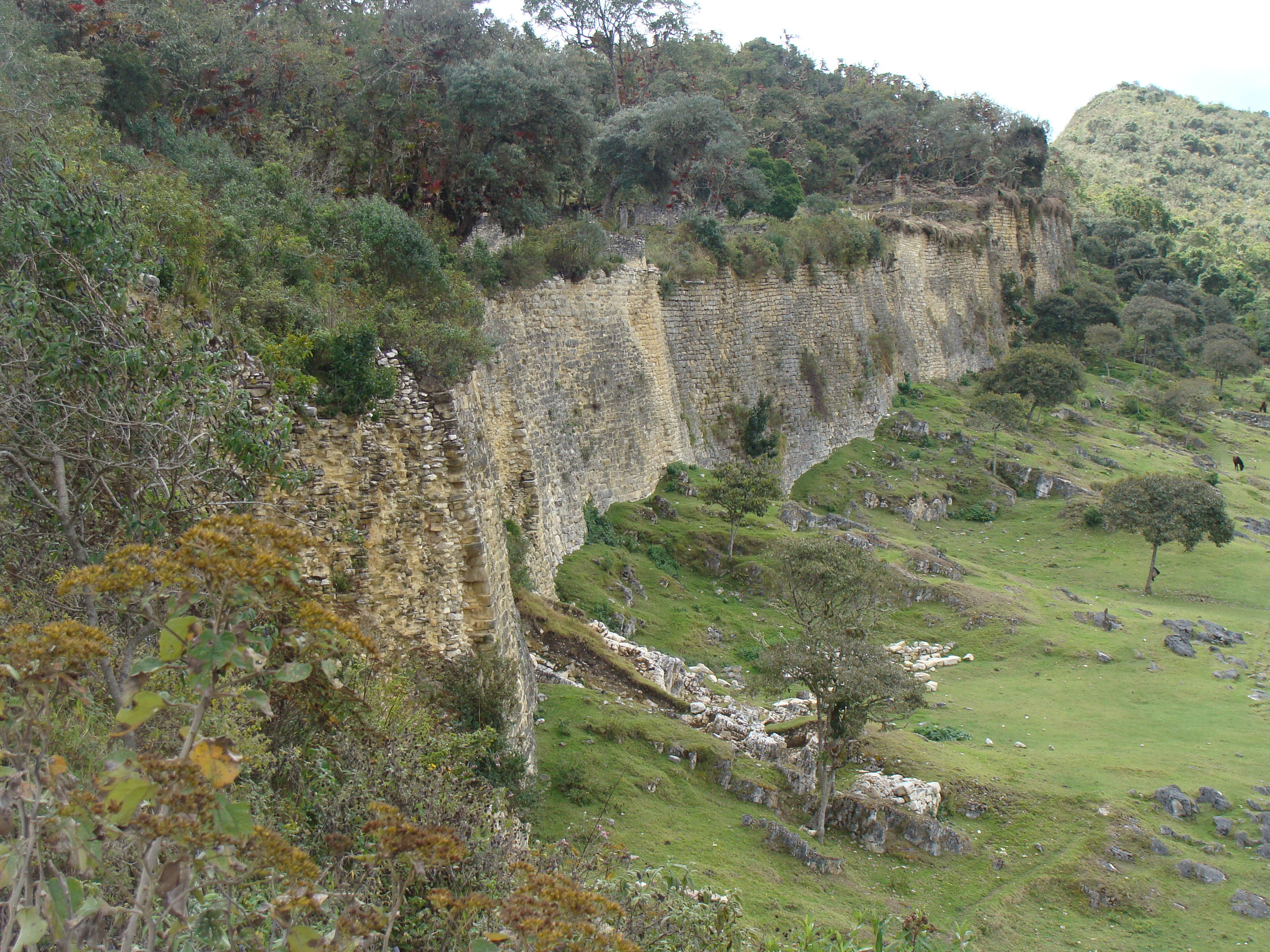
At Pedro Ruiz we hit a stretch of highway construction which closed the highway during the day, so we loaded the bikes on an evening microbus for the quick trip to Chachapoyas, the former capital of the Chacha people, who were conquered by the Incas in about 1500. We were headed for their most impressive fortress city, Kuelap. Riding further along the Rio Utcubamba, we got to a little place called El Tingo, where we hoped to organize a ride up to the ruin, but it turned out that there is almost no reliable transport. (It is a 10 kilometer, 1300 meter, 3-4 hour walk up to the ruins on a trail, but we wanted to take a rest day.) We weren't able to organize anything in El Tingo, but Nancy insisted that we call some agencies back in Chachapoyas, and we succeeded in getting one of the tours out of Chachapoyas to pick us up the next day. But Kuelap was an amazing site, built apparently as a fortress high on top of a mountain, much like Macchu Picchu was for the Inca. When the Incas conquered the Chacha people, they forced everyone out of the fortress, so it was hardly a factor when the Spanish conquerors came just a few years later.

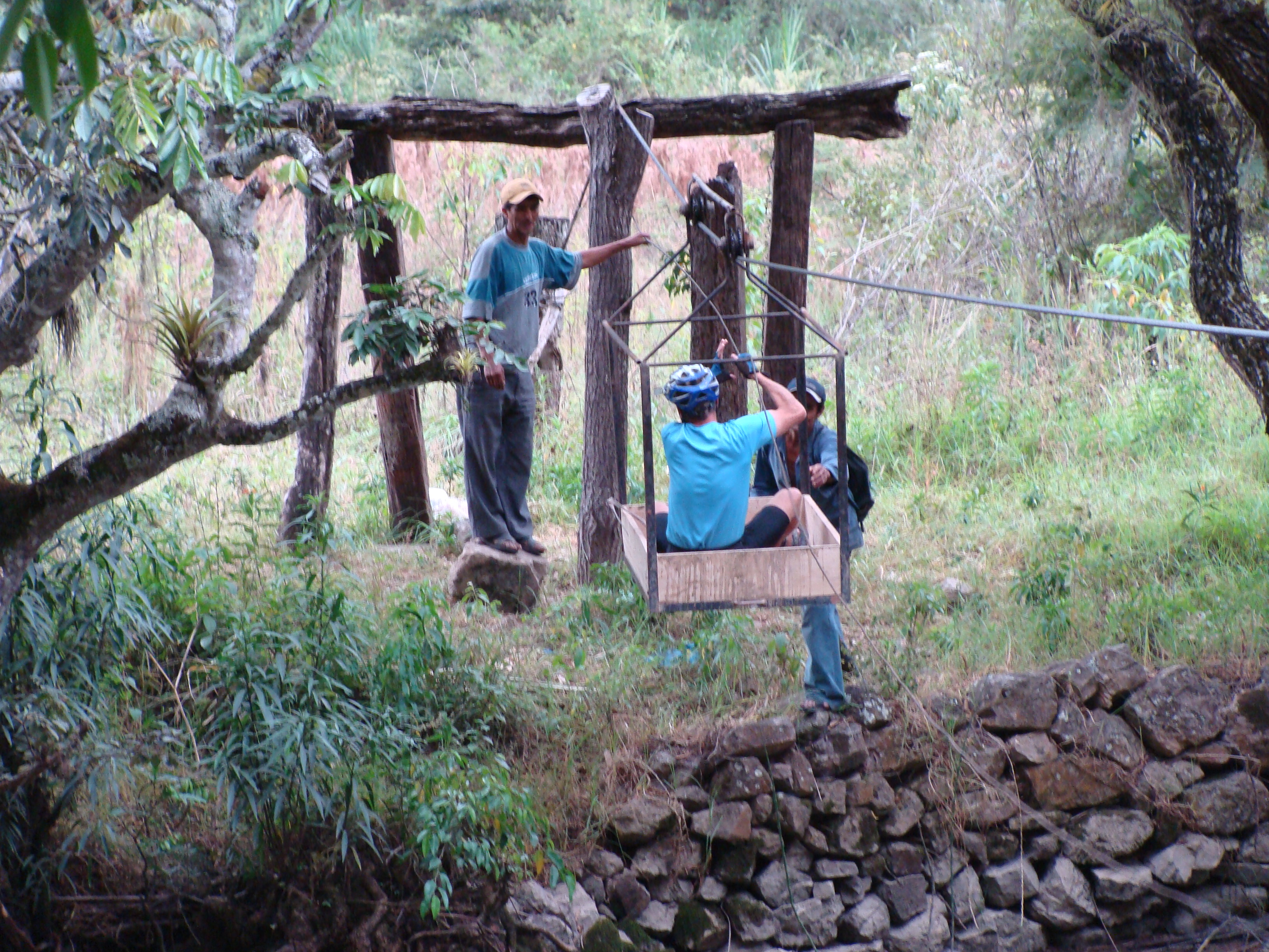
Ironically, the things we'll probably remember most about this stretch of the trip will not be the impressive fortress, but the joys of bike touring. On the way up the river we were yelled at by two workers from across the river - their cable car, the only way they had of getting across, was on the wrong side of the river. So they coached me on how to get in and take it across to them, and then we all came back across together. And in Tingo, we had time to do what the few other residents did. We just sat on the bench by the police station or in front of the little restaurant and watched the few people go by. A burro-load here, a microbus there. Perhaps an old woman carrying a load of firewood. Seeing the police lift the gate for a truck passing through. Just watching the little parade was all there was to do. And we stayed at the delightful and quaint little Hospedaje Casa León that looked like something from another century, but still had hot water in one of the bathrooms.
From El Tingo we rode still farther up the road until Nancy happened to spot a sign announcing the turnoff to another famous archaeological site of the Chacha people, Revash. We rode up a canyon about 5km and then hiked high up the canyon wall to see the ancient burial site. It certainly reminded us of an Anasazi site from the American southwest, but in miniature, as it was a burial site, instead of a place to live.
Despite the significant detour, we did get to Leymebamba that night just at dusk, ready to arrange transportation across the huge valley ahead to Celendín.
Saludos desde el Perú
Saludos a todos nuestros amigos que hablan el castellano! Cruzamos la frontera del Ecuador al Perú el sábado y quisimos mandar una nota. Estamos bién y continuando al sur.
Teníamos muchas experiencias buenas en Ecuador, incluso un viaje a las Islas Galápagos y mas de 1200 kilómetros de viaje por bicicleta. Estaba bién duro todo. Las cuestas son verdaderas cuestas, muy pendientes, y tuvimos varios dias de camino de tierra. Pero, como siempre, serán los días mas duros que vamos a recordar más, con toda esa belleza. Las vistas fueron astombrosas y esperamos que nuestras fotos muestren bién lo que veíamos pasando por estas montañas.
Entramos al Ecuador desde Colombia en Tulcán y de pronto experimentamos un nivel mucho mas bajo de tensión sobre la seguridad. Aunque Colombia está seguro y no tuvimos ningún problema allí, siempre nos dábamos cuenta de su historia y la situación actual. (Esperamos que ustedes oyeron las noticias que 15 de los rehenes mas importantes de las FARC ya están libres!) Ecuador estaba tranquilo y seguro en casi todas partes. Al menos de Quito (una ciudad grande, con los problemas de grandes ciudades) no pensamos ni poquito en asuntos de seguridad - todo fue tranquilo.
Viajando hacia Quito (y mas tarde saliendo de Quito) la Panamericana tenía demasiado tráfico y se hizo molestante. Nancy nos llevó en una ruta hasta la parte del Rio Amazón del este del país, el Oriente, donde estábamos sin tráfico y tuvimos una experiencia buena, pero con carreteras muy pendientes y difíciles.
La mejor parte fue de Cuenca hasta la frontera con Perú. Decidimos tomar la carretera menos transitado por la sierra hasta Perú en vez de la ruta que donde van los demás de ciclistas (y carros), por la costa. Fue muy difícil y también una experiencia increíble. No estamos seguros que podemos aguantar este tipo de reto, pero este tiempo en la sierra del sur del Ecuador recordaremos siempre. (Aquí hay una traducción mala de la historia de Nancy sobre este tema.)
Y hasta ahora nuestra experiencia con Perú es muy amable. La gente está tan amigable y muy abierta. Nancy escribió sobre nuestros primeros dias - hay una traducción mala aquí.)
Como siempre, hay muchas mas fotos y historias en www.hobobiker.com, con malas traducciones en este enlace.
Puedes ver
Una cosa más: Queremos recordarles de nuestra caridad favorita, Agua para la Vida. Agua Para La Vida provee agua potable a aldeas muy retiradas en el campo de Nicaragua, y hace un buen trabajo. Si puedes darles algun tipo de apoyo, les damos gracias a ustedes.
Muchas gracias por ser nuestros amigos! Siempre pensamos en ustedes.
Un abrazo a todos,
-Randy y Nancy
Mountains and People: Perceptions of Northern Peru
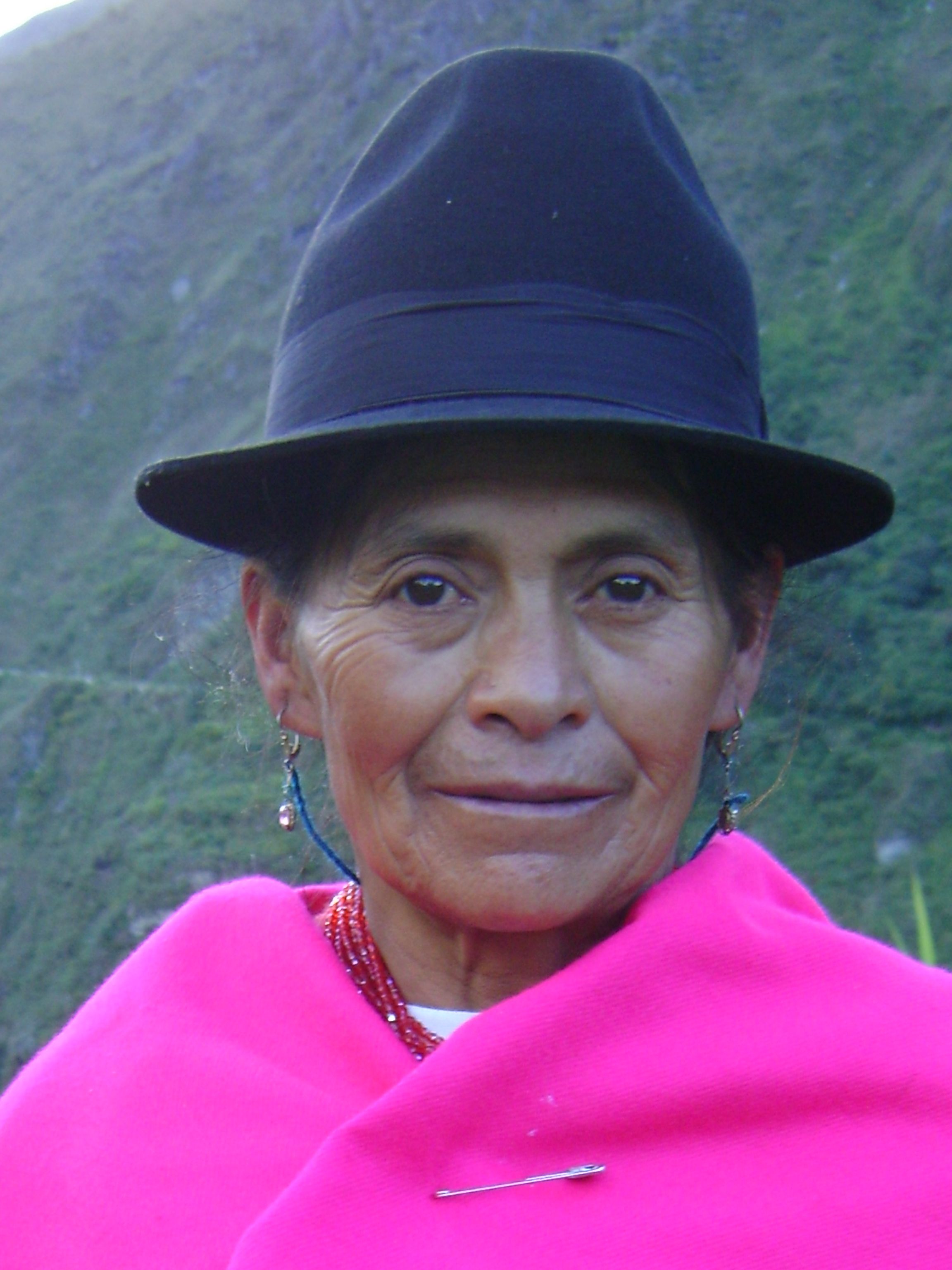
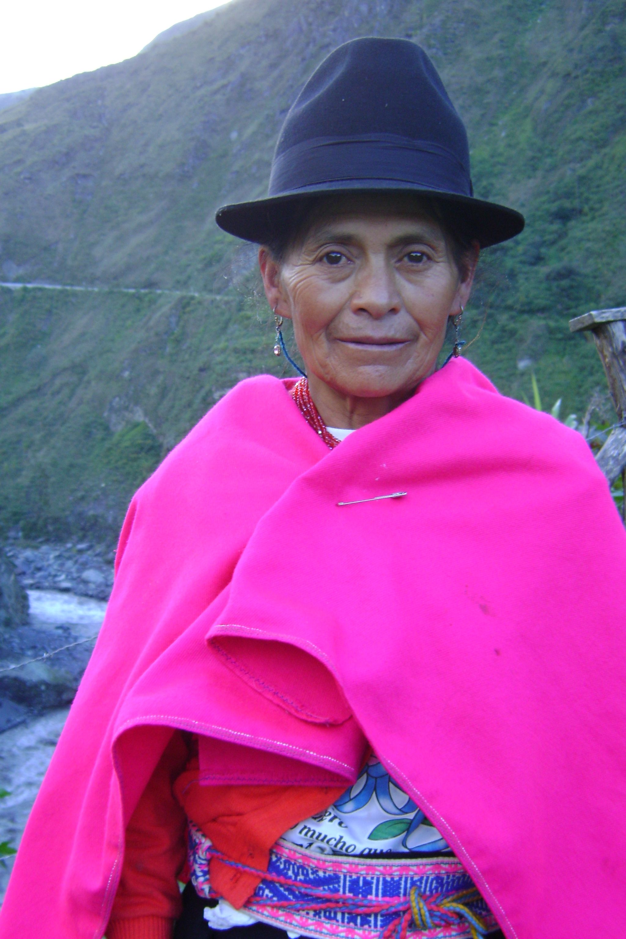
Peru has some of the biggest mountains and deepest valleys we have encountered so far. We find it very interesting to ride the high mountains of Peru because the sierras are inhabited by indigenous people who live in the traditional ways they have maintained for centuries. Not much has changed in hundreds of years. In some areas we have been riding through there is no electricity, no running water, no paved road, lots of sheep, cows, chickens, donkeys which carry cargoes of milk, wood, heavy loads of vegetables like potatoes, corn and cabbage. The people themselves carry huge loads on their backs. The women wear the same traditional clothes they have for ages including special hats which identify the area they come from. Around Cajamarca the women wear short skirts with ballooning petticoats, tall, wide-brimmed hand-woven hats made of fine strands of straw. They all have wraps and ponchos to either keep warm or carry a load. They're even shorter than me. From the distance they sometimes remind me of the profile of Halloween witch The women in Northern Peru can be seen herding donkeys loaded with metal containers of milk, babies on their backs and walking along a high mountain road while spinning wool on a stick, preparing the wool for knitting or weaving. The women always have busy hands. Always. Where we are right now the women knit afghans of multiple colors, ponchos, and sweaters. If they don't have a baby on their backs they're carrying a load of firewood, twigs, or huge bunches of herbs and greens.
The men work hard in the high fields growing the family's food. We see the men toiling on the sides of mountains, leaning over for hours planting, weeding and harvesting. At other times times we see them leading teams of oxen plowing the fields. We also see groups of men herding horses or donkeys heavily loaded from the harvested fields. Once we saw a train of burros carrying massive white bags full of cabbage. When one of the animals finally descended to the road, it refused to go any further. We watched with terror as one young man tried to drag the animal up the last slope to the unloading place. It tried to kick but missed. His handler kicked and whipped him but the poor donkey would go no further. It just lay down in the middle of the road, along a dangerous curve. The young man was furious. He unloaded the cargo and dragged the animal to its feet with the help of another man. The poor thing still could not go any further. The did manage to get it to the side of the road behind the guardrail. They just left the animal there and carried the load up the mountain the rest of the way on their own backs. The horse was lame and hardly stand on any its own legs. It changed its weight from one leg to the other, obviously in pain and didn't even mosey the few yards remaining to the unloading area. It twitched and sweated trying to recover. I felt helpless, a bystander watching a hard fact of life in this area. The animals work as hard as the people themselves.
I am always amazed to see cultivation of fields which barely cling to the slope. Occasional we see collapsed slopes and the result. In one area we rode through a whole village was wiped out by a landslide. In some areas the only crop they grow for sale was coffee and in other areas they grow fruits, potatoes, rice, cabbage, wheat, beans, corn and various other legumes for exporting to other areas. Near Leymebamba it is the time of the year for cutting the corn, and we saw flocks of wild parrots who have emigrated here for this special harvest. Wild flocks of dozens green parrots flying up and down the canyon above the Utcubamba Rivers. The racket they make is an unforgettable sound. They are immigrants without papers.
The Potato Truck Ride from Leymebamba to Celendín in Northern Peru
OK, I must confess we took a ride in a truck full of freshly-picked potatoes. The 100-mile ride took 10 hours through some very high mountains of northern Peru and down though hot valleys and back up to the heavens.
We have decided (or is it that I have decided?) that occasionally it does make sense to take alternative transportation through some areas which seem too difficult for biking with our load. The route we have taken through northern Peru has taken us through very beautiful, amazing landscapes. And amazing elevation climbs, descents and ascents. In one area from Leymebamba to Celendin, after reading another cyclist's blog through this area, I was intimidated and decided I would rather take a bus then climb up to 3600 meters (12,000 feet), descend to 900 meters (3000 feet) and then climb back up to 3100 meters on a dirt road, along cliffs that drop thousands of feet with only a slice of road carved on the face of the mountain.
But when we got to the place where we wanted to take the bus we found out was that there were no buses leaving for four days and there was no guarantee they would have room for us and our bikes anyway. So Randy asked around and contracted for us and our stuff to be hauled in the back of a truck full of potatoes. The 10-hour trip cost $15 and was itself an amazing experience, even though it wasn't on a bike. Amazing does not quite describe it.
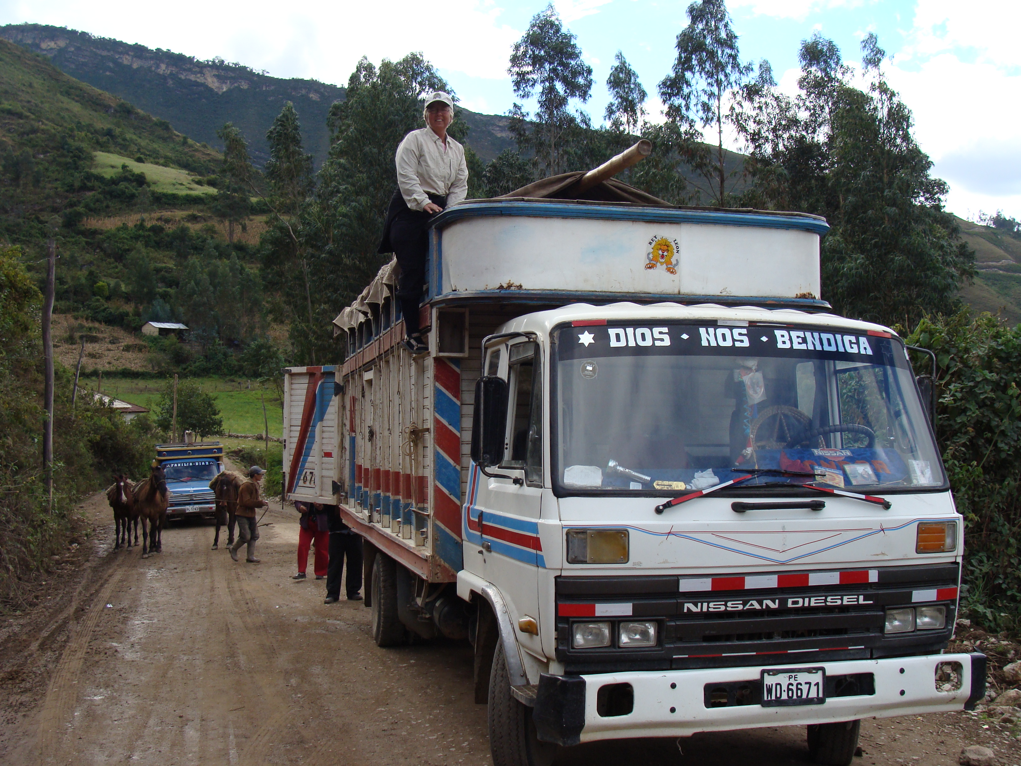
We were scheduled to leave at one in the afternoon but did not leave until 4:30. We watched for hours as load after load of sacks of potatoes were delivered by horses and mules from a far field. We talked with the driver, Marcial and his wife, while we waited in-between loads. He and his wife Olga had been driving this incredible hard route for over 30 years. In the past the road was even narrower and the trip would take two or three days because of landslides (and they had to do their own maintenance when they came to something blocking the road). Now the road is wider and has a maintenance crew. In my humble opinion, the road is still narrow and terribly scary. I was glad we had such an experienced driver. One small mistake or inattention on his part and we would have tumbled off the edge of the world.

The trip took all night. We had a small spot where we could huddle above the drivers cab in an open area where we sat on sacks of potatoes and partially under a canvas tarp. The tarp was draped over a bamboo beam and we sat under that. The view from up on the front of the truck was awe-inspiring. The drops off the cliff were terrifying and the wheels of this huge cargo truck barely hung onto the gravel road. We came upon only one other truck on the whole route. Both trucks had to maneuver very carefully to pass each other on this barely one-lane road. We backed down the mountain until there was a spot was wide enough for both of the trucks to pass without one being knocked of the side of the cliff. We stopped and chatted with the other folks for 15 minutes and sold a sack of potatoes to the other truck. I took this opportunity to climb out on the top of the cab to take some great sunset pictures. We continued on in the twilight and after a few hours stopped for dinner at a lone adobe building. Inside, lit by candles, we were served a meal of meat and rice under rafters of drying meat. As we ate we talked to the two young girls who cooked this delicious meal and to Marcial and Olga about our trip and some of the other cyclists who had dared travel this remote road (on their bikes). The meal cost $2 for both of us, including tea.
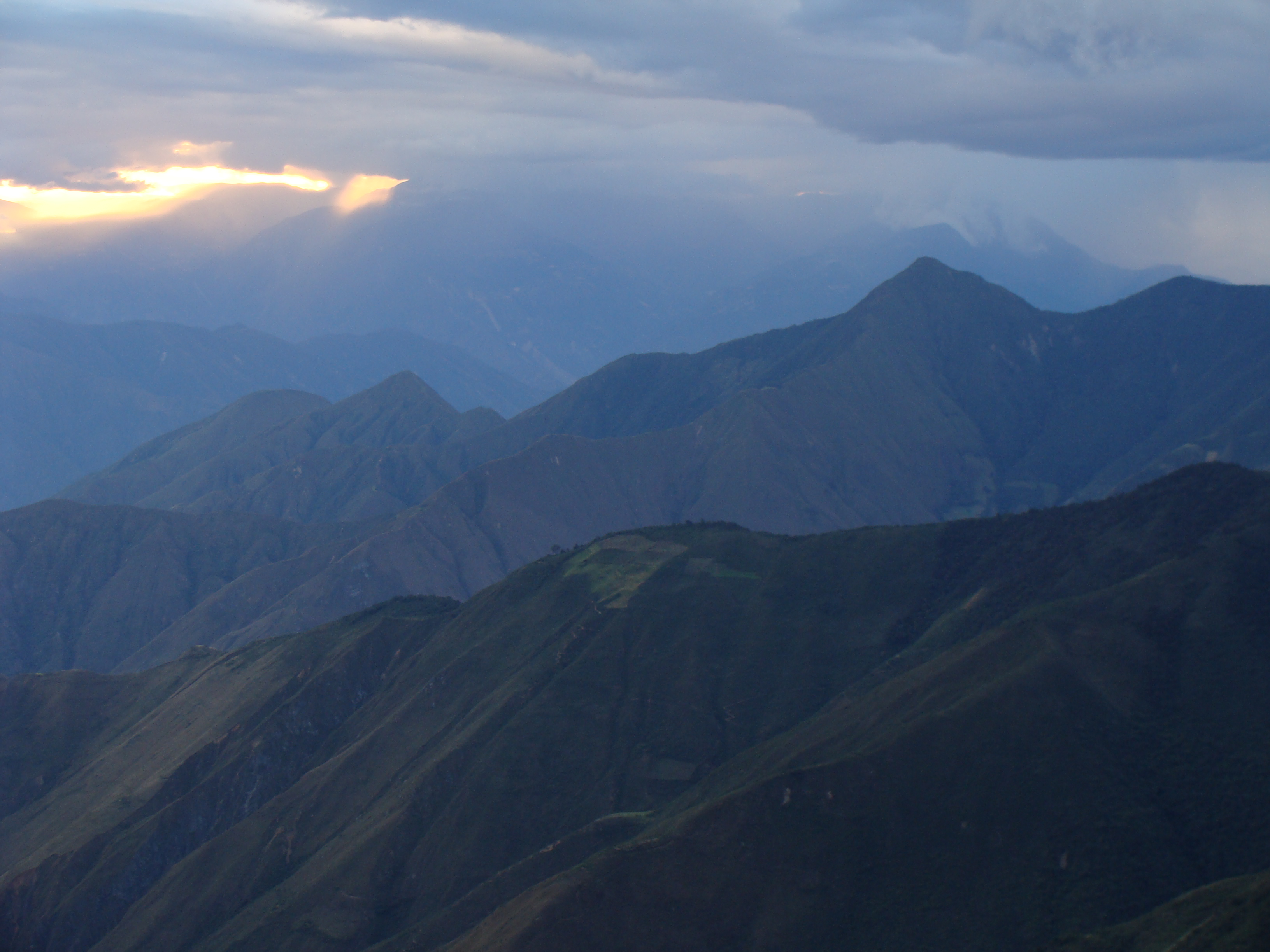
We climbed back up to our roost and watched the southern sky full of stars and constelations. It was pitch black. The milky way and its limits gleamed as we traveled though the desolate land. Not a single light from a house or a village appeared for 3 hours until we reached the bottom of the deep valley at La Balsa. The climate had changed from comfortable sunny climate of Leymebamba to high, rainy cloud forest at 3600 meters and then down to a fiery desert at 900 meters. The headlights of the truck showed all the changing vegetation in full glory. We had to duck for cover occasional to be avoid the cold rain, or overhanging vegetation and branches. The mango trees in the Marañon valley hung the lowest with ripening fruit. Bats scattered in the head lights. The edge of the cliffs disappeared in the darkness.
Several times during the trip the truck would stop, the engine would be turned off, the back doors of the truck would open up. Someone would climb up on the stacks of bags of potatoes and drag a large sack of potatoes out of the truck. Marcial is well-known in these parts, and he must have sold half the potatoes along the way, even though we were traveling in the middle of the night. A large sack of potatoes cost was sold for 37 Soles, about $13. Marcial had loaded about 50 bags of potatoes from the farmers in Leymebamba which Olga had negotiated a price of 30 soles per bag, so they were making 7 soles (a bit more than $2) on each bag. They have made this arduous 10-hour each way trip twice a week for 32 years! Gas prices are high and he owns this 8 year old truck, and he pays a helper to load and unload the truck. I bet he makes $100 a trip before expenses.
The bikes rested well on the stacks of potatoes. As for me, the sleep I got was not completely comfortable. A bed of sacks of potatoes is uncomfortable, a bit dirty and takes a bit of effort finding the perfect spot to sleep. Laying under a plastic sheet and above the lumpy bed, I got a few hours of sleep. Randy being a wonderful sleeper, can sleep anywhere, got a fine nights rest until 2:00 am when we were dropped off at a hotel in the middle of Celendin. We rolled our bikes into the center of the open patio, paid our 35 soles ($13) for a room with a double bed and a private bath with hot water. After stripping off our dirty clothes that smelled of horses, manure, dirt, potatoes and the mountains of the Andes, we climbed in bed to finish the rest of our sleep. The vision of the evening stars still danced in my head as I slipped away into a peaceful deep sleep.