Welcome to Hobobiker.com
¿Hablas español? Hay una versión español del sitio aquí y una traducción mala del sitio aquí.
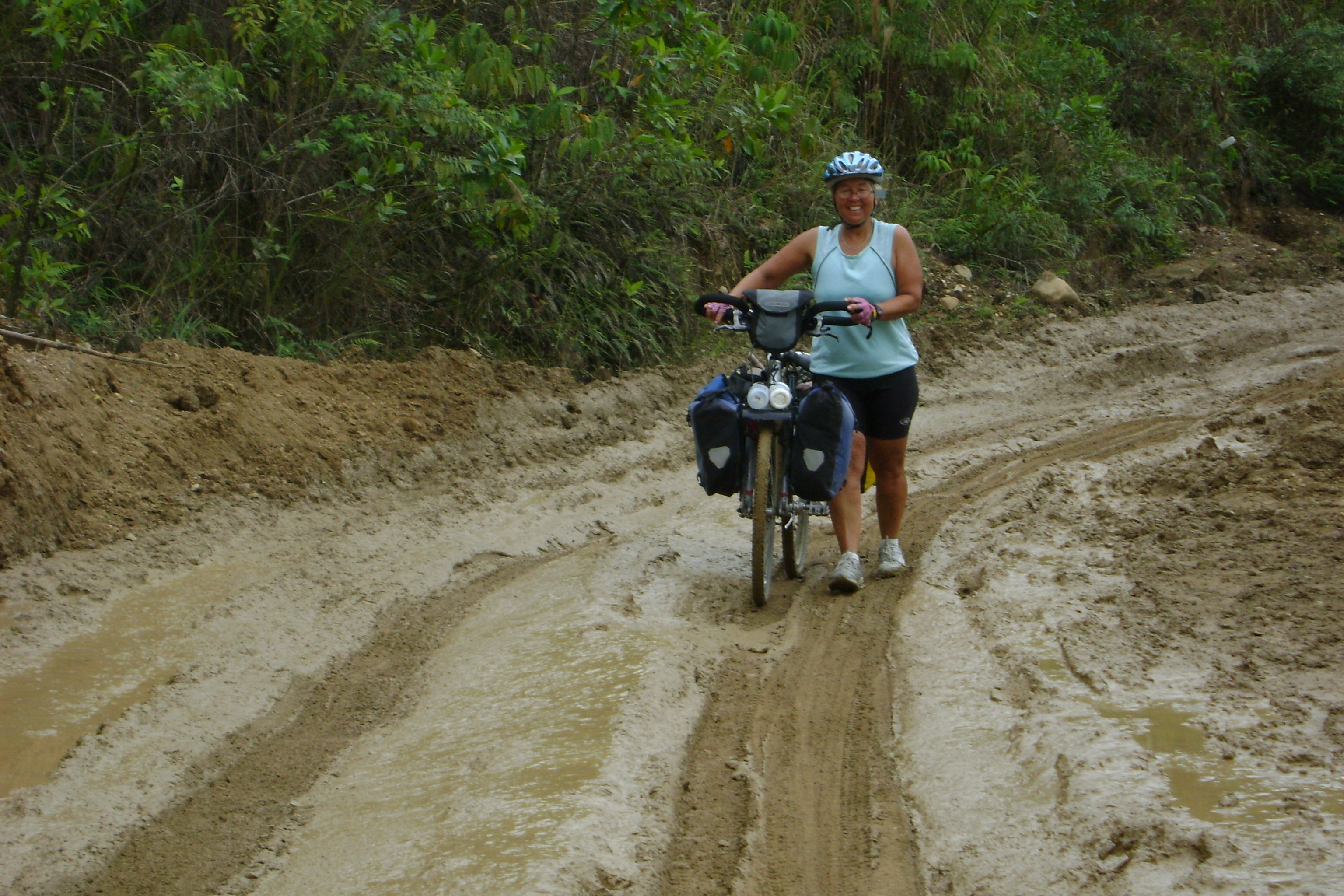
The Potato Truck Ride from Leymebamba to Celendín in Northern Peru
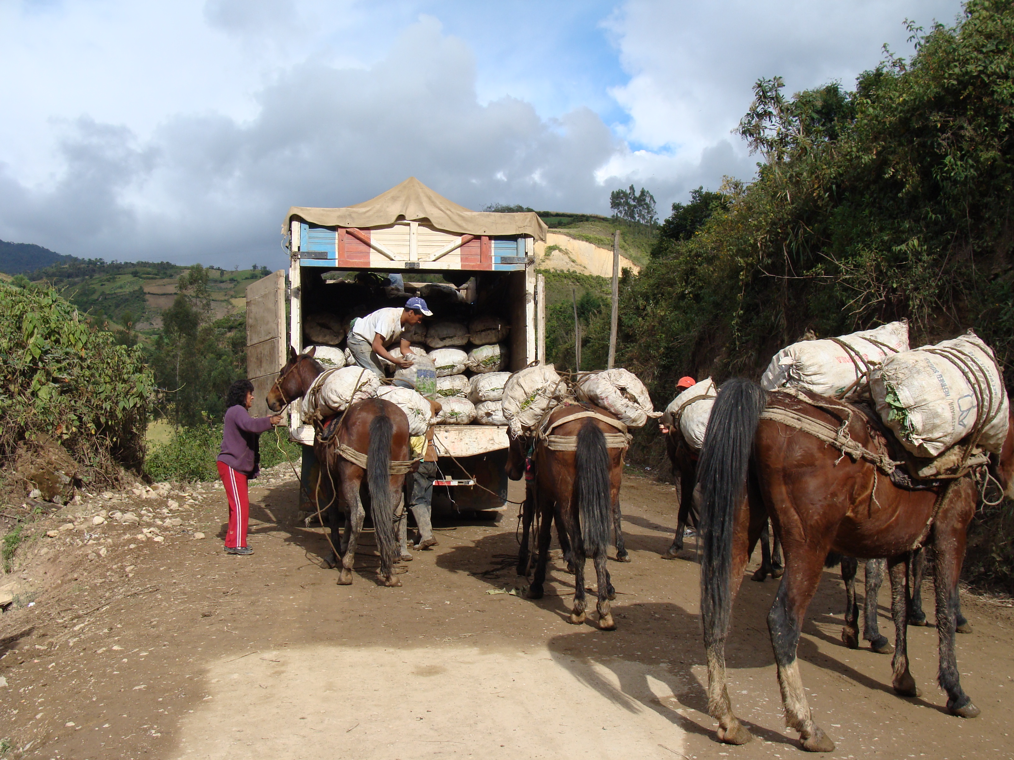
OK, I must confess we took a ride in a truck full of freshly-picked potatoes. The 100-mile ride took 10 hours through some very high mountains of northern Peru and down though hot valleys and back up to the heavens.
We have decided (or is it that I have decided?) that occasionally it does make sense to take alternative transportation through some areas which seem too difficult for biking with our load. The route we have taken through northern Peru has taken us through very beautiful, amazing landscapes. And amazing elevation climbs, descents and ascents. In one area from Leymebamba to Celendin, after reading another cyclist's blog through this area, I was intimidated and decided I would rather take a bus then climb up to 3600 meters (12,000 feet), descend to 900 meters (3000 feet) and then climb back up to 3100 meters on a dirt road, along cliffs that drop thousands of feet with only a slice of road carved on the face of the mountain. read more here... lee mas aquí... »
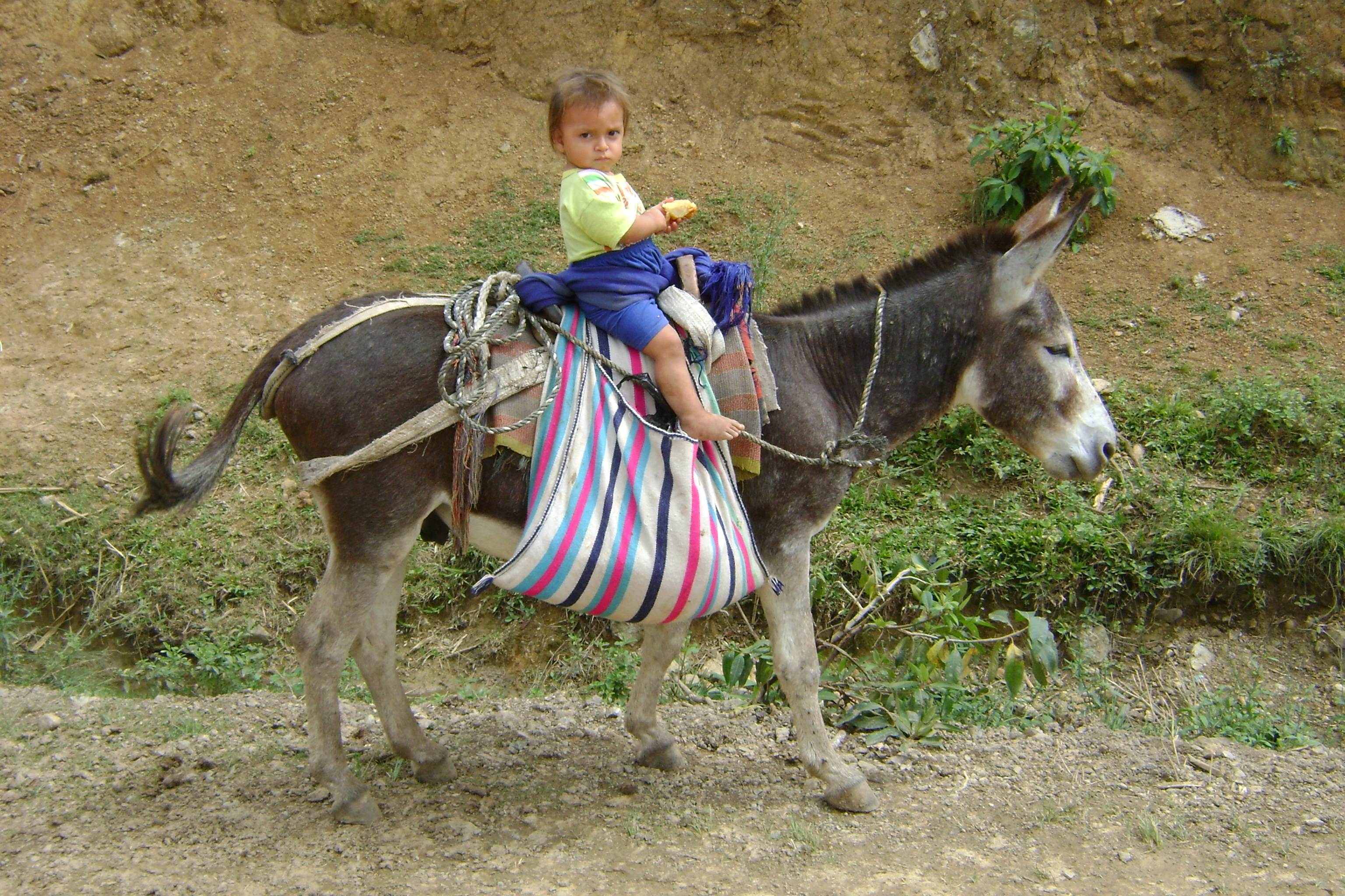
Mountains and People: Perceptions of Northern Peru
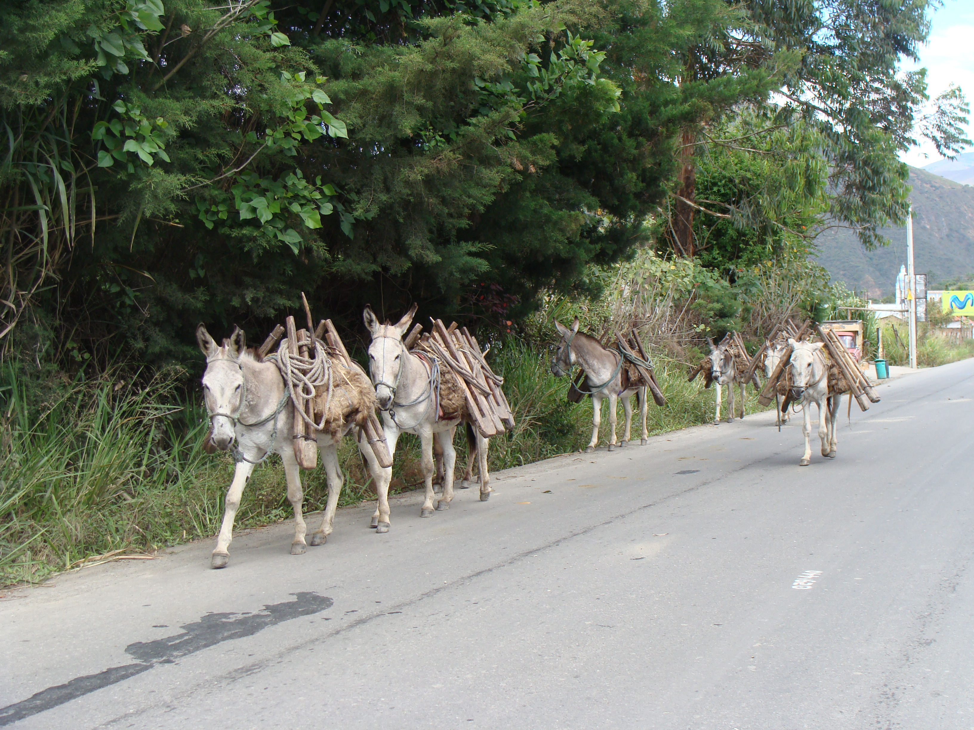
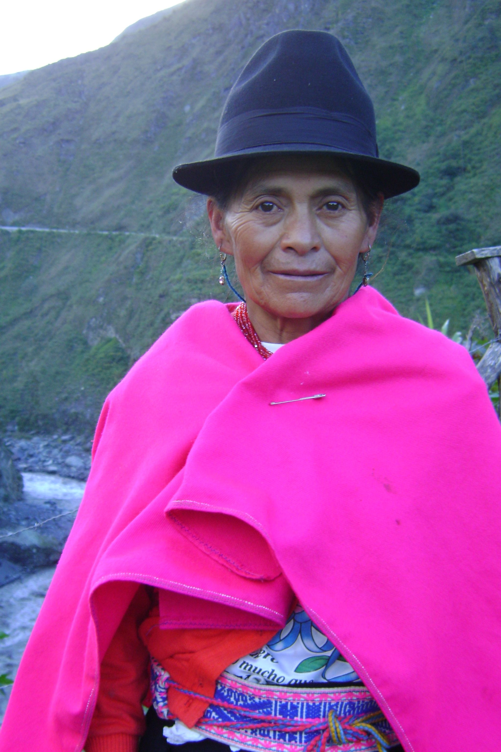
Peru has some of the biggest mountains and deepest valleys we have encountered so far. We find it very interesting to ride the high mountains of Peru because the sierras are inhabited by indigenous people who live in the traditional ways they have maintained for centuries. Not much has changed in hundreds of years. In some areas we have been riding through there is no electricity, no running water, no paved road, lots of sheep, cows, chickens, donkeys which carry cargoes of milk, wood, heavy loads of vegetables like potatoes, corn and cabbage. The people themselves carry huge loads on their backs. The women wear the same traditional clothes they have for ages including special hats which identify the area they come from. Around Cajamarca the women wear short skirts with ballooning petticoats, tall, wide-brimmed hand-woven hats made of fine strands of straw. They all have wraps and ponchos to either keep warm or carry a load. They're even shorter than me. From the distance they sometimes remind me of the profile of Halloween witch The women in Northern Peru can be seen herding donkeys loaded with metal containers of milk, babies on their backs and walking along a high mountain road while spinning wool on a stick, preparing the wool for knitting or weaving. The women always have busy hands. Always. Where we are right now the women knit afghans of multiple colors, ponchos, and sweaters. If they don't have a baby on their backs they're carrying a load of firewood, twigs, or huge bunches of herbs and greens. read more here... lee mas aquí... »
Up the Utcubamba River Valley to the land of the Chachas

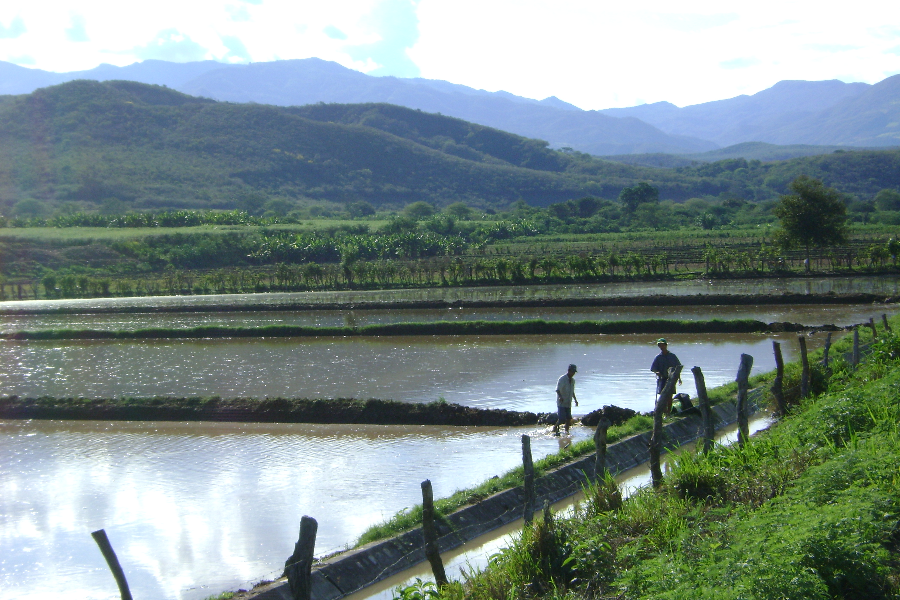
From San Ignacio we descended rapidly into a completely different kind of country - rice paddies everywhere. Neither of us had ever seen the cultivation of rice before, so we were amazed to see the effort required to work with the plants at the various parts of their life cycle. It was beautiful, too, but like we had left the high mountains and landed in a south-east Asian area!
After about 50 kilometers of dirt (formerly paved, but long since decayed) we hit beautiful new pavement for the first time in days. And it was downhill, too. But we soon turned off for a shortcut that we read about in Peter Berechree's incredible blog of his Andes-by-bike adventure. We took a dirt-road turnoff to the town of Bellavista and found our way to the banks of the Rio Marañon, a major river headed to the Amazon. Hoping that we'd gotten to the right place, we waved and yelled to a fellow cleaning his boat on the other side, he eventually came for us. We loaded the bikes up a 2x4 ramp and crossed over in a jiffy, then road a few miles to catch the highway again. We got a pleasant little diversion from the highway and probably eliminated 50 kilometers from our route. read more here... lee mas aquí... »
Ecuador Wrapup
Links:
- All our Ecuador stories in order
- All our Ecuador pictures
- Galapagos pictures
- Route notes and details, including maps and elevation profiles
Ecuador turned out to be a very pleasant, tranquil country. With the exception of Quito, which has problems like any other large city, we felt completely comfortable and safe everywhere in the country. In fact, we felt that Ecuador was as safe as our previous most-comfortable country, Nicaragua. (Nicaragua would have to exclude its capital, Managua, as well, but we didn't go there.)
Ecuador is incredibly well-organized for tourism and gringos. There are tours and language schools and even a fair number of people who speak some English. They use the US dollar for currency. There is a whole section of Quito (Gringolandia) devoted to nice restaurants and stores of every type catering to gringos. We were able to get some nice sports equipment (warm clothes and such) that you would not have found in most places we have been. read more here... lee mas aquí... »
Riding into Peru at La Balsa
We are now in Peru. Another country! This is the 11th country we have entered with our bikes. With something like 11,800 miles (19,000 kilometers) we crossed the Ecuador border into Peru at La Balsa. This was the quietest and most rural border crossing we have done to date. As the immigration officer stamped our paperwork, a chicken roamed the room pecking at crumbs, a herd of cows passed out front and the money changers sat on the bridge enjoying beer on this late Saturday. No one came up to us asking if we wanted to change our money from dollars (which they use in Ecuador) to Soles (Peru's currency). That was a first.
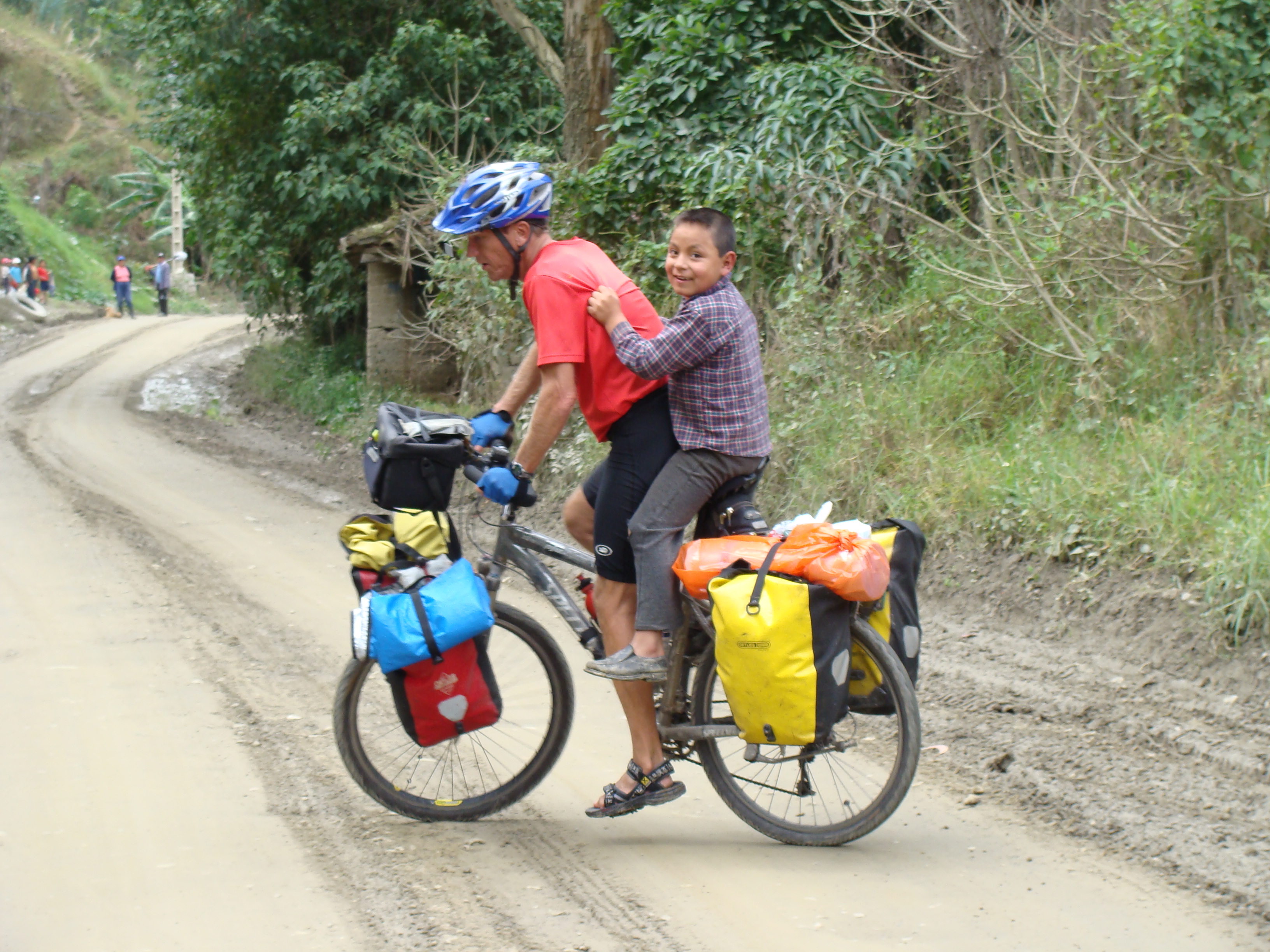
From the border we started off following a river and actually had a flat road for 7 kilometers. Yes flat. We heard that Peru is flatter then Ecuador but we could not believe it. Of course, we found out otherwise in the morning, as the road rose above the village of Namballe. The people were so friendly on our ride from Namballe to San Ignacio! We feel like rock stars once again. Everyone waves and beeps and everyone says hello and "welcome to Peru". We even got filmed by a couple passing by on motorcycles. He explained it is for marketing material promoting tourism in the town of San Ignacio. Along the route a young boy ran after us with two papayas in his hands to give us as a present. His name was Carlos and he had no shoes but he had a wonderful smile to go with his kindness. We have found the people much more outgoing and less intimidated than the reserved folks of the highlands of Ecuador. We like it when people think we are special. We make more contacts and find out more about the people we see along the way. read more here... lee mas aquí... »
Cuenca to the Peru Border
The ride from Cuenca to the Peru border was one of the best and most beautiful (and hardest) rides so far on this trip. We rode on quiet roads, some paved but most dirt. The landscape was gorgeous and the views amazing. We rode through small indigenous villages where the women wore colorful traditional dresses, jewelry, and felt hats. The traffic was almost non-existent as soon as we left Cuenca. It picked up a little as we rode in and out of Loja. In Loja by chance we met Chaski, a Peruvian man who is walking the Inca trail, learning about the traditional ways people grow potatoes. He is an educator and he is connecting the indigenous people of South America together. We had met him in the far north of Ecuador and got to have dinner with him again.
The next day we rode to Saraguro, a pleasant village with proud and friendly people. The people seem to have a nice life, a sense of community and continue with the traditional Ecuadoran Indigenous life style. Many of the indigenous villages we had passed through seemed reserved and hardship seems to weigh on their shoulders. This village was strikingly different. It was a much happier place. The people more open and had smiles to share. We wanted to stay for the Sunday market but Vilcabamba was calling us. read more here... lee mas aquí... »
Ecuador route notes for touring cyclists, including map and GPS info
Some notes about routes in Ecuador that are probably only interesting for people planning to tour here:
- Our Route, Trip Log, Notes, and GPS Tracks: Our complete maps and notes are now up..
- Maps: We carried the ITMB Ecuador Map. Although I hate the ITMB maps, this one worked. In addition, we bought the excellent book of strip maps published by the Instituto Geografico Militar, which is available in good bookstores in Ecuador, like Libri Mundi in Gringolandia in Quito and at other sites. There is also a general tourist map available in tourist offices. Its biggest benefit is the extensive charge of distances between cities.
- GPS Maps: We were unable to find any GPS maps at that time to download into our Garmin GPS, but since GPSTravelMaps.com has come into existence. If you know of others, please send us a note or leave a comment here.
- We came in from the north, at Tulcan, which is where most cyclists coming from the north would get to. By the time we got to Ibarra, the traffic started to get irritating on the Pan-Am.
Down into the Amazon basin and back up to Cuenca
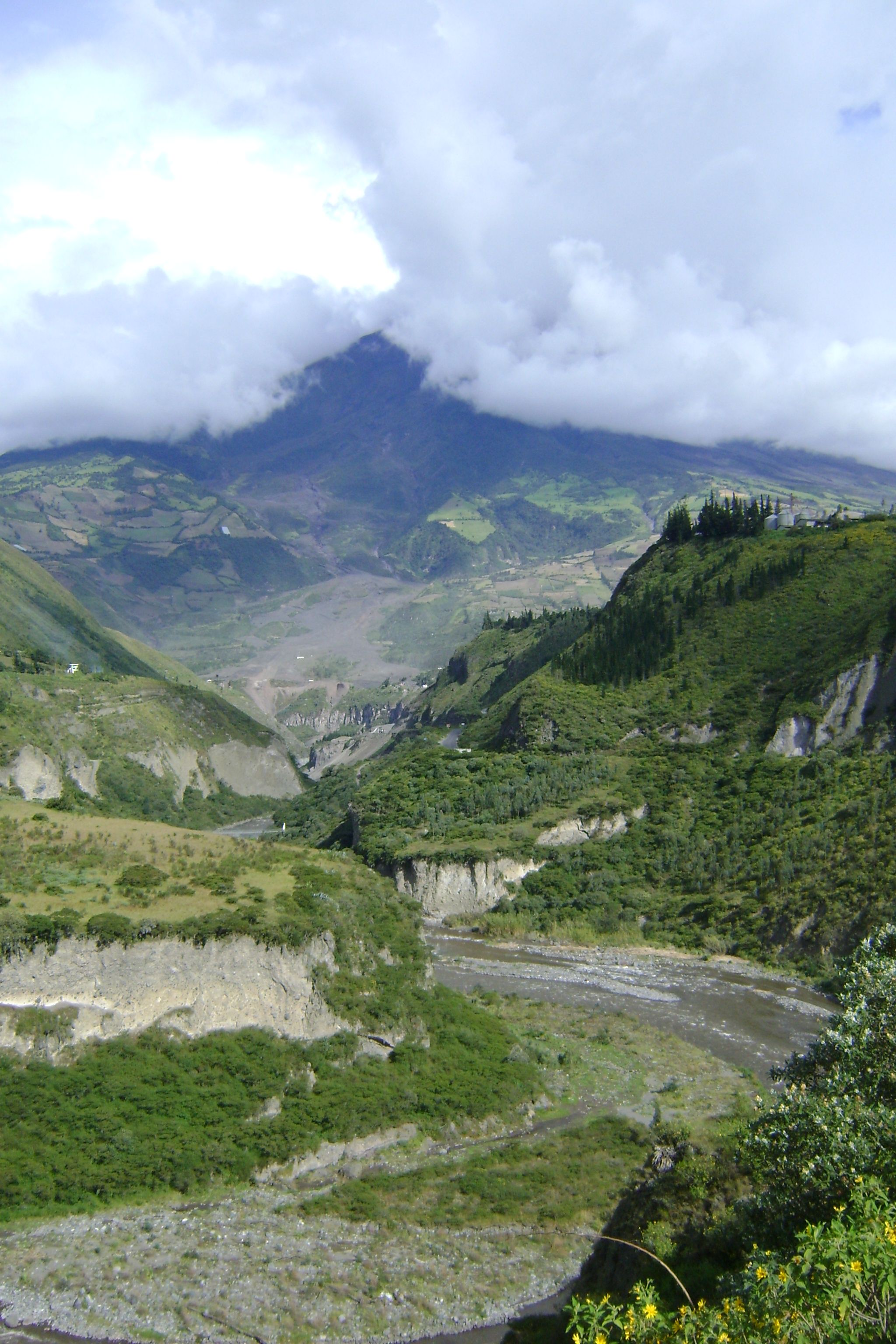
We have surfaced again and now are in Cuenca, Ecuador. After riding the Pan-American highway south from Quito for a hundred kilometers or so we decided to go to Baños to soak in the hot springs. Well, we liked that route much better than the Pan-Am, we continued down to the eastern Amazon region of Ecuador on the edge of the jungle and followed the roads south. Most of the time the roads were brand new and magnificent and other times dirt and pretty bad but the jungle lowlands were enchanting with wild bird sounds all around, exotic flowers, low traffic. The rain would would come and go most of the day and most times we found somewhere to sleep in a town. Actually the fanciest hotel we have slept in on our whole trip was in the delightful little town of Sucúa. It was our 3rd wedding anniversary and we felt we had found the honeymoon suite for $16 and just in time because we were like drowned rats arriving there in a big rainstorm.
A good part of the first part of the trip was around huge volcanos. We stopped in Baños for some hilly walks, soaking in hot springs and a visit to the local zoo. We then dropped down to the jungle on the way to Pugo. The road from Baños to Puyo was a mountain biker's dream come true. Though there were 7 tunnels along this road, the cyclists were diverted around on dirt roads and through wonderful forest. read more here... lee mas aquí... »